Directions to The Edwards Group Llc (Boston) with public transportation
The following transit lines have routes that pass near The Edwards Group Llc
 Bus: 21, 24, 240, 12, MATTAPAN LINE SHUTTLE.
- Train: FAIRMOUNT.
- Subway: MATTAPAN LINE.
How to get to The Edwards Group Llc by bus?
Click on the bus route to see step by step directions with maps, line arrival times and updated time schedules.
From Marina Bay, Boston
91 minFrom Orpheum Theatre (Orpheum Theatre Boston), Boston
66 minFrom Primark Boston, Boston
74 minFrom The Lawn on D, Boston
81 minFrom JFK Federal Building, Boston
76 minFrom Kenmore Square, Boston
69 minFrom The Liberty Hotel, Boston
88 minFrom Union Oyster House, Boston
76 minFrom South End, Boston
61 min
How to get to The Edwards Group Llc by train?
Click on the train route to see step by step directions with maps, line arrival times and updated time schedules.
From Marina Bay, Boston
59 minFrom Orpheum Theatre (Orpheum Theatre Boston), Boston
53 minFrom Primark Boston, Boston
52 minFrom The Lawn on D, Boston
63 minFrom JFK Federal Building, Boston
60 minFrom Kenmore Square, Boston
65 minFrom The Liberty Hotel, Boston
69 minFrom Union Oyster House, Boston
57 minFrom South End, Boston
51 min
How to get to The Edwards Group Llc by subway?
Click on the subway route to see step by step directions with maps, line arrival times and updated time schedules.
From Marina Bay, Boston
51 minFrom Orpheum Theatre (Orpheum Theatre Boston), Boston
36 minFrom Primark Boston, Boston
34 minFrom The Lawn on D, Boston
51 minFrom JFK Federal Building, Boston
46 minFrom Kenmore Square, Boston
56 minFrom The Liberty Hotel, Boston
43 minFrom Union Oyster House, Boston
51 minFrom South End, Boston
45 min
Bus stops near The Edwards Group Llc in Boston
Subway station near The Edwards Group Llc in Boston
- Butler, 14 min walk,VIEW
Bus lines to The Edwards Group Llc in Boston
What are the closest stations to The Edwards Group Llc?
The closest stations to The Edwards Group Llc are:
- Central Ave And Elliot St is 4 yards away, 1 min walk.
- Eliot St @ Central Ave - Central Ave Sta is 28 yards away, 1 min walk.
- Central Avenue @ Maple Street is 90 yards away, 2 min walk.
- River St @ Wichita Ter is 201 yards away, 3 min walk.
- Dorchester Ave @ Washington St is 445 yards away, 6 min walk.
- Butler is 1121 yards away, 14 min walk.
Which bus lines stop near The Edwards Group Llc?
These bus lines stop near The Edwards Group Llc: 21, 24, 240.
Which train line stops near The Edwards Group Llc?
FAIRMOUNT (#1619 | Fairmount)
Which subway line stops near The Edwards Group Llc?
MATTAPAN LINE (Mattapan)
What’s the nearest subway station to The Edwards Group Llc in Boston?
The nearest subway station to The Edwards Group Llc in Boston is Butler. It’s a 14 min walk away.
What’s the nearest bus station to The Edwards Group Llc in Boston?
The nearest bus stations to The Edwards Group Llc in Boston are Central Ave And Elliot St and Eliot St @ Central Ave - Central Ave Sta. The closest one is a 1 min walk away.
What time is the first subway to The Edwards Group Llc in Boston?
The MATTAPAN LINE is the first subway that goes to The Edwards Group Llc in Boston. It stops nearby at 5:01 AM.
What time is the last subway to The Edwards Group Llc in Boston?
The MATTAPAN LINE is the last subway that goes to The Edwards Group Llc in Boston. It stops nearby at 2:39 AM.
What time is the first bus to The Edwards Group Llc in Boston?
The 15 is the first bus that goes to The Edwards Group Llc in Boston. It stops nearby at 4:36 AM.
What time is the last bus to The Edwards Group Llc in Boston?
The 24 is the last bus that goes to The Edwards Group Llc in Boston. It stops nearby at 1:07 AM.
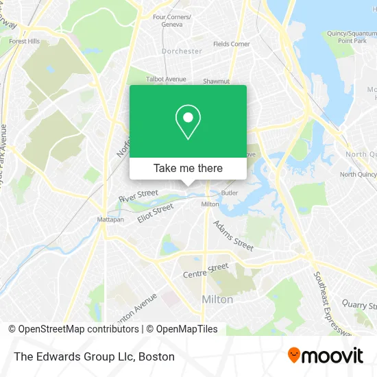
See The Edwards Group Llc, Boston, on the map
Public Transit to The Edwards Group Llc in Boston
Wondering how to get to The Edwards Group Llc in Boston? Moovit helps you find the best way to get to The Edwards Group Llc with step-by-step directions from the nearest public transit station.
Moovit provides free maps and live directions to help you navigate through your city. View schedules, routes, timetables, and find out how long does it take to get to The Edwards Group Llc in real time.
Looking for the nearest stop or station to The Edwards Group Llc? Check out this list of stops closest to your destination: Central Ave And Elliot St; Eliot St @ Central Ave - Central Ave Sta; Central Avenue @ Maple Street; River St @ Wichita Ter; Dorchester Ave @ Washington St; Butler.
Bus: 21, 24, 240, 12, MATTAPAN LINE SHUTTLE, MATTAPAN LINE SHUTTLE, RED/MATTAPAN LINE SHUTTLE, 15, 217.Train: FAIRMOUNT.Subway: MATTAPAN LINE.
Want to see if there’s another route that gets you there at an earlier time? Moovit helps you find alternative routes or times. Get directions from and directions to The Edwards Group Llc easily from the Moovit App or Website.
We make riding to The Edwards Group Llc easy, which is why over 1.7 million users, including users in Boston, trust Moovit as the best app for public transit. You don’t need to download an individual bus app or train app, Moovit is your all-in-one transit app that helps you find the best bus time or train time available.
For information on prices of subway, bus and train, costs and ride fares to The Edwards Group Llc, please check the Moovit app.
Use the app to navigate to popular places including to the airport, hospital, stadium, grocery store, mall, coffee shop, school, college, and university.
The Edwards Group Llc Address: 57 River St street in Boston
- Coach Carpet Cleaning,
- Schoolhouse at Lower Mills (Schoolhouses at Lower Mills Rentals),
- Rockitcoin,
- USPS Collection Box - Blue Box,
- MBTA Trolley To Ashmont station,
- RMV,
- Dr Rickey E. Smith Sr, DDS,
- Boston Renaissance Charter Public School,
- Irwin & Irwin,
- Auto Glass Back Window,
- Thomas Green,
- Coinstar,
- American Locksmith,
- Boston's Best Neighbor Award,
- International Brotherhood of Electrical Workers,
- Star Market,
- STARBUCKS,
- Ron Scott Realtor Milton Ma,
- New Locks Installation Services,
- Joy's Touch
Places Near The Edwards Group Llc (Boston)
- Boston Common, Boston,
- Boston Medical Center, Boston,
- Td Garden, Boston,
- Seaport District, Boston,
- Massachusetts General Hospital, Boston,
- Castle Island, Boston,
- Museum Of Science, Boston,
- Boston Children's Hospital, Boston,
- Wilbur Theatre, Boston,
- Quincy Market, Boston,
- Cheers, Boston,
- House Of Blues, Boston,
- Wang Theater, Boston,
- Leader Bank Pavilion (Leader Bank Pavillion), Boston,
- Mgm Music Hall, Boston,
- Prudential Center, Boston,
- Isabella Stewart Gardner Museum, Boston,
- North End, Boston,
- Faneuil Hall, Boston,
- Boston Convention & Exhibition Center, Boston
How to get to popular places in Boston with public transit
Get around Boston by public transit!
Traveling around Boston has never been so easy. See step by step directions as you travel to any attraction, street or major public transit station. View bus and train schedules, arrival times, service alerts and detailed routes on a map, so you know exactly how to get to anywhere in Boston.
When traveling to any destination around Boston use Moovit's Live Directions with Get Off Notifications to know exactly where and how far to walk, how long to wait for your line, and how many stops are left. Moovit will alert you when it's time to get off — no need to constantly re-check whether yours is the next stop.
Wondering how to use public transit in Boston or how to pay for public transit in Boston? Moovit public transit app can help you navigate your way with public transit easily, and at minimum cost. It includes public transit fees, ticket prices, and costs. Looking for a map of Boston public transit lines? Moovit public transit app shows all public transit maps in Boston with all Bus, Train, Subway and Ferry routes and stops on an interactive map.
Boston has 4 transit type(s), including: Bus, Train, Subway and Ferry, operated by several transit agencies, including MBTA, Southeastern Regional Transit Authority, MetroWest Regional Transit Authority, Rhode Island Public Transit Authority, WRTA, Lowell Regional Transit Authority, Merrimack Valley Transit, Montachusett Regional Transit Authority, Cape Cod Regional Transit Authority, Brockton Area Transit Authority, Martha's Vineyard Transit Authority, the WAVE - Nantucket Regional Transit Authority, GATRA, Cape Ann Transportation Authority and Massport