Directions to The English High School Association (Dedham) with public transportation
The following transit lines have routes that pass near The English High School Association
 Bus: 34E.
- Train: FRANKLIN/FOXBORO, FOXBORO EVENT SERVICE.
How to get to The English High School Association by bus?
Click on the bus route to see step by step directions with maps, line arrival times and updated time schedules.
From Lower Mills, Boston
67 minFrom VA Hospital, Boston
49 minFrom The Mall At Chestnut Hill, Newton
87 minFrom Milton, MA, Milton
78 minFrom Lemuel Shattuck Hospital, Boston
39 minFrom Milton Academy, Milton
77 minFrom Curry College, Milton
83 minFrom The Monument, Boston
42 minFrom Arnold Arboretum, Boston
37 minFrom Jamaica Plain, Boston
43 min
How to get to The English High School Association by train?
Click on the train route to see step by step directions with maps, line arrival times and updated time schedules.
Bus stop near The English High School Association in Dedham
- Washington St Opp Waldo Way, 3 min walk,VIEW
Train stations near The English High School Association in Dedham
Bus lines to The English High School Association in Dedham
- 34E, Forest Hills,VIEW
What are the closest stations to The English High School Association?
The closest stations to The English High School Association are:
- Washington St Opp Waldo Way is 209 yards away, 3 min walk.
- Norwood Depot is 3521 yards away, 41 min walk.
- Dedham Corporate Center is 4381 yards away, 51 min walk.
Which bus line stops near The English High School Association?
34E (Walpole Center Via Washington St)
Which train line stops near The English High School Association?
FRANKLIN/FOXBORO (#1709 | Foxboro)
What’s the nearest bus station to The English High School Association in Dedham?
The nearest bus station to The English High School Association in Dedham is Washington St Opp Waldo Way. It’s a 3 min walk away.
What time is the first bus to The English High School Association in Dedham?
The 34E is the first bus that goes to The English High School Association in Dedham. It stops nearby at 5:03 AM.
What time is the last bus to The English High School Association in Dedham?
The 34E is the last bus that goes to The English High School Association in Dedham. It stops nearby at 1:17 AM.
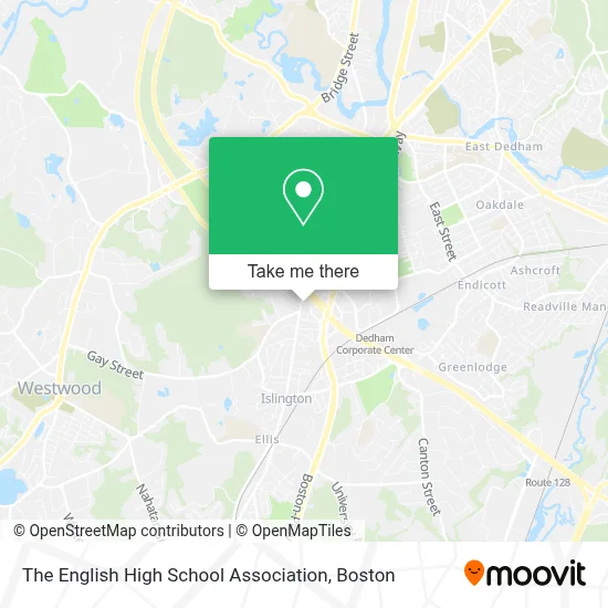
See The English High School Association, Dedham, on the map
Public Transit to The English High School Association in Dedham
Wondering how to get to The English High School Association in Dedham? Moovit helps you find the best way to get to The English High School Association with step-by-step directions from the nearest public transit station.
Moovit provides free maps and live directions to help you navigate through your city. View schedules, routes, timetables, and find out how long does it take to get to The English High School Association in real time.
Looking for the nearest stop or station to The English High School Association? Check out this list of stops closest to your destination: Washington St Opp Waldo Way; Norwood Depot; Dedham Corporate Center.
Bus: 34E.Train: FRANKLIN/FOXBORO, FOXBORO EVENT SERVICE.
Want to see if there’s another route that gets you there at an earlier time? Moovit helps you find alternative routes or times. Get directions from and directions to The English High School Association easily from the Moovit App or Website.
We make riding to The English High School Association easy, which is why over 1.7 million users, including users in Dedham, trust Moovit as the best app for public transit. You don’t need to download an individual bus app or train app, Moovit is your all-in-one transit app that helps you find the best bus time or train time available.
For information on prices of bus and train, costs and ride fares to The English High School Association, please check the Moovit app.
Use the app to navigate to popular places including to the airport, hospital, stadium, grocery store, mall, coffee shop, school, college, and university.
The English High School Association Address: 980 Washington St street in Dedham
- Bayada Assistive Care - State Programs,
- Pet Stain Carpet Cleaner,
- The Coughlin Group,
- Daniel Dennis & Company LLP,
- New American Funding - Dedham, Ma,
- Lo of Kenneth Federman,
- Hogan Tire & Auto,
- RCCG, Westwood Parish,
- Eric J. Roseen, DC,
- Davidson Robt J Rev,
- Murf's Code Classes,
- Holiday Inn-Boston Dedham,
- Lockout Locksmith,
- Tavern in the Square,
- Fox Stations Sales,
- Boston 25 News,
- WFXT-TV Fox 25 Boston,
- Locks Re-Keyed Locksmith,
- Marnette Bromberg: Allstate Insurance,
- Levine William M - Levine Dispute Resolution Center
Places Near The English High School Association (Dedham)
- House Of Blues, Boston,
- Prudential Center, Boston,
- Wang Theater, Boston,
- Boston Convention & Exhibition Center, Boston,
- Wilbur Theatre, Boston,
- Boston Children's Hospital, Boston,
- North End, Boston,
- Boston Medical Center, Boston,
- Boston Common, Boston,
- Museum Of Science, Boston,
- Td Garden, Boston,
- Mgm Music Hall, Boston,
- Massachusetts General Hospital, Boston,
- Faneuil Hall, Boston,
- Seaport District, Boston,
- Quincy Market, Boston,
- Isabella Stewart Gardner Museum, Boston,
- Cheers, Boston,
- Leader Bank Pavilion (Leader Bank Pavillion), Boston,
- Castle Island, Boston
How to get to popular places in Boston with public transit
Get around Dedham by public transit!
Traveling around Dedham has never been so easy. See step by step directions as you travel to any attraction, street or major public transit station. View bus and train schedules, arrival times, service alerts and detailed routes on a map, so you know exactly how to get to anywhere in Dedham.
When traveling to any destination around Dedham use Moovit's Live Directions with Get Off Notifications to know exactly where and how far to walk, how long to wait for your line, and how many stops are left. Moovit will alert you when it's time to get off — no need to constantly re-check whether yours is the next stop.
Wondering how to use public transit in Dedham or how to pay for public transit in Dedham? Moovit public transit app can help you navigate your way with public transit easily, and at minimum cost. It includes public transit fees, ticket prices, and costs. Looking for a map of Dedham public transit lines? Moovit public transit app shows all public transit maps in Dedham with all Bus, Train, Subway and Ferry routes and stops on an interactive map.
Boston has 4 transit type(s), including: Bus, Train, Subway and Ferry, operated by several transit agencies, including MBTA, Southeastern Regional Transit Authority, MetroWest Regional Transit Authority, Rhode Island Public Transit Authority, WRTA, Lowell Regional Transit Authority, Merrimack Valley Transit, Montachusett Regional Transit Authority, Cape Cod Regional Transit Authority, Brockton Area Transit Authority, Martha's Vineyard Transit Authority, the WAVE - Nantucket Regional Transit Authority, GATRA, Cape Ann Transportation Authority and Massport