How to get to The Fat Cat by bus?
Click on the bus route to see step by step directions with maps, line arrival times and updated time schedules.
From Fort Independence, Boston
108 minFrom Boston Latin Academy, Boston
58 minFrom Best Buy, Boston
77 minFrom Lower Mills, Boston
44 minFrom Milton Academy, Milton
33 minFrom Milton, MA, Milton
38 minFrom Dorchester District Court, Boston
46 minFrom Andrew Square, Boston
63 minFrom Carson Beach, Boston
78 minFrom Castle Island, Boston
104 min
How to get to The Fat Cat by train?
Click on the train route to see step by step directions with maps, line arrival times and updated time schedules.
How to get to The Fat Cat by subway?
Click on the subway route to see step by step directions with maps, line arrival times and updated time schedules.
Bus stops near The Fat Cat in Quincy
Subway station near The Fat Cat in Quincy
- Wollaston, 42 min walk,VIEW
Train station near The Fat Cat in Quincy
- Weymouth Landing/East Braintree, 62 min walk,VIEW
Bus lines to The Fat Cat in Quincy
What are the closest stations to The Fat Cat?
The closest stations to The Fat Cat are:
- School St @ Hancock St is 84 yards away, 2 min walk.
- Quincy Ave @ School St is 154 yards away, 3 min walk.
- Coddington St @ Washington St is 240 yards away, 3 min walk.
- Washington St Opp Foster St is 331 yards away, 5 min walk.
- Whitwell St @ Granite St is 366 yards away, 5 min walk.
- Wollaston is 3608 yards away, 42 min walk.
- Weymouth Landing/East Braintree is 5268 yards away, 62 min walk.
Which bus lines stop near The Fat Cat?
These bus lines stop near The Fat Cat: 210, 215, 225, 245.
Which train line stops near The Fat Cat?
GREENBUSH (#1063 | Greenbush)
Which subway line stops near The Fat Cat?
RED LINE (Ashmont/Braintree)
What’s the nearest bus station to The Fat Cat in Quincy?
The nearest bus station to The Fat Cat in Quincy is School St @ Hancock St. It’s a 2 min walk away.
What time is the first subway to The Fat Cat in Quincy?
The RED LINE is the first subway that goes to The Fat Cat in Quincy. It stops nearby at 5:18 AM.
What time is the last subway to The Fat Cat in Quincy?
The RED LINE is the last subway that goes to The Fat Cat in Quincy. It stops nearby at 1:49 AM.
What time is the first train to The Fat Cat in Quincy?
The GREENBUSH is the first train that goes to The Fat Cat in Quincy. It stops nearby at 5:46 AM.
What time is the last train to The Fat Cat in Quincy?
The GREENBUSH is the last train that goes to The Fat Cat in Quincy. It stops nearby at 12:14 AM.
What time is the first bus to The Fat Cat in Quincy?
The 216 is the first bus that goes to The Fat Cat in Quincy. It stops nearby at 4:41 AM.
What time is the last bus to The Fat Cat in Quincy?
The 220 is the last bus that goes to The Fat Cat in Quincy. It stops nearby at 1:52 AM.
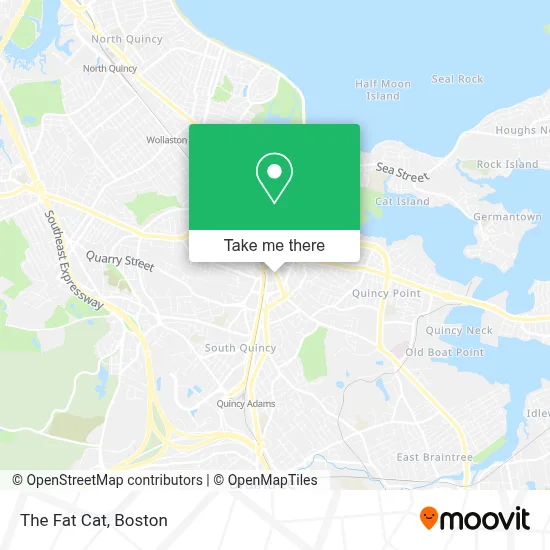
See The Fat Cat, Quincy, on the map
Public Transit to The Fat Cat in Quincy
Wondering how to get to The Fat Cat in Quincy? Moovit helps you find the best way to get to The Fat Cat with step-by-step directions from the nearest public transit station.
Moovit provides free maps and live directions to help you navigate through your city. View schedules, routes, timetables, and find out how long does it take to get to The Fat Cat in real time.
Looking for the nearest stop or station to The Fat Cat? Check out this list of stops closest to your destination: School St @ Hancock St; Quincy Ave @ School St; Coddington St @ Washington St; Washington St Opp Foster St; Whitwell St @ Granite St; Wollaston; Weymouth Landing/East Braintree.
Bus: 210, 215, 225, 245, 230, 236, 238, 216, 220, 222.Train: GREENBUSH.Subway: RED LINE.
Want to see if there’s another route that gets you there at an earlier time? Moovit helps you find alternative routes or times. Get directions from and directions to The Fat Cat easily from the Moovit App or Website.
We make riding to The Fat Cat easy, which is why over 1.7 million users, including users in Quincy, trust Moovit as the best app for public transit. You don’t need to download an individual bus app or train app, Moovit is your all-in-one transit app that helps you find the best bus time or train time available.
For information on prices of bus, subway and train, costs and ride fares to The Fat Cat, please check the Moovit app.
Use the app to navigate to popular places including to the airport, hospital, stadium, grocery store, mall, coffee shop, school, college, and university.
The Fat Cat Address: 1495 Hancock St street in Quincy
- William James Gifts,
- City of Quincy,
- South Shore Neptunes Dive Club,
- Gutter Pro.Com,
- Fuji at Woc,
- Urgence Locksmiths,
- Property Contractors and Services,
- Rug Carpet Cleaning,
- Stop & Shop Corporate Headquarters,
- Quincy District Court,
- 24 7 Available Locksmith,
- Monica's Point,
- Carvalho Group,
- Amazon Locker-Carbohydrate,
- Beth Israel Lahey Health Urgent Care,
- U.S. Army Quincy,
- Quincy Recruiting Station,
- Hancock Cemetery,
- Packaging Store,
- US Post Office
Places Near The Fat Cat (Quincy)
- Leader Bank Pavilion (Leader Bank Pavillion), Boston,
- Td Garden, Boston,
- Castle Island, Boston,
- Wilbur Theatre, Boston,
- Quincy Market, Boston,
- Boston Children's Hospital, Boston,
- North End, Boston,
- Boston Convention & Exhibition Center, Boston,
- Boston Common, Boston,
- Prudential Center, Boston,
- House Of Blues, Boston,
- Isabella Stewart Gardner Museum, Boston,
- Massachusetts General Hospital, Boston,
- Seaport District, Boston,
- Wang Theater, Boston,
- Faneuil Hall, Boston,
- Cheers, Boston,
- Museum Of Science, Boston,
- Mgm Music Hall, Boston,
- Boston Medical Center, Boston
How to get to popular places in Boston with public transit
Get around Quincy by public transit!
Traveling around Quincy has never been so easy. See step by step directions as you travel to any attraction, street or major public transit station. View bus and train schedules, arrival times, service alerts and detailed routes on a map, so you know exactly how to get to anywhere in Quincy.
When traveling to any destination around Quincy use Moovit's Live Directions with Get Off Notifications to know exactly where and how far to walk, how long to wait for your line, and how many stops are left. Moovit will alert you when it's time to get off — no need to constantly re-check whether yours is the next stop.
Wondering how to use public transit in Quincy or how to pay for public transit in Quincy? Moovit public transit app can help you navigate your way with public transit easily, and at minimum cost. It includes public transit fees, ticket prices, and costs. Looking for a map of Quincy public transit lines? Moovit public transit app shows all public transit maps in Quincy with all Bus, Train, Subway and Ferry routes and stops on an interactive map.
Boston has 4 transit type(s), including: Bus, Train, Subway and Ferry, operated by several transit agencies, including MBTA, Southeastern Regional Transit Authority, MetroWest Regional Transit Authority, Rhode Island Public Transit Authority, WRTA, Lowell Regional Transit Authority, Merrimack Valley Transit, Montachusett Regional Transit Authority, Cape Cod Regional Transit Authority, Brockton Area Transit Authority, Martha's Vineyard Transit Authority, the WAVE - Nantucket Regional Transit Authority, GATRA, Cape Ann Transportation Authority and Massport