Directions to The Girlhood Project (Cambridge) with public transportation
The following transit lines have routes that pass near The Girlhood Project
 Bus: 1, 109, 66, 77, 96.
- Train: FITCHBURG, FRAMINGHAM/WORCESTER, RED LINE.
- Subway: RED LINE, GREEN LINE D, GREEN LINE E, GREEN LINE B, GREEN LINE C.
How to get to The Girlhood Project by bus?
Click on the bus route to see step by step directions with maps, line arrival times and updated time schedules.
From Belle Isle Lobster & Seafood, Winthrop Town
120 minFrom Uscis Biometrics Office, Revere
79 minFrom JFK Library, Boston
85 minFrom Canopy by Hilton Boston Downtown, Boston
58 minFrom Seaport Holiday Farmers Market, Boston
70 minFrom Comfort Inn & Suites Logan International Airport, Revere
80 minFrom The Barking Crab, Boston
65 minFrom Dorchester District Court, Boston
86 minFrom Pizzeria Regina, Boston
56 minFrom SoWa Open Market, Boston
53 min
How to get to The Girlhood Project by train?
Click on the train route to see step by step directions with maps, line arrival times and updated time schedules.
How to get to The Girlhood Project by subway?
Click on the subway route to see step by step directions with maps, line arrival times and updated time schedules.
From Belle Isle Lobster & Seafood, Winthrop Town
63 minFrom Uscis Biometrics Office, Revere
64 minFrom JFK Library, Boston
60 minFrom Canopy by Hilton Boston Downtown, Boston
36 minFrom Seaport Holiday Farmers Market, Boston
42 minFrom Comfort Inn & Suites Logan International Airport, Revere
65 minFrom The Barking Crab, Boston
39 minFrom Dorchester District Court, Boston
54 minFrom Pizzeria Regina, Boston
39 minFrom SoWa Open Market, Boston
41 min
Bus stops near The Girlhood Project in Cambridge
Train station near The Girlhood Project in Cambridge
- Porter, 2 min walk,VIEW
Subway stations near The Girlhood Project in Cambridge
Bus lines to The Girlhood Project in Cambridge
What are the closest stations to The Girlhood Project?
The closest stations to The Girlhood Project are:
- Massachusetts Ave @ Shepard St is 27 yards away, 1 min walk.
- Massachusetts Ave @ Wendell St is 48 yards away, 1 min walk.
- Porter is 96 yards away, 2 min walk.
- Quincy St @ Broadway Opp Fogg Museum is 126 yards away, 2 min walk.
- Harvard Sq @ Garden St - Dawes Island is 441 yards away, 6 min walk.
- Waterhouse St @ Massachusetts Ave is 544 yards away, 7 min walk.
- Union Square is 1674 yards away, 20 min walk.
- Magoun Station is 1702 yards away, 21 min walk.
Which bus lines stop near The Girlhood Project?
These bus lines stop near The Girlhood Project: 1, 109, 66, 77, 96.
Which train lines stop near The Girlhood Project?
These train lines stop near The Girlhood Project: FITCHBURG, FRAMINGHAM/WORCESTER.
Which subway line stops near The Girlhood Project?
RED LINE (Alewife)
What’s the nearest subway station to The Girlhood Project in Cambridge?
The nearest subway station to The Girlhood Project in Cambridge is Union Square. It’s a 20 min walk away.
What’s the nearest train station to The Girlhood Project in Cambridge?
The nearest train station to The Girlhood Project in Cambridge is Porter. It’s a 2 min walk away.
What’s the nearest bus station to The Girlhood Project in Cambridge?
The nearest bus stations to The Girlhood Project in Cambridge are Massachusetts Ave @ Shepard St and Massachusetts Ave @ Wendell St. The closest one is a 1 min walk away.
What time is the first subway to The Girlhood Project in Cambridge?
The GREEN LINE E is the first subway that goes to The Girlhood Project in Cambridge. It stops nearby at 4:50 AM.
What time is the last subway to The Girlhood Project in Cambridge?
The GREEN LINE E is the last subway that goes to The Girlhood Project in Cambridge. It stops nearby at 2:38 AM.
What time is the first train to The Girlhood Project in Cambridge?
The FITCHBURG is the first train that goes to The Girlhood Project in Cambridge. It stops nearby at 5:47 AM.
What time is the last train to The Girlhood Project in Cambridge?
The FITCHBURG is the last train that goes to The Girlhood Project in Cambridge. It stops nearby at 12:17 AM.
What time is the first bus to The Girlhood Project in Cambridge?
The 66 is the first bus that goes to The Girlhood Project in Cambridge. It stops nearby at 4:56 AM.
What time is the last bus to The Girlhood Project in Cambridge?
The 66 is the last bus that goes to The Girlhood Project in Cambridge. It stops nearby at 2:36 AM.
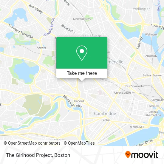
See The Girlhood Project, Cambridge, on the map
Public Transit to The Girlhood Project in Cambridge
Wondering how to get to The Girlhood Project in Cambridge? Moovit helps you find the best way to get to The Girlhood Project with step-by-step directions from the nearest public transit station.
Moovit provides free maps and live directions to help you navigate through your city. View schedules, routes, timetables, and find out how long does it take to get to The Girlhood Project in real time.
Looking for the nearest stop or station to The Girlhood Project? Check out this list of stops closest to your destination: Massachusetts Ave @ Shepard St; Massachusetts Ave @ Wendell St; Porter; Quincy St @ Broadway Opp Fogg Museum; Harvard Sq @ Garden St - Dawes Island; Waterhouse St @ Massachusetts Ave; Union Square; Magoun Station.
Bus: 1, 109, 66, 77, 96, 83, 68, 69.Train: FITCHBURG, FRAMINGHAM/WORCESTER, RED LINE.Subway: RED LINE, GREEN LINE D, GREEN LINE E, GREEN LINE B, GREEN LINE C.
Want to see if there’s another route that gets you there at an earlier time? Moovit helps you find alternative routes or times. Get directions from and directions to The Girlhood Project easily from the Moovit App or Website.
We make riding to The Girlhood Project easy, which is why over 1.7 million users, including users in Cambridge, trust Moovit as the best app for public transit. You don’t need to download an individual bus app or train app, Moovit is your all-in-one transit app that helps you find the best bus time or train time available.
For information on prices of bus, subway and train, costs and ride fares to The Girlhood Project, please check the Moovit app.
Use the app to navigate to popular places including to the airport, hospital, stadium, grocery store, mall, coffee shop, school, college, and university.
The Girlhood Project Address: 29 Everett St street in Cambridge
- Bon Appetit Caterers,
- Lesley University,
- Harkness Cafe @ Hls,
- 29 Everett Street,
- Lesley Basketball/Tennis Court,
- Seas Parking Lot,
- Harvard Immigration and Refugee Clinical Program,
- MBTA Bus Route 77 Harvard Square to Arlington Heights,
- Wendell Terrace Apartments,
- Earth Sciences Exhibit,
- Ernst Mayr Library of the Museum of Comparative Zoology, Harvard University,
- Harvard Museum Of Natural History,
- Harvard University Museums of Natural History,
- Harvard Law School,
- Baldwin School,
- Ra @ Hls Cafe,
- Harvard University-Law School,
- Harvard,
- John Harvard Apartments,
- Center for Acunpuncture & Oriental Medicine
Places Near The Girlhood Project (Cambridge)
- Seaport District, Boston,
- House Of Blues, Boston,
- North End, Boston,
- Boston Medical Center, Boston,
- Boston Children's Hospital, Boston,
- Prudential Center, Boston,
- Cheers, Boston,
- Td Garden, Boston,
- Quincy Market, Boston,
- Boston Convention & Exhibition Center, Boston,
- Wilbur Theatre, Boston,
- Boston Common, Boston,
- Leader Bank Pavilion (Leader Bank Pavillion), Boston,
- Museum Of Science, Boston,
- Faneuil Hall, Boston,
- Wang Theater, Boston,
- Isabella Stewart Gardner Museum, Boston,
- Mgm Music Hall, Boston,
- Castle Island, Boston,
- Massachusetts General Hospital, Boston
How to get to popular places in Boston with public transit
Get around Cambridge by public transit!
Traveling around Cambridge has never been so easy. See step by step directions as you travel to any attraction, street or major public transit station. View bus and train schedules, arrival times, service alerts and detailed routes on a map, so you know exactly how to get to anywhere in Cambridge.
When traveling to any destination around Cambridge use Moovit's Live Directions with Get Off Notifications to know exactly where and how far to walk, how long to wait for your line, and how many stops are left. Moovit will alert you when it's time to get off — no need to constantly re-check whether yours is the next stop.
Wondering how to use public transit in Cambridge or how to pay for public transit in Cambridge? Moovit public transit app can help you navigate your way with public transit easily, and at minimum cost. It includes public transit fees, ticket prices, and costs. Looking for a map of Cambridge public transit lines? Moovit public transit app shows all public transit maps in Cambridge with all Bus, Train, Subway and Ferry routes and stops on an interactive map.
Boston has 4 transit type(s), including: Bus, Train, Subway and Ferry, operated by several transit agencies, including MBTA, Southeastern Regional Transit Authority, MetroWest Regional Transit Authority, Rhode Island Public Transit Authority, WRTA, Lowell Regional Transit Authority, Merrimack Valley Transit, Montachusett Regional Transit Authority, Cape Cod Regional Transit Authority, Brockton Area Transit Authority, Martha's Vineyard Transit Authority, the WAVE - Nantucket Regional Transit Authority, GATRA, Cape Ann Transportation Authority and Massport