Directions to The Great Elm (Boston) with public transportation
The following transit lines have routes that pass near The Great Elm
 Bus: 111, 354, 39, 504, 9.
- Train: FAIRMOUNT, NEEDHAM.
- Subway: GREEN LINE B, GREEN LINE D, GREEN LINE E, ORANGE LINE, RED LINE.
How to get to The Great Elm by bus?
Click on the bus route to see step by step directions with maps, line arrival times and updated time schedules.
From Revere Beach, Revere
73 minFrom Best Western Adams Inn Quincy - Boston, Quincy
85 minFrom Newton, MA, Newton
47 minFrom Medford, MA, Medford
60 minFrom Codman Square, Boston
64 minFrom Qea, Quincy
99 minFrom Hebrew Rehab Center, Boston
57 minFrom Hotel Hilton Boston/Woburn, Boston
46 minFrom Heartbreak Hill, Newton
47 minFrom Arlington, MA, Arlington
97 min
How to get to The Great Elm by train?
Click on the train route to see step by step directions with maps, line arrival times and updated time schedules.
How to get to The Great Elm by subway?
Click on the subway route to see step by step directions with maps, line arrival times and updated time schedules.
From Revere Beach, Revere
46 minFrom Best Western Adams Inn Quincy - Boston, Quincy
38 minFrom Newton, MA, Newton
52 minFrom Medford, MA, Medford
45 minFrom Codman Square, Boston
35 minFrom Qea, Quincy
30 minFrom Hebrew Rehab Center, Boston
48 minFrom Hotel Hilton Boston/Woburn, Boston
29 minFrom Heartbreak Hill, Newton
53 min
Bus stops near The Great Elm in Boston
- Charles St S @ Park Plaza, 3 min walk,VIEW
- Downtown Crossing - Franklin St @ Washington St, 3 min walk,VIEW
- Stuart St @ Charles St S, 4 min walk,VIEW
- Chauncy St @ Summer St, 5 min walk,VIEW
- Temple Pl @ Washington St, 6 min walk,VIEW
- Tremont St @ Boylston Station, 6 min walk,VIEW
- Tremont St Opp Temple Pl, 6 min walk,VIEW
- Washington St @ Essex St, 7 min walk,VIEW
- Park Street - Tremont St @ Winter St, 13 min walk,VIEW
- Park Street - Tremont St Opp Hamilton Pl, 14 min walk,VIEW
Subway stations near The Great Elm in Boston
Bus lines to The Great Elm in Boston
- 43, Park St & Tremont St,VIEW
- RED LINE SHUTTLE, Ashmont - Park Street via Post Office,VIEW
- RED LINE SHUTTLE, JFK/UMass - Park Street via Post Office,VIEW
- RED LINE SHUTTLE, JFK/UMass - Park Street,VIEW
- 39, Haymarket Via Forest Hills,VIEW
- 57, Haymarket Via Kenmore,VIEW
- 501, Brighton Via Copley (Express),VIEW
- 504, Watertown Via Copley And Newton Corner (Express),VIEW
- 11, Chauncy & Summer,VIEW
- 15, Haymarket Via Fields Corner & Nubian,VIEW
- SL5, Downtown,VIEW
- GREEN LINE E SHUTTLE, Heath Street - Park Street,VIEW
- GREEN LINE SHUTTLE, Boston University East - Park Street,VIEW
- RED LINE SHUTTLE, South Station (Shuttle),VIEW
- SL4, South Station,VIEW
- RED LINE SHUTTLE, Kendall/MIT - Park Street,VIEW
- RED LINE SHUTTLE, Kendall/MIT - Broadway via Pearl Street,VIEW
- RED LINE SHUTTLE, Kendall/MIT - Broadway via Downtown Crossing,VIEW
- RED LINE SHUTTLE, Alewife (Shuttle),VIEW
- RED LINE SHUTTLE, Park Street (Shuttle),VIEW
What are the closest stations to The Great Elm?
The closest stations to The Great Elm are:
- Charles St S @ Park Plaza is 198 yards away, 3 min walk.
- Downtown Crossing - Franklin St @ Washington St is 226 yards away, 3 min walk.
- Arlington is 244 yards away, 3 min walk.
- Stuart St @ Charles St S is 282 yards away, 4 min walk.
- Chauncy St @ Summer St is 341 yards away, 5 min walk.
- Temple Pl @ Washington St is 401 yards away, 6 min walk.
- Tremont St @ Boylston Station is 435 yards away, 6 min walk.
- Tremont St Opp Temple Pl is 462 yards away, 6 min walk.
- Chinatown is 470 yards away, 6 min walk.
- Washington St @ Essex St is 526 yards away, 7 min walk.
- Park Street is 606 yards away, 8 min walk.
- Park Street - Tremont St @ Winter St is 1039 yards away, 13 min walk.
- Park Street - Tremont St Opp Hamilton Pl is 1118 yards away, 14 min walk.
Which bus lines stop near The Great Elm?
These bus lines stop near The Great Elm: 111, 354, 39, 504, 9, SL4, SL5.
Which train lines stop near The Great Elm?
These train lines stop near The Great Elm: FAIRMOUNT, NEEDHAM.
Which subway lines stop near The Great Elm?
These subway lines stop near The Great Elm: GREEN LINE B, GREEN LINE D, GREEN LINE E, ORANGE LINE, RED LINE.
What’s the nearest subway station to The Great Elm in Boston?
The nearest subway station to The Great Elm in Boston is Arlington. It’s a 3 min walk away.
What’s the nearest bus station to The Great Elm in Boston?
The nearest bus stations to The Great Elm in Boston are Charles St S @ Park Plaza and Downtown Crossing - Franklin St @ Washington St. The closest one is a 3 min walk away.
What time is the first subway to The Great Elm in Boston?
The GREEN LINE E is the first subway that goes to The Great Elm in Boston. It stops nearby at 5:07 AM.
What time is the last subway to The Great Elm in Boston?
The GREEN LINE E is the last subway that goes to The Great Elm in Boston. It stops nearby at 2:18 AM.
What time is the first bus to The Great Elm in Boston?
The 57 is the first bus that goes to The Great Elm in Boston. It stops nearby at 5:00 AM.
What time is the last bus to The Great Elm in Boston?
The 11 is the last bus that goes to The Great Elm in Boston. It stops nearby at 1:15 AM.
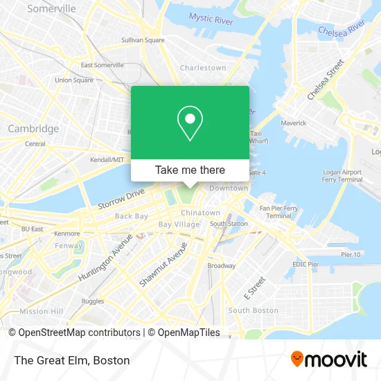
See The Great Elm, Boston, on the map
Public Transit to The Great Elm in Boston
Wondering how to get to The Great Elm in Boston? Moovit helps you find the best way to get to The Great Elm with step-by-step directions from the nearest public transit station.
Moovit provides free maps and live directions to help you navigate through your city. View schedules, routes, timetables, and find out how long does it take to get to The Great Elm in real time.
Looking for the nearest stop or station to The Great Elm? Check out this list of stops closest to your destination: Charles St S @ Park Plaza; Downtown Crossing - Franklin St @ Washington St; Arlington; Stuart St @ Charles St S; Chauncy St @ Summer St; Temple Pl @ Washington St; Tremont St @ Boylston Station; Tremont St Opp Temple Pl; Chinatown; Washington St @ Essex St; Park Street; Park Street - Tremont St @ Winter St; Park Street - Tremont St Opp Hamilton Pl.
Bus: 111, 354, 39, 504, 9, SL4, SL5, 43, RED LINE SHUTTLE, RED LINE SHUTTLE, RED LINE SHUTTLE, 57, 501.Train: FAIRMOUNT, NEEDHAM.Subway: GREEN LINE B, GREEN LINE D, GREEN LINE E, ORANGE LINE, RED LINE, GREEN LINE C.
Want to see if there’s another route that gets you there at an earlier time? Moovit helps you find alternative routes or times. Get directions from and directions to The Great Elm easily from the Moovit App or Website.
We make riding to The Great Elm easy, which is why over 1.7 million users, including users in Boston, trust Moovit as the best app for public transit. You don’t need to download an individual bus app or train app, Moovit is your all-in-one transit app that helps you find the best bus time or train time available.
For information on prices of bus, subway and train, costs and ride fares to The Great Elm, please check the Moovit app.
Use the app to navigate to popular places including to the airport, hospital, stadium, grocery store, mall, coffee shop, school, college, and university.
Location: Boston
- Boston Common,
- The Tadpole Playground and the Frog Pond,
- Frog Pond (The Boston Common Frog Pond),
- Frog Pond,
- Freedom Trail (Pirates & Patriots Freedom Trl Tour),
- Visitor Information Center at Boston Common,
- Boston Common Visitor Center,
- Parkman Bandstand,
- Tremont St,
- Cohen & Associates (Marc A Cohen CPA),
- 141 Tremont Street,
- Boston Common,
- Tremont Street subway,
- Beantown Trolley Tours,
- 139 Tremont St,
- Alcohol Treatment Center 24 Hour Help Line,
- Lambert's Marketplace,
- Southbound Platform (Track 5),
- Somerset Club,
- Freedom Trail Starting Point
Places Near The Great Elm (Boston)
- Quincy Market, Boston,
- Museum Of Science, Boston,
- Cheers, Boston,
- North End, Boston,
- Castle Island, Boston,
- Seaport District, Boston,
- Wilbur Theatre, Boston,
- Td Garden, Boston,
- Mgm Music Hall, Boston,
- Isabella Stewart Gardner Museum, Boston,
- Boston Children's Hospital, Boston,
- Boston Medical Center, Boston,
- Wang Theater, Boston,
- House Of Blues, Boston,
- Prudential Center, Boston,
- Faneuil Hall, Boston,
- Leader Bank Pavilion (Leader Bank Pavillion), Boston,
- Boston Common, Boston,
- Massachusetts General Hospital, Boston,
- Boston Convention & Exhibition Center, Boston
How to get to popular places in Boston with public transit
Get around Boston by public transit!
Traveling around Boston has never been so easy. See step by step directions as you travel to any attraction, street or major public transit station. View bus and train schedules, arrival times, service alerts and detailed routes on a map, so you know exactly how to get to anywhere in Boston.
When traveling to any destination around Boston use Moovit's Live Directions with Get Off Notifications to know exactly where and how far to walk, how long to wait for your line, and how many stops are left. Moovit will alert you when it's time to get off — no need to constantly re-check whether yours is the next stop.
Wondering how to use public transit in Boston or how to pay for public transit in Boston? Moovit public transit app can help you navigate your way with public transit easily, and at minimum cost. It includes public transit fees, ticket prices, and costs. Looking for a map of Boston public transit lines? Moovit public transit app shows all public transit maps in Boston with all Bus, Train, Subway and Ferry routes and stops on an interactive map.
Boston has 4 transit type(s), including: Bus, Train, Subway and Ferry, operated by several transit agencies, including MBTA, Southeastern Regional Transit Authority, MetroWest Regional Transit Authority, Rhode Island Public Transit Authority, WRTA, Lowell Regional Transit Authority, Merrimack Valley Transit, Montachusett Regional Transit Authority, Cape Cod Regional Transit Authority, Brockton Area Transit Authority, Martha's Vineyard Transit Authority, the WAVE - Nantucket Regional Transit Authority, GATRA, Cape Ann Transportation Authority and Massport