Directions to The Haymakers (Somerville) with public transportation
The following transit lines have routes that pass near The Haymakers
 Bus: 101, 83, 89, 96, 80.
- Train: FITCHBURG, LOWELL, RED LINE.
- Subway: GREEN LINE E, GREEN LINE B, GREEN LINE C.
How to get to The Haymakers by bus?
Click on the bus route to see step by step directions with maps, line arrival times and updated time schedules.
From Castle Island, Boston
82 minFrom Hilton Garden Inn Boston Logan Airport, Boston
60 minFrom Fort Independence, Boston
81 minFrom Bentley University, Waltham
109 minFrom Harvard Vanguard - Kenmore, Boston
50 minFrom Six Flags New England, Newton
86 minFrom City Winery Boston, Boston
35 minFrom Saugus, MA, Saugus
58 minFrom Woburn, MA, Woburn
50 minFrom Melrose Wakefield Hospital, Malden
46 min
How to get to The Haymakers by train?
Click on the train route to see step by step directions with maps, line arrival times and updated time schedules.
How to get to The Haymakers by subway?
Click on the subway route to see step by step directions with maps, line arrival times and updated time schedules.
Bus stops near The Haymakers in Somerville
Subway station near The Haymakers in Somerville
- Magoun Station, 14 min walk,VIEW
Train station near The Haymakers in Somerville
- Porter, 32 min walk,VIEW
Bus lines to The Haymakers in Somerville
- 101, Malden,VIEW
- 80, Lechmere,VIEW
- 89, Sullivan,VIEW
- GREEN LINE E SHUTTLE, Government Center - Medford/Tufts (Shuttle),VIEW
- GREEN LINE E SHUTTLE, Medford/Tufts - North Station,VIEW
- GREEN LINE E SHUTTLE, North Station - Medford/Tufts (Shuttle),VIEW
- 89/93, Haymarket Via Sullivan,VIEW
- GREEN LINE E SHUTTLE, East Somerville (Shuttle),VIEW
- GREEN LINE SHUTTLE, Medford/Tufts Via Union Square (Shuttle),VIEW
What are the closest stations to The Haymakers?
The closest stations to The Haymakers are:
- Main St @ Henry St is 108 yards away, 2 min walk.
- Broadway @ William St is 244 yards away, 3 min walk.
- Medford St @ Broadway - Magoun Sq is 273 yards away, 4 min walk.
- Broadway @ Hinckley St - Magoun Sq is 283 yards away, 4 min walk.
- Magoun Square - Medford St @ Lowell St is 359 yards away, 5 min walk.
- Magoun Station is 1167 yards away, 14 min walk.
- Porter is 2661 yards away, 32 min walk.
Which bus lines stop near The Haymakers?
These bus lines stop near The Haymakers: 101, 83, 89, 96.
Which train lines stop near The Haymakers?
These train lines stop near The Haymakers: FITCHBURG, LOWELL.
Which subway line stops near The Haymakers?
GREEN LINE E (Lechmere)
What’s the nearest subway station to The Haymakers in Somerville?
The nearest subway station to The Haymakers in Somerville is Magoun Station. It’s a 14 min walk away.
What’s the nearest bus station to The Haymakers in Somerville?
The nearest bus station to The Haymakers in Somerville is Main St @ Henry St. It’s a 2 min walk away.
What time is the first subway to The Haymakers in Somerville?
The GREEN LINE E is the first subway that goes to The Haymakers in Somerville. It stops nearby at 4:51 AM.
What time is the last subway to The Haymakers in Somerville?
The GREEN LINE E is the last subway that goes to The Haymakers in Somerville. It stops nearby at 2:39 AM.
What time is the first train to The Haymakers in Somerville?
The FITCHBURG is the first train that goes to The Haymakers in Somerville. It stops nearby at 5:47 AM.
What time is the last train to The Haymakers in Somerville?
The FITCHBURG is the last train that goes to The Haymakers in Somerville. It stops nearby at 12:17 AM.
What time is the first bus to The Haymakers in Somerville?
The 89/93 is the first bus that goes to The Haymakers in Somerville. It stops nearby at 4:37 AM.
What time is the last bus to The Haymakers in Somerville?
The 89 is the last bus that goes to The Haymakers in Somerville. It stops nearby at 1:43 AM.
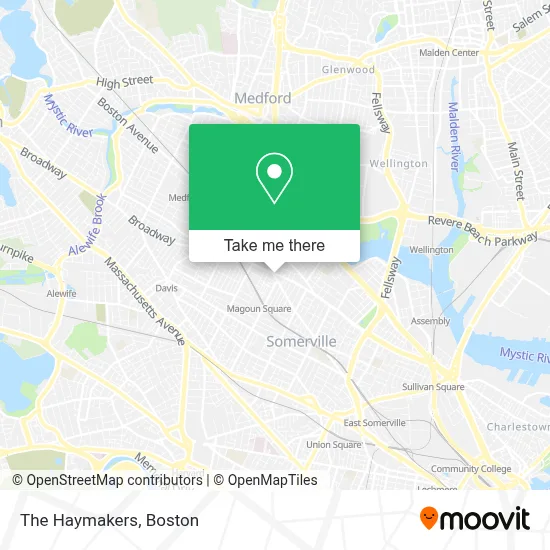
See The Haymakers, Somerville, on the map
Public Transit to The Haymakers in Somerville
Wondering how to get to The Haymakers in Somerville? Moovit helps you find the best way to get to The Haymakers with step-by-step directions from the nearest public transit station.
Moovit provides free maps and live directions to help you navigate through your city. View schedules, routes, timetables, and find out how long does it take to get to The Haymakers in real time.
Looking for the nearest stop or station to The Haymakers? Check out this list of stops closest to your destination: Main St @ Henry St; Broadway @ William St; Medford St @ Broadway - Magoun Sq; Broadway @ Hinckley St - Magoun Sq; Magoun Square - Medford St @ Lowell St; Magoun Station; Porter.
Bus: 101, 83, 89, 96, 80, GREEN LINE E SHUTTLE, GREEN LINE E SHUTTLE, GREEN LINE E SHUTTLE, 89/93.Train: FITCHBURG, LOWELL, RED LINE.Subway: GREEN LINE E, GREEN LINE B, GREEN LINE C.
Want to see if there’s another route that gets you there at an earlier time? Moovit helps you find alternative routes or times. Get directions from and directions to The Haymakers easily from the Moovit App or Website.
We make riding to The Haymakers easy, which is why over 1.7 million users, including users in Somerville, trust Moovit as the best app for public transit. You don’t need to download an individual bus app or train app, Moovit is your all-in-one transit app that helps you find the best bus time or train time available.
For information on prices of bus, subway and train, costs and ride fares to The Haymakers, please check the Moovit app.
Use the app to navigate to popular places including to the airport, hospital, stadium, grocery store, mall, coffee shop, school, college, and university.
Location: Somerville, Boston
- Magoun Sq.,
- Rodriguez Hardwood Flooring Inc,
- Magoun Square Barber Shop,
- Pat's Towing Inc.,
- Trum Field,
- Magoun Square,
- Somerville Animal Control,
- Somerville Inspectional Services,
- Crispr Therapeutics,
- Public Tavern,
- Order Sons Of Italy In America,
- MBTA Bus Route 89,
- Wellness Spa,
- Digirolamo Richard G Law Offices,
- Hillside Auto Repair And Gas Station,
- Elevate Digital Marketing,
- Keyme Locksmiths,
- Amazon Locker - Imani,
- Atm 7eleven, Inc.,
- Atm 7eleven-Fcti
Places Near The Haymakers (Somerville)
- North End, Boston,
- Castle Island, Boston,
- Prudential Center, Boston,
- Wilbur Theatre, Boston,
- Faneuil Hall, Boston,
- Quincy Market, Boston,
- House Of Blues, Boston,
- Boston Common, Boston,
- Cheers, Boston,
- Td Garden, Boston,
- Seaport District, Boston,
- Isabella Stewart Gardner Museum, Boston,
- Boston Convention & Exhibition Center, Boston,
- Boston Medical Center, Boston,
- Leader Bank Pavilion (Leader Bank Pavillion), Boston,
- Massachusetts General Hospital, Boston,
- Boston Children's Hospital, Boston,
- Mgm Music Hall, Boston,
- Museum Of Science, Boston,
- Wang Theater, Boston
How to get to popular places in Boston with public transit
Get around Somerville by public transit!
Traveling around Somerville has never been so easy. See step by step directions as you travel to any attraction, street or major public transit station. View bus and train schedules, arrival times, service alerts and detailed routes on a map, so you know exactly how to get to anywhere in Somerville.
When traveling to any destination around Somerville use Moovit's Live Directions with Get Off Notifications to know exactly where and how far to walk, how long to wait for your line, and how many stops are left. Moovit will alert you when it's time to get off — no need to constantly re-check whether yours is the next stop.
Wondering how to use public transit in Somerville or how to pay for public transit in Somerville? Moovit public transit app can help you navigate your way with public transit easily, and at minimum cost. It includes public transit fees, ticket prices, and costs. Looking for a map of Somerville public transit lines? Moovit public transit app shows all public transit maps in Somerville with all Bus, Train, Subway and Ferry routes and stops on an interactive map.
Boston has 4 transit type(s), including: Bus, Train, Subway and Ferry, operated by several transit agencies, including MBTA, Southeastern Regional Transit Authority, MetroWest Regional Transit Authority, Rhode Island Public Transit Authority, WRTA, Lowell Regional Transit Authority, Merrimack Valley Transit, Montachusett Regional Transit Authority, Cape Cod Regional Transit Authority, Brockton Area Transit Authority, Martha's Vineyard Transit Authority, the WAVE - Nantucket Regional Transit Authority, GATRA, Cape Ann Transportation Authority and Massport