Directions to The Heartwell Institute (Worcester) with public transportation
The following transit lines have routes that pass near The Heartwell Institute
 Bus: 14, 15, CLINTON-WORCESTER COMMUTER SHUTTLE, GREYHOUND US0230, 23.
- Train: FRAMINGHAM/WORCESTER.
How to get to The Heartwell Institute by bus?
Click on the bus route to see step by step directions with maps, line arrival times and updated time schedules.
Bus stops near The Heartwell Institute in Worcester
Bus lines to The Heartwell Institute in Worcester
- 23, Central Hub,VIEW
- 26, Great Brook Valley,VIEW
- 30, West Boylston Walmart,VIEW
- 14, Price Chopper Pulman St,VIEW
- 15, Julio Drive Shrewsbury,VIEW
- CLINTON-WORCESTER COMMUTER SHUTTLE, Mart Intermodal Transportation Center, Fitchburg,VIEW
- 3, Worcester State University,VIEW
- 24, Umass Medical Center,VIEW
- 31, Lincoln Plaza,VIEW
What are the closest stations to The Heartwell Institute?
The closest stations to The Heartwell Institute are:
- Major Taylor & Mlk In is 293 yards away, 4 min walk.
- Summer And Post Office is 302 yards away, 4 min walk.
- Shrewsbury St at Mulberry is 400 yards away, 5 min walk.
- Worcester Medical/ St. Vincent is 595 yards away, 7 min walk.
- Foster St + Major Taylor Blvd is 801 yards away, 10 min walk.
Which bus lines stop near The Heartwell Institute?
These bus lines stop near The Heartwell Institute: 14, 15, CLINTON-WORCESTER COMMUTER SHUTTLE, GREYHOUND US0230.
Which train line stops near The Heartwell Institute?
FRAMINGHAM/WORCESTER (#525 | Worcester)
What’s the nearest bus station to The Heartwell Institute in Worcester?
The nearest bus stations to The Heartwell Institute in Worcester are Major Taylor & Mlk In and Summer And Post Office. The closest one is a 4 min walk away.
What time is the first bus to The Heartwell Institute in Worcester?
The 3 is the first bus that goes to The Heartwell Institute in Worcester. It stops nearby at 5:10 AM.
What time is the last bus to The Heartwell Institute in Worcester?
The 26 is the last bus that goes to The Heartwell Institute in Worcester. It stops nearby at 11:31 PM.
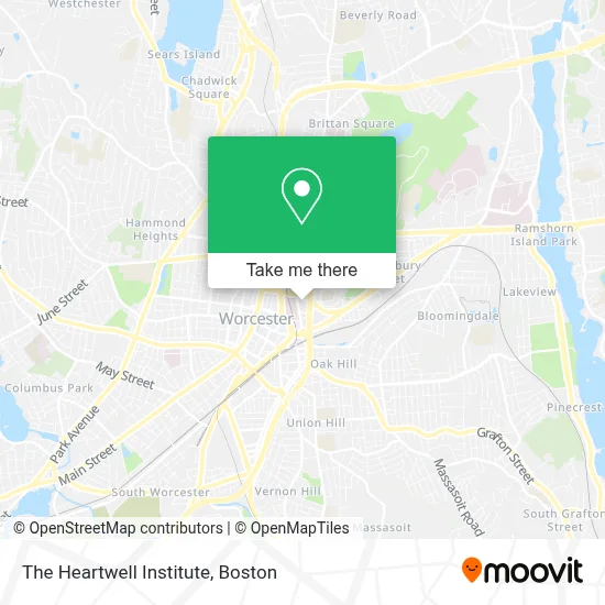
See The Heartwell Institute, Worcester, on the map
Public Transit to The Heartwell Institute in Worcester
Wondering how to get to The Heartwell Institute in Worcester? Moovit helps you find the best way to get to The Heartwell Institute with step-by-step directions from the nearest public transit station.
Moovit provides free maps and live directions to help you navigate through your city. View schedules, routes, timetables, and find out how long does it take to get to The Heartwell Institute in real time.
Looking for the nearest stop or station to The Heartwell Institute? Check out this list of stops closest to your destination: Major Taylor & Mlk In; Summer And Post Office; Shrewsbury St at Mulberry; Worcester Medical/ St. Vincent; Foster St + Major Taylor Blvd.
Bus: 14, 15, CLINTON-WORCESTER COMMUTER SHUTTLE, GREYHOUND US0230, 23, 26, 30, 3, 24, 31.Train: FRAMINGHAM/WORCESTER.
Want to see if there’s another route that gets you there at an earlier time? Moovit helps you find alternative routes or times. Get directions from and directions to The Heartwell Institute easily from the Moovit App or Website.
We make riding to The Heartwell Institute easy, which is why over 1.7 million users, including users in Worcester, trust Moovit as the best app for public transit. You don’t need to download an individual bus app or train app, Moovit is your all-in-one transit app that helps you find the best bus time or train time available.
For information on prices of bus and train, costs and ride fares to The Heartwell Institute, please check the Moovit app.
Use the app to navigate to popular places including to the airport, hospital, stadium, grocery store, mall, coffee shop, school, college, and university.
The Heartwell Institute Address: 4 E Central St street in Worcester
- Madaiah Lokeshwari, MD,
- Daniel Morin, Pa,
- Worcester Medical Center (Brian C Downey),
- Apurva Shah, MD,
- Kavita Seetharaman, MD,
- Worcester Pediatrics,
- Christina McCarthy, Pa-C,
- Patricia Chernosky, MD,
- Saint Vincent Medical Group: Thoracic Surgery,
- Dr Eddison Ramsaran MD,
- Thomas King, MD,
- STARBUCKS,
- Mezcal Tequila Kitchen,
- Suite 590 St Vincent Hospital,
- LAZ Parking Saint Vincent Hospital,
- Saint Vincent Hospital at Worcester Medical Center,
- St Vincent Hospital TH Medical,
- Greg Livanos DMD,
- Worcester Dermatology,
- Sewer Cleaning Services Near Me
Places Near The Heartwell Institute (Worcester)
- Wilbur Theatre, Boston,
- Cheers, Boston,
- Isabella Stewart Gardner Museum, Boston,
- Seaport District, Boston,
- Mgm Music Hall, Boston,
- Quincy Market, Boston,
- Wang Theater, Boston,
- Leader Bank Pavilion (Leader Bank Pavillion), Boston,
- Td Garden, Boston,
- Boston Medical Center, Boston,
- House Of Blues, Boston,
- Boston Children's Hospital, Boston,
- Faneuil Hall, Boston,
- Museum Of Science, Boston,
- Boston Common, Boston,
- Boston Convention & Exhibition Center, Boston,
- Castle Island, Boston,
- North End, Boston,
- Prudential Center, Boston,
- Massachusetts General Hospital, Boston
How to get to popular places in Boston with public transit
Get around Worcester by public transit!
Traveling around Worcester has never been so easy. See step by step directions as you travel to any attraction, street or major public transit station. View bus and train schedules, arrival times, service alerts and detailed routes on a map, so you know exactly how to get to anywhere in Worcester.
When traveling to any destination around Worcester use Moovit's Live Directions with Get Off Notifications to know exactly where and how far to walk, how long to wait for your line, and how many stops are left. Moovit will alert you when it's time to get off — no need to constantly re-check whether yours is the next stop.
Wondering how to use public transit in Worcester or how to pay for public transit in Worcester? Moovit public transit app can help you navigate your way with public transit easily, and at minimum cost. It includes public transit fees, ticket prices, and costs. Looking for a map of Worcester public transit lines? Moovit public transit app shows all public transit maps in Worcester with all Bus, Train, Subway and Ferry routes and stops on an interactive map.
Boston has 4 transit type(s), including: Bus, Train, Subway and Ferry, operated by several transit agencies, including MBTA, Southeastern Regional Transit Authority, MetroWest Regional Transit Authority, Rhode Island Public Transit Authority, WRTA, Lowell Regional Transit Authority, Merrimack Valley Transit, Montachusett Regional Transit Authority, Cape Cod Regional Transit Authority, Brockton Area Transit Authority, Martha's Vineyard Transit Authority, the WAVE - Nantucket Regional Transit Authority, GATRA, Cape Ann Transportation Authority and Massport