How to get to The Helmway by bus?
Click on the bus route to see step by step directions with maps, line arrival times and updated time schedules.
From Amazon Fulfillment Bos7, Fall River
192 minFrom Charlton Memorial Hospital, Fall River
102 minFrom Lizzy Borden House, Fall River
64 minFrom Barahona Express, Providence
86 minFrom B.M.C. Durfee High School, Fall River
83 minFrom Walmart Fall River Supercenter, Fall River
97 minFrom Bristol Community College, Fall River
84 min
Bus stops near The Helmway in Boston
Bus lines to The Helmway in Boston
What are the closest stations to The Helmway?
The closest stations to The Helmway are:
- E Main Opposite Forest is 249 yards away, 4 min walk.
- E Main Opposite Enterprise is 772 yards away, 10 min walk.
Which bus line stops near The Helmway?
60 (Newport Via E Main Rd)
What’s the nearest bus station to The Helmway in Boston?
The nearest bus station to The Helmway in Boston is E Main Opposite Forest. It’s a 4 min walk away.
What time is the first bus to The Helmway in Boston?
The 60 is the first bus that goes to The Helmway in Boston. It stops nearby at 5:36 AM.
What time is the last bus to The Helmway in Boston?
The 60 is the last bus that goes to The Helmway in Boston. It stops nearby at 1:12 AM.
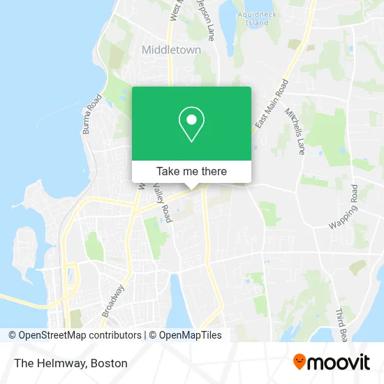
See The Helmway, Boston, on the map
Public Transit to The Helmway in Boston
Wondering how to get to The Helmway in Boston? Moovit helps you find the best way to get to The Helmway with step-by-step directions from the nearest public transit station.
Moovit provides free maps and live directions to help you navigate through your city. View schedules, routes, timetables, and find out how long does it take to get to The Helmway in real time.
Looking for the nearest stop or station to The Helmway? Check out this list of stops closest to your destination: E Main Opposite Forest; E Main Opposite Enterprise.
Bus: 60, 63.
Want to see if there’s another route that gets you there at an earlier time? Moovit helps you find alternative routes or times. Get directions from and directions to The Helmway easily from the Moovit App or Website.
We make riding to The Helmway easy, which is why over 1.7 million users, including users in Boston, trust Moovit as the best app for public transit. You don’t need to download an individual bus app or train app, Moovit is your all-in-one transit app that helps you find the best bus time or train time available.
For information on prices of bus, costs and ride fares to The Helmway, please check the Moovit app.
Use the app to navigate to popular places including to the airport, hospital, stadium, grocery store, mall, coffee shop, school, college, and university.
The Helmway Address: 425 E Main Rd street in Boston
- Wilmer Pro Painting,
- Lesco Service Center,
- Ramada by Wyndham Middletown Newport Area,
- Town Hall Of Middletown,
- Second Beach/Sachuset TWN Bch,
- Middletown Ri,
- Island Paws Spa & Boutique,
- Bee Exotic Travel,
- Root. Hair And Beauty,
- Jenkins Construction,
- Healing Point,
- Colonial Chimney Sweep,
- The Nail Files,
- Lucitetombstones,
- A Better Idea! Promotional Products Agency,
- Healthcare Industry Promotions,
- Lands End Limousine Inc,
- Island Time Catering,
- West House II,
- Kv Rentals
Places Near The Helmway (Boston)
- Boston Children's Hospital, Boston,
- Castle Island, Boston,
- House Of Blues, Boston,
- North End, Boston,
- Seaport District, Boston,
- Faneuil Hall, Boston,
- Leader Bank Pavilion (Leader Bank Pavillion), Boston,
- Wang Theater, Boston,
- Boston Convention & Exhibition Center, Boston,
- Boston Common, Boston,
- Massachusetts General Hospital, Boston,
- Boston Medical Center, Boston,
- Prudential Center, Boston,
- Cheers, Boston,
- Td Garden, Boston,
- Mgm Music Hall, Boston,
- Quincy Market, Boston,
- Wilbur Theatre, Boston,
- Museum Of Science, Boston,
- Isabella Stewart Gardner Museum, Boston
How to get to popular places in Boston with public transit
Get around Boston by public transit!
Traveling around Boston has never been so easy. See step by step directions as you travel to any attraction, street or major public transit station. View bus and train schedules, arrival times, service alerts and detailed routes on a map, so you know exactly how to get to anywhere in Boston.
When traveling to any destination around Boston use Moovit's Live Directions with Get Off Notifications to know exactly where and how far to walk, how long to wait for your line, and how many stops are left. Moovit will alert you when it's time to get off — no need to constantly re-check whether yours is the next stop.
Wondering how to use public transit in Boston or how to pay for public transit in Boston? Moovit public transit app can help you navigate your way with public transit easily, and at minimum cost. It includes public transit fees, ticket prices, and costs. Looking for a map of Boston public transit lines? Moovit public transit app shows all public transit maps in Boston with all Bus, Train, Subway and Ferry routes and stops on an interactive map.
Boston has 4 transit type(s), including: Bus, Train, Subway and Ferry, operated by several transit agencies, including MBTA, Southeastern Regional Transit Authority, MetroWest Regional Transit Authority, Rhode Island Public Transit Authority, WRTA, Lowell Regional Transit Authority, Merrimack Valley Transit, Montachusett Regional Transit Authority, Cape Cod Regional Transit Authority, Brockton Area Transit Authority, Martha's Vineyard Transit Authority, the WAVE - Nantucket Regional Transit Authority, GATRA, Cape Ann Transportation Authority and Massport