See The Hotel. Brussels on the map
Directions to The Hotel. Brussels with public transportation
The following transit lines have routes that pass near The Hotel. Brussels
 Bus:
Bus: - Train:
- Subway:
How to get to The Hotel. Brussels by bus?
Click on the bus route to see step by step directions with maps, line arrival times and updated time schedules.
How to get to The Hotel. Brussels by train?
Click on the train route to see step by step directions with maps, line arrival times and updated time schedules.
Bus stations near The Hotel. Brussels
- Louise / Louiza,3 min walk,
- Louise,3 min walk,
- Porte De Namur / Naamsepoort,6 min walk,
- Petit Sablon / Kleine Zavel,7 min walk,
Light Rail stations near The Hotel. Brussels
- Louise,4 min walk,
Bus lines to The Hotel. Brussels
- 33,Dansaert - Louise,
- 54,Trone - Forest (bervoets),
- N08,Gare Centrale - Wiener,
- N09,Gare Centrale - Herrmann-debroux,
- N10,Gare Centrale - Fort-jaco,
- 38,Heros,
- N06,Musee du Tram,
- N11,Homborch,
- 71,De Brouckere,
- 95,Wiener,
- N04,Cim. De Bruxelles,
- N05,Kraainem,
- N12,Gare Centrale,
- 34,Porte De Namur,
- 64,Bordet Station,
- 80,Pte De Namur Via Parc Leop,
What are the closest stations to The Hotel. Brussels?
The closest stations to The Hotel. Brussels are:
- Louise / Louiza is 173 meters away, 3 min walk.
- Louise is 193 meters away, 3 min walk.
- Porte De Namur / Naamsepoort is 423 meters away, 6 min walk.
- Petit Sablon / Kleine Zavel is 454 meters away, 7 min walk.
Which bus lines stop near The Hotel. Brussels?
These bus lines stop near The Hotel. Brussels: 12, 33, 48, 64, 80.
Which train lines stop near The Hotel. Brussels?
These train lines stop near The Hotel. Brussels: IC, S2, S4, S9.
Which subway lines stop near The Hotel. Brussels?
These subway lines stop near The Hotel. Brussels: 2, 6.
What’s the nearest light rail station to The Hotel. Brussels?
The nearest light rail station to The Hotel. Brussels is Louise. It’s a 4 min walk away.
What’s the nearest bus stop to The Hotel. Brussels?
The nearest bus stops to The Hotel. Brussels are Louise / Louiza and Louise. The closest one is a 3 min walk away.
What time is the first light rail to The Hotel. Brussels?
The 97 is the first light rail that goes to The Hotel. Brussels. It stops nearby at 5:25 AM.
What time is the last light rail to The Hotel. Brussels?
The 8 is the last light rail that goes to The Hotel. Brussels. It stops nearby at 1:03 AM.
What time is the first subway to The Hotel. Brussels?
The 6 is the first subway that goes to The Hotel. Brussels. It stops nearby at 5:19 AM.
What time is the last subway to The Hotel. Brussels?
The 6 is the last subway that goes to The Hotel. Brussels. It stops nearby at 12:40 AM.
What time is the first bus to The Hotel. Brussels?
The 71 is the first bus that goes to The Hotel. Brussels. It stops nearby at 5:10 AM.
What time is the last bus to The Hotel. Brussels?
The 71 is the last bus that goes to The Hotel. Brussels. It stops nearby at 12:57 AM.
How much is the subway fare to The Hotel. Brussels?
The subway fare to The Hotel. Brussels costs about €2.10.
How much is the bus fare to The Hotel. Brussels?
The bus fare to The Hotel. Brussels costs about €2.10.
See The Hotel. Brussels on the map
Public Transportation to The Hotel. Brussels
Wondering how to get to The Hotel. Brussels, Belgium? Moovit helps you find the best way to get to The Hotel. Brussels with step-by-step directions from the nearest public transit station.
Moovit provides free maps and live directions to help you navigate through your city. View schedules, routes, timetables, and find out how long does it take to get to The Hotel. Brussels in real time.
Looking for the nearest stop or station to The Hotel. Brussels? Check out this list of stops closest to your destination: Louise / Louiza; Louise; Porte De Namur / Naamsepoort; Petit Sablon / Kleine Zavel.
Bus:Train:Subway:
Want to see if there’s another route that gets you there at an earlier time? Moovit helps you find alternative routes or times. Get directions from and directions to The Hotel. Brussels easily from the Moovit App or Website.
We make riding to The Hotel. Brussels easy, which is why over 1.5 million users, including users in Brussel, trust Moovit as the best app for public transit. You don’t need to download an individual bus app or train app, Moovit is your all-in-one transit app that helps you find the best bus time or train time available.
For information on prices of bus, train and subway, costs and ride fares to The Hotel. Brussels, please check the Moovit app.
Use the app to navigate to popular places including to the airport, hospital, stadium, grocery store, mall, coffee shop, school, college, and university.
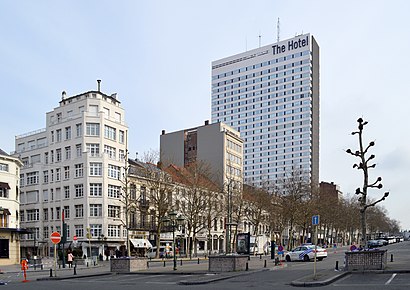
The Hotel. Brussels Address: Boulevard de Waterloolaan 38 street in Brussel
Attractions near The Hotel. Brussels
The Hotel Brussels,Façonnable,CafÉ D'egmont,Tod's,Gucci,Hermès,Glacière,Juttu,La Fabrique En Ville,Iselp,La Chemiserie Traditionnelle,Kent,Zara,Parc D'Egmont - Egmontpark,Van Cleef & Arpels,Louizatunnel / Tunnel Louise ,Sofitel Brussels Le Louise,Weekday,Moncler,Apple BelgiëHow to get to popular attractions in Brussel with public transit
DHL Express Belgium, Machelen,AZ Groeninge - Campus Reepkaai, Kortrijk,Geluwe, Wervik,E19 - Kleine Bareel, Antwerpen,Denderhoutem, Haaltert,Aquafun, De Haan,Station Edingen (Gare d'Enghien), Herne,CC De Ploter, Ternat,Fleurus, Fleurus,DKW Evergem - terrein Kerkbrugge, Evergem,AZ Delta - Campus Westlaan, Roeselare,KMSK Deinze, Deinze,DreamLand, Oostende,Station Gavere-Asper, Gavere,Maerlant Atheneum - Campus Blankenberge, De Haan,Zwembad Palaestra, Deinze,Sint-Gertrudiscollege (SGW), Wetteren,Kachtem, Izegem,Frietkotheek Wezze, Avelgem,Dienstverleningscentrum Maria ter Engelen Klerken, HouthulstGet around Brussel by public transit!
Traveling around Brussel has never been so easy. See step by step directions as you travel to any attraction, street or major public transit station. View bus and train schedules, arrival times, service alerts and detailed routes on a map, so you know exactly how to get to anywhere in Brussel.
When traveling to any destination around Brussel use Moovit's Live Directions with Get Off Notifications to know exactly where and how far to walk, how long to wait for your line, and how many stops are left. Moovit will alert you when it's time to get off — no need to constantly re-check whether yours is the next stop.
Wondering how to use public transit in Brussel or how to pay for public transit in Brussel? Moovit public transit app can help you navigate your way with public transit easily, and at minimum cost. It includes public transit fees, ticket prices, and costs. Looking for a map of Brussel public transit lines? Moovit public transit app shows all public transit maps in Brussel with all bus, train or subway routes and stops on an interactive map.
Brussel has 3 transit type(s), including: bus, train or subway, operated by several transit agencies, including STIB, STIB, STIB, Brussels City Shuttle, NMBS/SNCB, NMBS/SNCB, De Lijn, De Lijn, TEC Liège - Verviers, TEC Charleroi, TEC Charleroi, TEC Namur - Luxembourg, TEC Brabant Wallon, TEC Hainaut and DeWaterbus