Directions to The Huntington (Boston) with public transportation
The following transit lines have routes that pass near The Huntington
 Bus: 1, 22, 39, 9, GREEN LINE E SHUTTLE.
- Train: NEEDHAM, FRANKLIN/FOXBORO, ORANGE LINE, PROVIDENCE/STOUGHTON.
- Subway: GREEN LINE E, ORANGE LINE.
How to get to The Huntington by bus?
Click on the bus route to see step by step directions with maps, line arrival times and updated time schedules.
From Mount Ida College, Newton
67 minFrom Arnold Arboretum, Boston
35 minFrom Spaulding Rehabilitation Hospital, Boston
54 minFrom Malden Catholic High School, Malden
77 minFrom Codman Square, Boston
53 minFrom VA Hospital, Boston
50 minFrom Arlington, MA, Arlington
69 minFrom Hebrew Rehab Center, Boston
38 minFrom West Roxbury VA Medical Center, Boston
63 minFrom Silver Line Stop Terminal B, Boston
22 min
How to get to The Huntington by train?
Click on the train route to see step by step directions with maps, line arrival times and updated time schedules.
How to get to The Huntington by subway?
Click on the subway route to see step by step directions with maps, line arrival times and updated time schedules.
Bus stops near The Huntington in Boston
Subway station near The Huntington in Boston
- Prudential, 10 min walk,VIEW
Train station near The Huntington in Boston
- Ruggles, 12 min walk,VIEW
Bus lines to The Huntington in Boston
- 9, Kenmore Via Boston Latin,VIEW
- 39, Haymarket Via Forest Hills,VIEW
- GREEN LINE E SHUTTLE, Park Street (Shuttle),VIEW
- GREEN LINE E SHUTTLE, Prudential (Shuttle),VIEW
- 1, Nubian,VIEW
- 1 BU (CHARLES RIVER-MEDICAL CAMPUS), Comm Ave @ Buick St,VIEW
- ORANGE LINE SHUTTLE, Ruggles - Copley,VIEW
- ORANGE LINE SHUTTLE, Forest Hills - Back Bay (Shuttle),VIEW
- ORANGE LINE SHUTTLE, Forest Hills - Copley,VIEW
- ORANGE LINE SHUTTLE, Forest Hills - Back Bay via Ruggles Busway (Shuttle),VIEW
- ORANGE LINE SHUTTLE, Ruggles - Back Bay,VIEW
- ORANGE LINE SHUTTLE, Jackson Square - Copley,VIEW
- ORANGE LINE SHUTTLE, Jackson Square - Back Bay,VIEW
- ORANGE LINE SHUTTLE, Forest Hills - Back Bay via Copley (Shuttle),VIEW
What are the closest stations to The Huntington?
The closest stations to The Huntington are:
- Huntington Ave @ Opera Pl is 66 yards away, 1 min walk.
- Massachusetts Ave Opp Christian Science Ctr is 335 yards away, 4 min walk.
- Mass Ave T Station (To Crc) is 561 yards away, 7 min walk.
- Massachusetts Ave Station - Shuttle is 619 yards away, 8 min walk.
- Prudential is 767 yards away, 10 min walk.
- Ruggles is 945 yards away, 12 min walk.
Which bus lines stop near The Huntington?
These bus lines stop near The Huntington: 1, 22, 39.
Which train line stops near The Huntington?
NEEDHAM (#620 | South Station)
Which subway lines stop near The Huntington?
These subway lines stop near The Huntington: GREEN LINE E, ORANGE LINE.
What’s the nearest subway station to The Huntington in Boston?
The nearest subway station to The Huntington in Boston is Prudential. It’s a 10 min walk away.
What’s the nearest train station to The Huntington in Boston?
The nearest train station to The Huntington in Boston is Ruggles. It’s a 12 min walk away.
What’s the nearest bus station to The Huntington in Boston?
The nearest bus station to The Huntington in Boston is Huntington Ave @ Opera Pl. It’s a 1 min walk away.
What time is the first subway to The Huntington in Boston?
The GREEN LINE E is the first subway that goes to The Huntington in Boston. It stops nearby at 5:16 AM.
What time is the last subway to The Huntington in Boston?
The GREEN LINE E is the last subway that goes to The Huntington in Boston. It stops nearby at 2:10 AM.
What time is the first train to The Huntington in Boston?
The PROVIDENCE/STOUGHTON is the first train that goes to The Huntington in Boston. It stops nearby at 4:28 AM.
What time is the last train to The Huntington in Boston?
The PROVIDENCE/STOUGHTON is the last train that goes to The Huntington in Boston. It stops nearby at 12:34 AM.
What time is the first bus to The Huntington in Boston?
The 1 is the first bus that goes to The Huntington in Boston. It stops nearby at 4:47 AM.
What time is the last bus to The Huntington in Boston?
The 1 is the last bus that goes to The Huntington in Boston. It stops nearby at 2:35 AM.
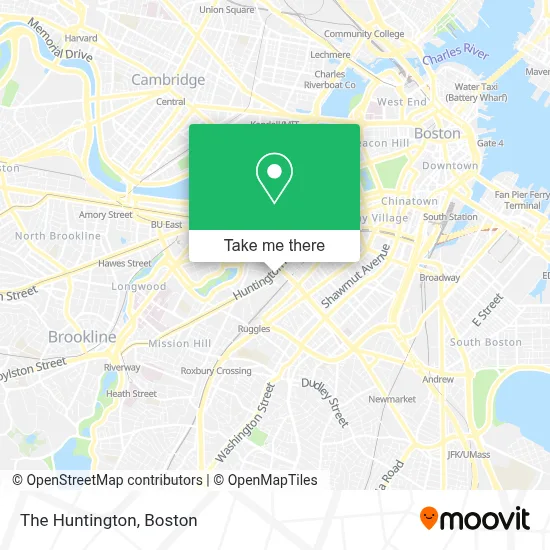
See The Huntington, Boston, on the map
Public Transit to The Huntington in Boston
Wondering how to get to The Huntington in Boston? Moovit helps you find the best way to get to The Huntington with step-by-step directions from the nearest public transit station.
Moovit provides free maps and live directions to help you navigate through your city. View schedules, routes, timetables, and find out how long does it take to get to The Huntington in real time.
Looking for the nearest stop or station to The Huntington? Check out this list of stops closest to your destination: Huntington Ave @ Opera Pl; Massachusetts Ave Opp Christian Science Ctr; Mass Ave T Station (To Crc); Massachusetts Ave Station - Shuttle; Prudential; Ruggles.
Bus: 1, 22, 39, 9, GREEN LINE E SHUTTLE, GREEN LINE E SHUTTLE, 1 BU (CHARLES RIVER-MEDICAL CAMPUS), ORANGE LINE SHUTTLE, ORANGE LINE SHUTTLE, ORANGE LINE SHUTTLE, ORANGE LINE SHUTTLE, ORANGE LINE SHUTTLE.Train: NEEDHAM, FRANKLIN/FOXBORO, ORANGE LINE, PROVIDENCE/STOUGHTON.Subway: GREEN LINE E, ORANGE LINE.
Want to see if there’s another route that gets you there at an earlier time? Moovit helps you find alternative routes or times. Get directions from and directions to The Huntington easily from the Moovit App or Website.
We make riding to The Huntington easy, which is why over 1.7 million users, including users in Boston, trust Moovit as the best app for public transit. You don’t need to download an individual bus app or train app, Moovit is your all-in-one transit app that helps you find the best bus time or train time available.
For information on prices of bus, subway and train, costs and ride fares to The Huntington, please check the Moovit app.
Use the app to navigate to popular places including to the airport, hospital, stadium, grocery store, mall, coffee shop, school, college, and university.
The Huntington Address: 264 Huntington Ave street in Boston
- Huntington Theatre,
- Huntington Theatre Company,
- St. Botolph Building,
- Playa Bowls,
- New England Conservatory,
- Plimpton Shattuck Black Box Theatre,
- New England Conservatory Of Music Residence Hall,
- Blick Art Materials,
- Caffe Bene (Caffe Peace),
- Symphony Station,
- New England Conservatory Jordan Hall,
- WGBH,
- Judgemet Free Zone,
- Caffe Bene,
- Symphony Hall,
- Boston Pops Concert,
- Matthews Arena,
- Tanglewood Music Center,
- Huntington Avenue & Massachusetts Avenue,
- Jordan Hall
Places Near The Huntington (Boston)
- Td Garden, Boston,
- Prudential Center, Boston,
- Boston Medical Center, Boston,
- Quincy Market, Boston,
- Boston Convention & Exhibition Center, Boston,
- Castle Island, Boston,
- Boston Children's Hospital, Boston,
- Faneuil Hall, Boston,
- Seaport District, Boston,
- Leader Bank Pavilion (Leader Bank Pavillion), Boston,
- North End, Boston,
- Mgm Music Hall, Boston,
- Cheers, Boston,
- Wang Theater, Boston,
- Isabella Stewart Gardner Museum, Boston,
- Boston Common, Boston,
- Wilbur Theatre, Boston,
- Massachusetts General Hospital, Boston,
- House Of Blues, Boston,
- Museum Of Science, Boston
How to get to popular places in Boston with public transit
Get around Boston by public transit!
Traveling around Boston has never been so easy. See step by step directions as you travel to any attraction, street or major public transit station. View bus and train schedules, arrival times, service alerts and detailed routes on a map, so you know exactly how to get to anywhere in Boston.
When traveling to any destination around Boston use Moovit's Live Directions with Get Off Notifications to know exactly where and how far to walk, how long to wait for your line, and how many stops are left. Moovit will alert you when it's time to get off — no need to constantly re-check whether yours is the next stop.
Wondering how to use public transit in Boston or how to pay for public transit in Boston? Moovit public transit app can help you navigate your way with public transit easily, and at minimum cost. It includes public transit fees, ticket prices, and costs. Looking for a map of Boston public transit lines? Moovit public transit app shows all public transit maps in Boston with all Bus, Train, Subway and Ferry routes and stops on an interactive map.
Boston has 4 transit type(s), including: Bus, Train, Subway and Ferry, operated by several transit agencies, including MBTA, Southeastern Regional Transit Authority, MetroWest Regional Transit Authority, Rhode Island Public Transit Authority, WRTA, Lowell Regional Transit Authority, Merrimack Valley Transit, Montachusett Regional Transit Authority, Cape Cod Regional Transit Authority, Brockton Area Transit Authority, Martha's Vineyard Transit Authority, the WAVE - Nantucket Regional Transit Authority, GATRA, Cape Ann Transportation Authority and Massport