Directions to The K-Money Club (Brookline) with public transportation
The following transit lines have routes that pass near The K-Money Club
 Bus: 65, 66, GREEN LINE C SHUTTLE, GREEN LINE C SHUTTLE, SHUTTLE.
- Train: FRAMINGHAM/WORCESTER.
- Subway: GREEN LINE C, GREEN LINE D.
How to get to The K-Money Club by bus?
Click on the bus route to see step by step directions with maps, line arrival times and updated time schedules.
From Chelsea, MA, Chelsea
99 minFrom Davio's Seaport, Boston
59 minFrom Milton Academy, Milton
107 minFrom Waltham, MA, Waltham
58 minFrom Museum Of Science, Boston
52 minFrom TownePlace Suites Boston Logan Airport/Chelsea, Chelsea
89 minFrom Boston Harbor Hotel, Boston
52 minFrom Beth Israel Deaconess Hospital-Milton, Milton
98 minFrom Royale Boston, Boston
44 minFrom Massport Bus 77 Chelsea Employee Parking, Chelsea
89 min
How to get to The K-Money Club by train?
Click on the train route to see step by step directions with maps, line arrival times and updated time schedules.
How to get to The K-Money Club by subway?
Click on the subway route to see step by step directions with maps, line arrival times and updated time schedules.
From Davio's Seaport, Boston
58 minFrom Milton Academy, Milton
85 minFrom Museum Of Science, Boston
51 minFrom TownePlace Suites Boston Logan Airport/Chelsea, Chelsea
61 minFrom Boston Harbor Hotel, Boston
45 minFrom Beth Israel Deaconess Hospital-Milton, Milton
102 minFrom Royale Boston, Boston
34 minFrom Massport Bus 77 Chelsea Employee Parking, Chelsea
61 min
Bus stops near The K-Money Club in Brookline
Subway stations near The K-Money Club in Brookline
Bus lines to The K-Money Club in Brookline
What are the closest stations to The K-Money Club?
The closest stations to The K-Money Club are:
- Washington St Opp Greenough St is 0 yards away, 1 min walk.
- Fairbanks Street is 432 yards away, 6 min walk.
- Harvard St @ Harris St is 494 yards away, 6 min walk.
- Coolidge Corner is 778 yards away, 10 min walk.
- Brookline Hills is 1575 yards away, 19 min walk.
Which bus lines stop near The K-Money Club?
These bus lines stop near The K-Money Club: 65, 66.
Which train line stops near The K-Money Club?
FRAMINGHAM/WORCESTER (#525 | Worcester)
Which subway line stops near The K-Money Club?
GREEN LINE C (Cleveland Circle)
What’s the nearest subway station to The K-Money Club in Brookline?
The nearest subway station to The K-Money Club in Brookline is Coolidge Corner. It’s a 10 min walk away.
What’s the nearest bus station to The K-Money Club in Brookline?
The nearest bus station to The K-Money Club in Brookline is Washington St Opp Greenough St. It’s a 1 min walk away.
What time is the first subway to The K-Money Club in Brookline?
The GREEN LINE D is the first subway that goes to The K-Money Club in Brookline. It stops nearby at 4:51 AM.
What time is the last subway to The K-Money Club in Brookline?
The GREEN LINE D is the last subway that goes to The K-Money Club in Brookline. It stops nearby at 2:26 AM.
What time is the first bus to The K-Money Club in Brookline?
The 66 is the first bus that goes to The K-Money Club in Brookline. It stops nearby at 5:13 AM.
What time is the last bus to The K-Money Club in Brookline?
The 66 is the last bus that goes to The K-Money Club in Brookline. It stops nearby at 2:17 AM.
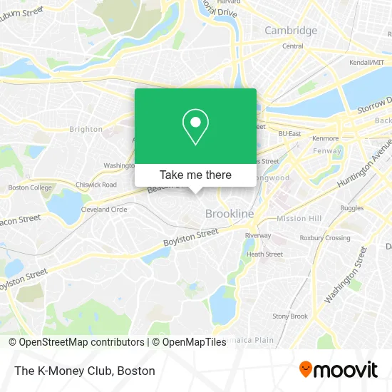
See The K-Money Club, Brookline, on the map
Public Transit to The K-Money Club in Brookline
Wondering how to get to The K-Money Club in Brookline? Moovit helps you find the best way to get to The K-Money Club with step-by-step directions from the nearest public transit station.
Moovit provides free maps and live directions to help you navigate through your city. View schedules, routes, timetables, and find out how long does it take to get to The K-Money Club in real time.
Looking for the nearest stop or station to The K-Money Club? Check out this list of stops closest to your destination: Washington St Opp Greenough St; Fairbanks Street; Harvard St @ Harris St; Coolidge Corner; Brookline Hills.
Bus: 65, 66, GREEN LINE C SHUTTLE, GREEN LINE C SHUTTLE, SHUTTLE.Train: FRAMINGHAM/WORCESTER.Subway: GREEN LINE C, GREEN LINE D.
Want to see if there’s another route that gets you there at an earlier time? Moovit helps you find alternative routes or times. Get directions from and directions to The K-Money Club easily from the Moovit App or Website.
We make riding to The K-Money Club easy, which is why over 1.7 million users, including users in Brookline, trust Moovit as the best app for public transit. You don’t need to download an individual bus app or train app, Moovit is your all-in-one transit app that helps you find the best bus time or train time available.
For information on prices of subway, bus and train, costs and ride fares to The K-Money Club, please check the Moovit app.
Use the app to navigate to popular places including to the airport, hospital, stadium, grocery store, mall, coffee shop, school, college, and university.
The K-Money Club Address: 504 Washington St street in Brookline
- 18 Griggs Rd Parking,
- Janji & Runjanjicom,
- Park Property Management Group,
- Sentry Management,
- Pony Express,
- Reps Gloves,
- Advanced Family Eyecare,
- Chiropractors Accept Cigna,
- Hohn Payne Band,
- Rahul Mehrotra Assoc,
- Kramian,
- Atlas ATM,
- Last Drop,
- Hot Nosh Boston,
- Behind the Veil,
- Auburn Harris Courtyard Apartments,
- R&RHQ,
- Fenway Financial Services LLC,
- Michael Robinson Dr,
- Sydney Associates
Places Near The K-Money Club (Brookline)
- Cheers, Boston,
- Boston Children's Hospital, Boston,
- Boston Medical Center, Boston,
- Prudential Center, Boston,
- Boston Convention & Exhibition Center, Boston,
- Wilbur Theatre, Boston,
- Quincy Market, Boston,
- Castle Island, Boston,
- Mgm Music Hall, Boston,
- House Of Blues, Boston,
- Isabella Stewart Gardner Museum, Boston,
- Td Garden, Boston,
- Seaport District, Boston,
- North End, Boston,
- Museum Of Science, Boston,
- Massachusetts General Hospital, Boston,
- Leader Bank Pavilion (Leader Bank Pavillion), Boston,
- Boston Common, Boston,
- Wang Theater, Boston,
- Faneuil Hall, Boston
How to get to popular places in Boston with public transit
Get around Brookline by public transit!
Traveling around Brookline has never been so easy. See step by step directions as you travel to any attraction, street or major public transit station. View bus and train schedules, arrival times, service alerts and detailed routes on a map, so you know exactly how to get to anywhere in Brookline.
When traveling to any destination around Brookline use Moovit's Live Directions with Get Off Notifications to know exactly where and how far to walk, how long to wait for your line, and how many stops are left. Moovit will alert you when it's time to get off — no need to constantly re-check whether yours is the next stop.
Wondering how to use public transit in Brookline or how to pay for public transit in Brookline? Moovit public transit app can help you navigate your way with public transit easily, and at minimum cost. It includes public transit fees, ticket prices, and costs. Looking for a map of Brookline public transit lines? Moovit public transit app shows all public transit maps in Brookline with all Bus, Train, Subway and Ferry routes and stops on an interactive map.
Boston has 4 transit type(s), including: Bus, Train, Subway and Ferry, operated by several transit agencies, including MBTA, Southeastern Regional Transit Authority, MetroWest Regional Transit Authority, Rhode Island Public Transit Authority, WRTA, Lowell Regional Transit Authority, Merrimack Valley Transit, Montachusett Regional Transit Authority, Cape Cod Regional Transit Authority, Brockton Area Transit Authority, Martha's Vineyard Transit Authority, the WAVE - Nantucket Regional Transit Authority, GATRA, Cape Ann Transportation Authority and Massport