Directions to The Launch (New Bedford) with public transportation
The following transit lines have routes that pass near The Launch
 Bus: 208, 9, PETER PAN, WNB, 203.
- Train: FALL RIVER/NEW BEDFORD.
- Ferry: CUTTYHUNK FERRY.
How to get to The Launch by bus?
Click on the bus route to see step by step directions with maps, line arrival times and updated time schedules.
From Amazon Fulfillment Bos7, Fall River
109 minFrom Bedford Industrial Park, New Bedford
68 minFrom Bristol Community College, Fall River
61 minFrom Charlton Memorial Hospital, Fall River
79 minFrom Walmart Fall River Supercenter, Fall River
74 minFrom B.M.C. Durfee High School, Fall River
60 minFrom Lizzy Borden House, Fall River
66 minFrom RMV New Bedford, New Bedford
65 minFrom Falmouth MA USA, Falmouth
93 minFrom Mass Maritime Academy, Buzzards Bay
119 min
How to get to The Launch by train?
Click on the train route to see step by step directions with maps, line arrival times and updated time schedules.
Bus stops near The Launch in New Bedford
Ferry stations near The Launch in New Bedford
Train station near The Launch in New Bedford
- New Bedford, 47 min walk,VIEW
Bus lines to The Launch in New Bedford
- 203, Terminal,VIEW
- 201, Fort Rodman,VIEW
- 205, South Central,VIEW
- 9, SRTA New Bedford Terminal - SRTA Fall River Terminal,VIEW
- 202, SRTA New Bedford Terminal - Lund's Corner,VIEW
- 204, SRTA New Bedford Terminal - Theodore H. Rice Blvd,VIEW
- 206, Rockway St and Carriage Dr - SRTA New Bedford Terminal,VIEW
- 208, SRTA New Bedford Terminal - King's Highway Stop & Shop,VIEW
- 210, Ann & Hope Plaza - SRTA New Bedford Terminal,VIEW
- 211, SRTA New Bedford Terminal - NB11 End of Line Stop,VIEW
- 299, Purchase St and Weld St - Keith Middle School,VIEW
- WARE, Cranberry Plaza - SRTA New Bedford Terminal,VIEW
- PETER PAN, CAPE COD - PROVIDENCE - NEW YORK,VIEW
- PETER PAN, NEW YORK - PROVIDENCE - CAPE COD,VIEW
- WNB, SRTA,VIEW
What are the closest stations to The Launch?
The closest stations to The Launch are:
- Union St And Sixth St is 81 yards away, 2 min walk.
- Pleasant St And Spring St is 117 yards away, 2 min walk.
- SRTA Terminal New Bedford is 318 yards away, 4 min walk.
- SRTA is 318 yards away, 4 min walk.
- Cuttyhunk Ferry Pier, New Bedford, MA is 3245 yards away, 38 min walk.
- New Bedford, MA is 3395 yards away, 40 min walk.
- New Bedford is 4024 yards away, 47 min walk.
Which bus lines stop near The Launch?
These bus lines stop near The Launch: 208, 9, PETER PAN, WNB.
Which train line stops near The Launch?
FALL RIVER/NEW BEDFORD (#2011 | New Bedford)
What’s the nearest bus station to The Launch in New Bedford?
The nearest bus stations to The Launch in New Bedford are Union St And Sixth St and Pleasant St And Spring St. The closest one is a 2 min walk away.
What time is the first train to The Launch in New Bedford?
The FALL RIVER/NEW BEDFORD is the first train that goes to The Launch in New Bedford. It stops nearby at 4:16 AM.
What time is the last train to The Launch in New Bedford?
The FALL RIVER/NEW BEDFORD is the last train that goes to The Launch in New Bedford. It stops nearby at 1:38 AM.
What time is the first bus to The Launch in New Bedford?
The 202 is the first bus that goes to The Launch in New Bedford. It stops nearby at 5:20 AM.
What time is the last bus to The Launch in New Bedford?
The 9 is the last bus that goes to The Launch in New Bedford. It stops nearby at 10:10 PM.
What time is the first ferry to The Launch in New Bedford?
The SEASTREAK is the first ferry that goes to The Launch in New Bedford. It stops nearby at 8:20 AM.
What time is the last ferry to The Launch in New Bedford?
The SEASTREAK is the last ferry that goes to The Launch in New Bedford. It stops nearby at 8:40 PM.
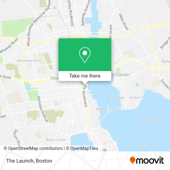
See The Launch, New Bedford, on the map
Public Transit to The Launch in New Bedford
Wondering how to get to The Launch in New Bedford? Moovit helps you find the best way to get to The Launch with step-by-step directions from the nearest public transit station.
Moovit provides free maps and live directions to help you navigate through your city. View schedules, routes, timetables, and find out how long does it take to get to The Launch in real time.
Looking for the nearest stop or station to The Launch? Check out this list of stops closest to your destination: Union St And Sixth St; Pleasant St And Spring St; SRTA Terminal New Bedford; SRTA; Cuttyhunk Ferry Pier; New Bedford, MA; New Bedford.
Bus: 208, 9, PETER PAN, WNB, 203, 201, 205, 202, 204, 206.Train: FALL RIVER/NEW BEDFORD.Ferry: CUTTYHUNK FERRY.
Want to see if there’s another route that gets you there at an earlier time? Moovit helps you find alternative routes or times. Get directions from and directions to The Launch easily from the Moovit App or Website.
We make riding to The Launch easy, which is why over 1.7 million users, including users in New Bedford, trust Moovit as the best app for public transit. You don’t need to download an individual bus app or train app, Moovit is your all-in-one transit app that helps you find the best bus time or train time available.
For information on prices of bus and train, costs and ride fares to The Launch, please check the Moovit app.
Use the app to navigate to popular places including to the airport, hospital, stadium, grocery store, mall, coffee shop, school, college, and university.
The Launch Address: 50 Union St street in New Bedford
- Latti & Anderson, Llp,
- South Coast Stitch And Mend Studio,
- New Beige,
- Marder Seafood,
- Lanagan & Co. Inc.,
- Cork Wine And Tapas,
- Atlantic Brokerage House,
- Salt And Sole,
- Plumbhunneez Inc.,
- The Cozy Crib,
- Power & Grace Yoga,
- Kettle Black Gallery,
- Mariner’S Home,
- New Bedford Ship Supply,
- Whaling Museum,
- The White Whale at the New Bedford Whaling Museum,
- Mrs. Farias, Realtor,
- Acushnet Creamery,
- Candela Cucina,
- New Bedford Visitor Center
Places Near The Launch (New Bedford)
- Td Garden, Boston,
- Boston Medical Center, Boston,
- Massachusetts General Hospital, Boston,
- Leader Bank Pavilion (Leader Bank Pavillion), Boston,
- Faneuil Hall, Boston,
- Wilbur Theatre, Boston,
- Seaport District, Boston,
- Boston Common, Boston,
- Castle Island, Boston,
- Prudential Center, Boston,
- Mgm Music Hall, Boston,
- Boston Children's Hospital, Boston,
- North End, Boston,
- House Of Blues, Boston,
- Museum Of Science, Boston,
- Cheers, Boston,
- Quincy Market, Boston,
- Boston Convention & Exhibition Center, Boston,
- Isabella Stewart Gardner Museum, Boston,
- Wang Theater, Boston
How to get to popular places in Boston with public transit
Get around New Bedford by public transit!
Traveling around New Bedford has never been so easy. See step by step directions as you travel to any attraction, street or major public transit station. View bus and train schedules, arrival times, service alerts and detailed routes on a map, so you know exactly how to get to anywhere in New Bedford.
When traveling to any destination around New Bedford use Moovit's Live Directions with Get Off Notifications to know exactly where and how far to walk, how long to wait for your line, and how many stops are left. Moovit will alert you when it's time to get off — no need to constantly re-check whether yours is the next stop.
Wondering how to use public transit in New Bedford or how to pay for public transit in New Bedford? Moovit public transit app can help you navigate your way with public transit easily, and at minimum cost. It includes public transit fees, ticket prices, and costs. Looking for a map of New Bedford public transit lines? Moovit public transit app shows all public transit maps in New Bedford with all Bus, Train, Subway and Ferry routes and stops on an interactive map.
Boston has 4 transit type(s), including: Bus, Train, Subway and Ferry, operated by several transit agencies, including MBTA, Southeastern Regional Transit Authority, MetroWest Regional Transit Authority, Rhode Island Public Transit Authority, WRTA, Lowell Regional Transit Authority, Merrimack Valley Transit, Montachusett Regional Transit Authority, Cape Cod Regional Transit Authority, Brockton Area Transit Authority, Martha's Vineyard Transit Authority, the WAVE - Nantucket Regional Transit Authority, GATRA, Cape Ann Transportation Authority and Massport