Directions to The Light Between (Manhattan) with public transportation
The following transit lines have routes that pass near The Light Between
 Bus: M15-SBS, M31, QM34, M15, M57.
- Train: BABYLON BRANCH, FAR ROCKAWAY BRANCH, PORT WASHINGTON BRANCH, RONKONKOMA BRANCH, YEL.
- Subway: 4, 5, 6, N, R.
- Cable Car: ROOSEVELT ISLAND TRAM.
How to get to The Light Between by bus?
Click on the bus route to see step by step directions with maps, line arrival times and updated time schedules.
How to get to The Light Between by train?
Click on the train route to see step by step directions with maps, line arrival times and updated time schedules.
How to get to The Light Between by subway?
Click on the subway route to see step by step directions with maps, line arrival times and updated time schedules.
Bus stops near The Light Between in Manhattan
Cable Car station near The Light Between in Manhattan
- Manhattan Tram Station, 6 min walk,VIEW
Subway station near The Light Between in Manhattan
- Lexington Av/59 St, 8 min walk,VIEW
Bus lines to The Light Between in Manhattan
What are the closest stations to The Light Between?
The closest stations to The Light Between are:
- York Av/E 60 St is 126 yards away, 2 min walk.
- 1 Av/E 60 St is 230 yards away, 3 min walk.
- 1 Av/E 57 St is 265 yards away, 4 min walk.
- E 57 St/Sutton Pl is 315 yards away, 4 min walk.
- Manhattan Tram Station is 465 yards away, 6 min walk.
- Lexington Av/59 St is 656 yards away, 8 min walk.
Which bus lines stop near The Light Between?
These bus lines stop near The Light Between: M15-SBS, M31, QM34.
Which train lines stop near The Light Between?
These train lines stop near The Light Between: BABYLON BRANCH, FAR ROCKAWAY BRANCH, PORT WASHINGTON BRANCH, RONKONKOMA BRANCH, YEL.
Which subway lines stop near The Light Between?
These subway lines stop near The Light Between: 4, 5, 6, N, R, W.
What’s the nearest subway station to The Light Between in Manhattan?
The nearest subway station to The Light Between in Manhattan is Lexington Av/59 St. It’s a 8 min walk away.
What’s the nearest bus station to The Light Between in Manhattan?
The nearest bus station to The Light Between in Manhattan is York Av/E 60 St. It’s a 2 min walk away.
What’s the nearest cable car station to The Light Between in Manhattan?
The nearest cable car station to The Light Between in Manhattan is Manhattan Tram Station. It’s a 6 min walk away.
What time is the first subway to The Light Between in Manhattan?
The 4 is the first subway that goes to The Light Between in Manhattan. It stops nearby at 3:00 AM.
What time is the last subway to The Light Between in Manhattan?
The 4 is the last subway that goes to The Light Between in Manhattan. It stops nearby at 3:41 AM.
What time is the first bus to The Light Between in Manhattan?
The M15 is the first bus that goes to The Light Between in Manhattan. It stops nearby at 3:26 AM.
What time is the last bus to The Light Between in Manhattan?
The M15 is the last bus that goes to The Light Between in Manhattan. It stops nearby at 2:58 AM.
What time is the first cable car to The Light Between in Manhattan?
The ROOSEVELT ISLAND TRAM is the first cable car that goes to The Light Between in Manhattan. It stops nearby at 5:52 AM.
What time is the last cable car to The Light Between in Manhattan?
The ROOSEVELT ISLAND TRAM is the last cable car that goes to The Light Between in Manhattan. It stops nearby at 2:10 AM.
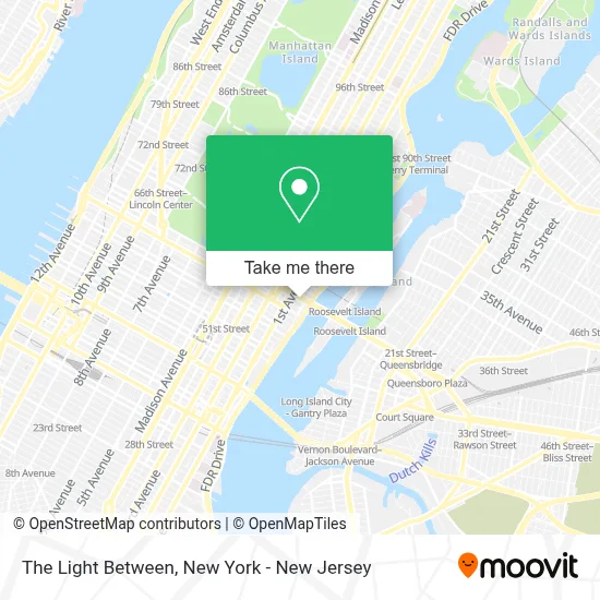
See The Light Between, Manhattan, on the map
Public Transit to The Light Between in Manhattan
Wondering how to get to The Light Between in Manhattan? Moovit helps you find the best way to get to The Light Between with step-by-step directions from the nearest public transit station.
Moovit provides free maps and live directions to help you navigate through your city. View schedules, routes, timetables, and find out how long does it take to get to The Light Between in real time.
Looking for the nearest stop or station to The Light Between? Check out this list of stops closest to your destination: York Av/E 60 St; 1 Av/E 60 St; 1 Av/E 57 St; E 57 St/Sutton Pl; Manhattan Tram Station; Lexington Av/59 St.
Bus: M15-SBS, M31, QM34, M15, M57.Train: BABYLON BRANCH, FAR ROCKAWAY BRANCH, PORT WASHINGTON BRANCH, RONKONKOMA BRANCH, YEL.Subway: 4, 5, 6, N, R, W.Cable Car: ROOSEVELT ISLAND TRAM.
Want to see if there’s another route that gets you there at an earlier time? Moovit helps you find alternative routes or times. Get directions from and directions to The Light Between easily from the Moovit App or Website.
We make riding to The Light Between easy, which is why over 1.5 million users, including users in Manhattan, trust Moovit as the best app for public transit. You don’t need to download an individual bus app or train app, Moovit is your all-in-one transit app that helps you find the best bus time or train time available.
For information on prices of subway, bus and train, costs and ride fares to The Light Between, please check the Moovit app.
Use the app to navigate to popular places including to the airport, hospital, stadium, grocery store, mall, coffee shop, school, college, and university.
The Light Between Address: 407 E 59th St street in Manhattan
- East River Medical Imaging PC,
- Queensborough Oval Park,
- Morso Nyc,
- 430 East 59th Street,
- Sutton East Tennis Club,
- Nyc Parking 425 East 58 Garage Corporation,
- Mykonian Garden,
- Tennis Pro Shop Nyc,
- Librairie De France,
- 59th 59th St and York Ave,
- Tennisinmanhattan,
- Guastavino's,
- Senior Living Behavioral Health,
- Nima P. Patel Md,
- Advanced Vascular Care,
- J's Cleaners - 410 East 59th Street,
- Citi Bike Station - E 60 St & York Ave,
- Motivaldi | Premium Cocktail Shaker Set,
- Checkmate,
- East River Greenway & Bike Path (FDR Drive - Midtown to Yorkville)
Places Near The Light Between (Manhattan)
- 376 Hudson Street, Manhattan,
- SoHo, Manhattan,
- 1 Police Plaza, Manhattan,
- Katz's Deli, Manhattan,
- Hudson Yards, Manhattan,
- Bellevue Hospital, Manhattan,
- qqqq, Manhattan,
- Rockefeller Center, Manhattan,
- San Gennaro Feast, Manhattan,
- 911 Memorial, Manhattan,
- 111 Centre New York City Supreme Court, Manhattan,
- Wall Street, Manhattan,
- Chinatown, Manhattan,
- Queens Center Mall, Queens,
- 3 Stone St, Manhattan,
- 66 John Street, Manhattan,
- 26 Federal Plaza, Manhattan,
- Pier 83, Manhattan,
- Mountainside Hospital, Glen Ridge,
- Times Square, Manhattan
How to get to popular places in New York - New Jersey with public transit
Get around Manhattan by public transit!
Traveling around Manhattan has never been so easy. See step by step directions as you travel to any attraction, street or major public transit station. View bus and train schedules, arrival times, service alerts and detailed routes on a map, so you know exactly how to get to anywhere in Manhattan.
When traveling to any destination around Manhattan use Moovit's Live Directions with Get Off Notifications to know exactly where and how far to walk, how long to wait for your line, and how many stops are left. Moovit will alert you when it's time to get off — no need to constantly re-check whether yours is the next stop.
Wondering how to use public transit in Manhattan or how to pay for public transit in Manhattan? Moovit public transit app can help you navigate your way with public transit easily, and at minimum cost. It includes public transit fees, ticket prices, and costs. Looking for a map of Manhattan public transit lines? Moovit public transit app shows all public transit maps in Manhattan with all Bus, Train, Subway, Light Rail, Ferry and Cable Car routes and stops on an interactive map.
New York - New Jersey has 6 transit type(s), including: Bus, Train, Subway, Light Rail, Ferry and Cable Car, operated by several transit agencies, including MTA Subway, Metro-North Railroad, LIRR, PATH, MTA New York City Transit - Express routes, MTA Bus, NJ Transit, NYC Ferry, NICE bus, Bee-Line Bus, NJ Transit Rail, Norwalk Transit District, Hartford Line, River Valley Transit and HART