How to get to The Middle Root by bus?
Click on the bus route to see step by step directions with maps, line arrival times and updated time schedules.
From FedEx, Kentwood
49 minFrom LJ, Wyoming
39 minFrom Grandville, MI, Grandville
49 minFrom Hearthside Food Solutions H1, Kentwood
58 minFrom XD Power Fitness, Wyoming
47 minFrom Cpi Shows, Comstock Park
25 minFrom City of Wyoming, Wyoming
38 minFrom Legends Sports, Grand Rapids
47 minFrom The Network, Wyoming
31 minFrom Adweb Associates, East Grand Rapids
24 min
Bus stops near The Middle Root in Grand Rapids
Train station near The Middle Root in Grand Rapids
- Grand Rapids Vernon J. Ehlers Station, 63 min walk,VIEW
Bus lines to The Middle Root in Grand Rapids
What are the closest stations to The Middle Root?
The closest stations to The Middle Root are:
- Medical Mile Station (Wb) is 46 yards away, 1 min walk.
- Lyon/Ottawa (Wb) is 259 yards away, 4 min walk.
- Monroe/Lyon (Nb) is 360 yards away, 5 min walk.
- Monroe/Pearl (Sb) is 366 yards away, 5 min walk.
- Scribner/Bridge (Nb) is 747 yards away, 9 min walk.
- Grand Rapids Vernon J. Ehlers Station is 5283 yards away, 63 min walk.
Which bus lines stop near The Middle Root?
These bus lines stop near The Middle Root: 13, 6, 9, 90.
What’s the nearest bus station to The Middle Root in Grand Rapids?
The nearest bus station to The Middle Root in Grand Rapids is Medical Mile Station (Wb). It’s a 1 min walk away.
What time is the first train to The Middle Root in Grand Rapids?
The PERE MARQUETTE is the first train that goes to The Middle Root in Grand Rapids. It stops nearby at 6:00 AM.
What time is the last train to The Middle Root in Grand Rapids?
The PERE MARQUETTE is the last train that goes to The Middle Root in Grand Rapids. It stops nearby at 11:34 PM.
What time is the first bus to The Middle Root in Grand Rapids?
The 11 is the first bus that goes to The Middle Root in Grand Rapids. It stops nearby at 5:19 AM.
What time is the last bus to The Middle Root in Grand Rapids?
The 51 is the last bus that goes to The Middle Root in Grand Rapids. It stops nearby at 1:15 AM.
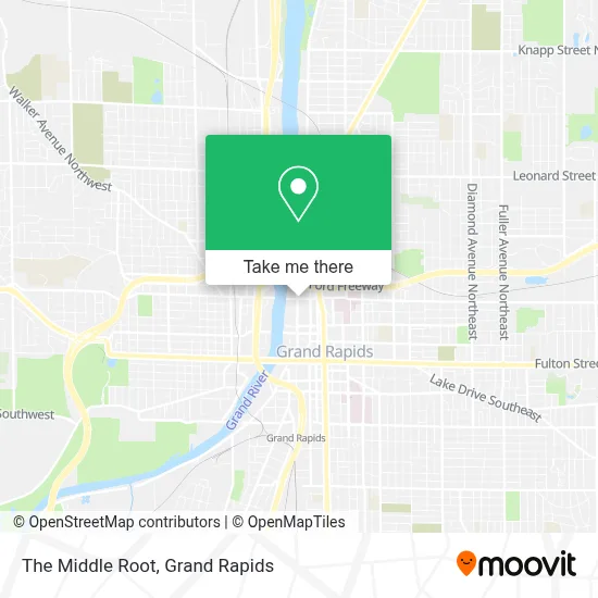
See The Middle Root, Grand Rapids, on the map
Public Transit to The Middle Root in Grand Rapids
Wondering how to get to The Middle Root in Grand Rapids? Moovit helps you find the best way to get to The Middle Root with step-by-step directions from the nearest public transit station.
Moovit provides free maps and live directions to help you navigate through your city. View schedules, routes, timetables, and find out how long does it take to get to The Middle Root in real time.
Looking for the nearest stop or station to The Middle Root? Check out this list of stops closest to your destination: Medical Mile Station (Wb); Lyon/Ottawa (Wb); Monroe/Lyon (Nb); Monroe/Pearl (Sb); Scribner/Bridge (Nb); Grand Rapids Vernon J. Ehlers Station.
Bus: 13, 6, 9, 90, 45, 11, 51, 7.Train: PERE MARQUETTE.
Want to see if there’s another route that gets you there at an earlier time? Moovit helps you find alternative routes or times. Get directions from and directions to The Middle Root easily from the Moovit App or Website.
We make riding to The Middle Root easy, which is why over 1.5 million users, including users in Grand Rapids, trust Moovit as the best app for public transit. You don’t need to download an individual bus app or train app, Moovit is your all-in-one transit app that helps you find the best bus time or train time available.
For information on prices of bus, costs and ride fares to The Middle Root, please check the Moovit app.
Use the app to navigate to popular places including to the airport, hospital, stadium, grocery store, mall, coffee shop, school, college, and university.
Location: Grand Rapids
- Gerald R. Ford Federal Building & US Courthouse,
- DeVos Convention Center,
- Devos Place Convention Center,
- Government Center Parking Ramp,
- City of GR Park / Calder Plaza,
- DeVos Place,
- Chow Free-Delivery CBD Dispensary Fulfillment Services,
- Fiorletta Law Group,
- Fifth Third Private Bank - Jackson Labbe,
- Tap-A-Few Bartending Services,
- The Grand River Ballroom @ Bridgewater Place,
- 61st District Court,
- Kent County Courthouse,
- Van Andel Research Institute,
- Watersview Rooftop Bar,
- Silver Line - Medical Mile,
- MDRD,
- Idc,
- Spectrum Health Medical Group,
- DeVos Pediatric Ophthalmology
Places Near The Middle Root (Grand Rapids)
- Helel DeVos Children's Hospital Food Court, Grand Rapids,
- Metro Cascade,
- Van Andel Arena, Grand Rapids,
- Pine Rest Mental Health, Grand Rapids,
- Kent County Courthouse, Grand Rapids,
- Butterworth Hospital Internal Radiology, Grand Rapids,
- Lemmen-Holton Cancer Pavilion, Grand Rapids,
- Union High School, Grand Rapids,
- Frederik Meijer Gardens, Grand Rapids,
- Woodland Mall, Kentwood,
- Grandville, MI, Grandville,
- Spectrum Health-Blodgett Hospital, East Grand Rapids,
- Hudsonville,
- Blodgett Hospital, East Grand Rapids,
- Byron Center,
- John Ball Zoo, Grand Rapids,
- University of Michigan Health Metro Health Hospital, Wyoming,
- YMCA - David D. Hunting, Grand Rapids,
- Grand Rapids Community College, Grand Rapids,
- Spectrum Health Butterworth Hospital, Grand Rapids
How to get to popular places in Grand Rapids with public transit
Get around Grand Rapids by public transit!
Traveling around Grand Rapids has never been so easy. See step by step directions as you travel to any attraction, street or major public transit station. View bus and train schedules, arrival times, service alerts and detailed routes on a map, so you know exactly how to get to anywhere in Grand Rapids.
When traveling to any destination around Grand Rapids use Moovit's Live Directions with Get Off Notifications to know exactly where and how far to walk, how long to wait for your line, and how many stops are left. Moovit will alert you when it's time to get off — no need to constantly re-check whether yours is the next stop.
Wondering how to use public transit in Grand Rapids or how to pay for public transit in Grand Rapids? Moovit public transit app can help you navigate your way with public transit easily, and at minimum cost. It includes public transit fees, ticket prices, and costs. Looking for a map of Grand Rapids public transit lines? Moovit public transit app shows all public transit maps in Grand Rapids with all Bus and Train routes and stops on an interactive map.
Grand Rapids has 2 transit type(s), including: Bus and Train, operated by several transit agencies, including The Rapid, Amtrak and FlixBus-us