Directions to The Queen's Medical Center (Urban Honolulu) with public transportation
The following transit lines have routes that pass near The Queen's Medical Center
How to get to The Queen's Medical Center by bus?
Click on the bus route to see step by step directions with maps, line arrival times and updated time schedules.
Bus stops near The Queen's Medical Center in Urban Honolulu
- S Beretania St + Alapai St, 3 min walk,
- S Beretania St + Punchbowl St, 3 min walk,
- Lusitana St + Opp Lauhala St, 4 min walk,
- Kinau St + Alapai St, 6 min walk,
- Queen Emma St + Vineyard St, 7 min walk,
- Queen Emma St + S Beretania St, 9 min walk,
Bus lines to The Queen's Medical Center in Urban Honolulu
- 1, Kalihi Transit Center,
- 1L, Halawa Aloha Stadium Stn - Limited Stops,
- 2, Alapai Transit Center,
- 2L, Kalihi Transit Center - Limited Stops,
- 4, Uh Manoa,
- A, City Express! A,
- C, Country Express! C,
- E, Country Express! E,
- 3, Kaimuki-Salt Lake,
- 9, Kaimuki-Pearl Harbor,
- 13, Liliha-Waikiki-University,
- 20, Waikiki-Airport-Aloha Stadium,
- 40, Honolulu-Makaha,
- 42, Ewa Beach-Waikiki,
- 51, Honolulu-Wahiawa,
- 52, Honolulu-Mililani-Haleiwa,
- 53, Honolulu-Pacific Palisades,
- 54, Honolulu-Pearl City,
- 80, Hawaii Kai Park & Ride Express,
- 81, Waipahu Express,
What are the closest stations to The Queen's Medical Center?
The closest stations to The Queen's Medical Center are:
- S Beretania St + Alapai St is 187 yards away, 3 min walk.
- S Beretania St + Punchbowl St is 199 yards away, 3 min walk.
- Lusitana St + Opp Lauhala St is 306 yards away, 4 min walk.
- Kinau St + Alapai St is 431 yards away, 6 min walk.
- Queen Emma St + Vineyard St is 459 yards away, 7 min walk.
- Queen Emma St + S Beretania St is 675 yards away, 9 min walk.
Which bus lines stop near The Queen's Medical Center?
These bus lines stop near The Queen's Medical Center: 13, 2, 2L, 51, A.
What’s the nearest bus stop to The Queen's Medical Center in Urban Honolulu?
The nearest bus stops to The Queen's Medical Center in Urban Honolulu are S Beretania St + Alapai St and S Beretania St + Punchbowl St. The closest one is a 3 min walk away.
What time is the first bus to The Queen's Medical Center in Urban Honolulu?
The 40 is the first bus that goes to The Queen's Medical Center in Urban Honolulu. It stops nearby at 3:12 AM.
What time is the last bus to The Queen's Medical Center in Urban Honolulu?
The 2 is the last bus that goes to The Queen's Medical Center in Urban Honolulu. It stops nearby at 2:32 AM.
See The Queen's Medical Center, Urban Honolulu, on the map
Public Transit to The Queen's Medical Center in Urban Honolulu
Wondering how to get to The Queen's Medical Center in Urban Honolulu, United States? Moovit helps you find the best way to get to The Queen's Medical Center with step-by-step directions from the nearest public transit station.
Moovit provides free maps and live directions to help you navigate through your city. View schedules, routes, timetables, and find out how long does it take to get to The Queen's Medical Center in real time.
Looking for the nearest stop or station to The Queen's Medical Center? Check out this list of stops closest to your destination: S Beretania St + Alapai St; S Beretania St + Punchbowl St; Lusitana St + Opp Lauhala St; Kinau St + Alapai St; Queen Emma St + Vineyard St; Queen Emma St + S Beretania St.
Bus: 13, 2, 2L, 51, A, C, E, 3, 9, 1, 1L, 4, 122, 123, 6, 60, PH6.
Want to see if there’s another route that gets you there at an earlier time? Moovit helps you find alternative routes or times. Get directions from and directions to The Queen's Medical Center easily from the Moovit App or Website.
We make riding to The Queen's Medical Center easy, which is why over 1.5 million users, including users in Urban Honolulu, trust Moovit as the best app for public transit. You don’t need to download an individual bus app or train app, Moovit is your all-in-one transit app that helps you find the best bus time or train time available.
For information on prices of bus, costs and ride fares to The Queen's Medical Center, please check the Moovit app.
Use the app to navigate to popular places including to the airport, hospital, stadium, grocery store, mall, coffee shop, school, college, and university.
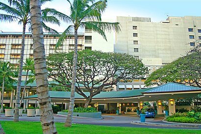
The Queen's Medical Center Address: Punchbowl Street street in Urban Honolulu
Attractions near The Queen's Medical Center
The Queen's Medical Center,The Queen's Imaging Department,Queen Emma Tower @ Queen's Hospital,Queen's Medical Center parking garage,1301 Punchbowl Street,Women's Health Center, The Queen's Medical Center,Womens Health Center--queens Hospital,Queen's Medical Center ER,Kamehameha Wing - The Queens Medical Center,Queen's Physicians Office Building 1,The Queen s Medical Center,Queen's Miller Street Parking Complex,queens medical center x-ray department,The Queen's Medical Center - Employee Health,Diagnostic Laboratory Services (Queens POB I),Queens Pob 3 Imaging,queen liliuokalani building department of education,Queen's Physicians Office Building III,The Queen’S Conference Center,Queens Medical Center EndoscopyHow to get to popular attractions in Urban Honolulu with public transit
Village Park, Hawaii, Royal Kunia,Izumo Taishakyo Mission of Hamaii, Urban Honolulu,Bubba Gump Shrimp Co., Urban Honolulu,Kahekili & Likelike, Kaneohe,Makaha, Hawaii, Makaha,Palama Market, Waimalu,Jamba Juice Airport Trade Center, Urban Honolulu,Main Lobby Hilton Hawaiian Village, Urban Honolulu,Salt Lake Chinese Restaurant, Urban Honolulu,Fook Lam Seafood Restaurant, Urban Honolulu,Kulu Kulu, Urban Honolulu,Mapunapuna, Hawaii, Urban Honolulu,Aliamanu Military Reservation, Hawaii, Urban Honolulu,Waimea Valley Waterfall, Pupukea,Carl's Jr., Urban Honolulu,Waimea Bay,Pipeline, Pupukea,Laniakea (Turtle) Beach,Waianae, Hawaii, Waianae,Monkeypod Kitchen by Merriman, Ko OlinaGet around Honolulu by public transit!
Traveling around Honolulu has never been so easy. See step by step directions as you travel to any attraction, street or major public transit station. View bus and train schedules, arrival times, service alerts and detailed routes on a map, so you know exactly how to get to anywhere in Honolulu.
When traveling to any destination around Honolulu use Moovit's Live Directions with Get Off Notifications to know exactly where and how far to walk, how long to wait for your line, and how many stops are left. Moovit will alert you when it's time to get off — no need to constantly re-check whether yours is the next stop.
Wondering how to use public transit in Honolulu or how to pay for public transit in Honolulu? Moovit public transit app can help you navigate your way with public transit easily, and at minimum cost. It includes public transit fees, ticket prices, and costs. Looking for a map of Honolulu public transit lines? Moovit public transit app shows all public transit maps in Honolulu with all Bus and Metro routes and stops on an interactive map.
Honolulu has 2 transit type(s), including: Bus and Metro, operated by several transit agencies, including TheBus, DTS