Directions to The Shops At Wisconsin Place (Bethesda) with public transportation
The following transit lines have routes that pass near The Shops At Wisconsin Place
How to get to The Shops At Wisconsin Place by bus?
Click on the bus route to see step by step directions with maps, line arrival times and updated time schedules.
How to get to The Shops At Wisconsin Place by metro?
Click on the metro route to see step by step directions with maps, line arrival times and updated time schedules.
Bus stations near The Shops At Wisconsin Place in Bethesda
- Wisconsin Ave Nw & Western Ave, 5 min walk,
- Friendship Hts Station, 5 min walk,
Bus lines to The Shops At Wisconsin Place in Bethesda
- N2, West To Friendship Heights,
- 31, North To Friendship Heights,
- 33, South To Federal Triangle,
- 1, Silver Spring - Friendship Heights,
- T2, Rockville - Friendship Heights,
- L8, Aspen Hill - Friendship Heights,
- 11, Silver Spring - Friendship Heights,
- 23, Friendship Heights - Sibley Hospital,
- 29, Bethesda - Glen Echo/Friendship Heights,
- 34, Aspen Hill - Friendship Heights,
- T2, RIVER ROAD,
- E4, MILITARY ROAD-CROSSTOWN,
- N4, MASSACHUSETTS AVE,
- N6, MASSACHUSETTS AVE,
- L8, CONNECTICUT AVE-MARYLAND,
What are the closest stations to The Shops At Wisconsin Place?
The closest stations to The Shops At Wisconsin Place are:
- Wisconsin Ave Nw & Western Ave is 332 yards away, 5 min walk.
- Friendship Hts Station is 339 yards away, 5 min walk.
Which bus lines stop near The Shops At Wisconsin Place?
These bus lines stop near The Shops At Wisconsin Place: 31, N2, N4.
Which metro line stops near The Shops At Wisconsin Place?
METRORAIL RED LINE
What’s the nearest bus stop to The Shops At Wisconsin Place in Bethesda?
The nearest bus stops to The Shops At Wisconsin Place in Bethesda are Wisconsin Ave Nw & Western Ave and Friendship Hts Station. The closest one is a 5 min walk away.
See The Shops At Wisconsin Place, Bethesda, on the map
Public Transit to The Shops At Wisconsin Place in Bethesda
Wondering how to get to The Shops At Wisconsin Place in Bethesda, United States? Moovit helps you find the best way to get to The Shops At Wisconsin Place with step-by-step directions from the nearest public transit station.
Moovit provides free maps and live directions to help you navigate through your city. View schedules, routes, timetables, and find out how long does it take to get to The Shops At Wisconsin Place in real time.
Looking for the nearest stop or station to The Shops At Wisconsin Place? Check out this list of stops closest to your destination: Wisconsin Ave Nw & Western Ave; Friendship Hts Station.
Bus: 31, N2, N4, 33, 1, T2, L8, 11, 23.Metro: METRORAIL RED LINE.
Want to see if there’s another route that gets you there at an earlier time? Moovit helps you find alternative routes or times. Get directions from and directions to The Shops At Wisconsin Place easily from the Moovit App or Website.
We make riding to The Shops At Wisconsin Place easy, which is why over 1.5 million users, including users in Bethesda, trust Moovit as the best app for public transit. You don’t need to download an individual bus app or train app, Moovit is your all-in-one transit app that helps you find the best bus time or train time available.
For information on prices of bus and metro, costs and ride fares to The Shops At Wisconsin Place, please check the Moovit app.
Use the app to navigate to popular places including to the airport, hospital, stadium, grocery store, mall, coffee shop, school, college, and university.
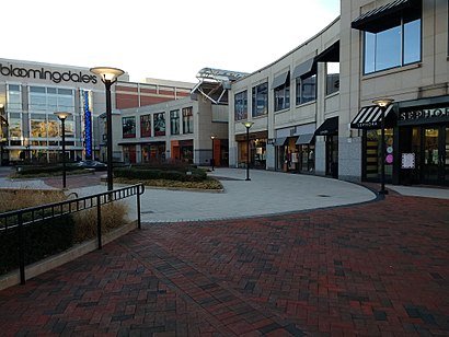
The Shops At Wisconsin Place Address: The Shops at Wisconsin Place, 5425 Wisconsin Avenue, Chevy Chase, MD 20815, USA street in Bethesda
Attractions near The Shops At Wisconsin Place
Kimchi BBQ Taco Korean Grill,The Mills,Sushiko Chevy Chase,Sushi-Ko,Trips,5425,Potomac Pizza,Eagle Bank,RBC Wealth Management,Capital Cosmetic Dentistry,Capital One Bank,Indique Heights,Luxoptics,Gifford's Ice Cream,Right Fit Locksmith,Acl Locksmith,Giant Food,Busy Bees,Potomac Pizza,Chevy Chase CenterHow to get to popular attractions in Bethesda with public transit
Carderock Recreation Area, Montgomery County,Northeast Regional Recreation Center (NERRC), Baltimore County,Broken Land Park & Ride, Howard County,World Bank C Building, Washington,Halethorpe MARC Station Parking Lot, Baltimore County,Exit 62 - SR 243 (Nutley St) / Fairfax, Vienna, Fairfax County,St. Andrews Episcopal School, Montgomery County,I-95 Exit 80 - Belcamp (MD 543), Harford County,Rockville High School, Montgomery County,DCity Smokehouse, Washington,Hybla Valley, Fairfax County,GCDC, Washington,Northrop Grumman Square 1, Anne Arundel County,Wilde Lake High School, Howard County,Homewood Suites by Hilton Baltimore-BWI Airport, Anne Arundel County,Howard University, Washington,Duke Ellington School of the Arts, Washington,National City Christian Church, Washington,Wyndham Old Town Alexandria, Alexandria,Burleith, WashingtonGet around Washington, D.C. - Baltimore, MD by public transit!
Traveling around Washington, D.C. - Baltimore, MD has never been so easy. See step by step directions as you travel to any attraction, street or major public transit station. View bus and train schedules, arrival times, service alerts and detailed routes on a map, so you know exactly how to get to anywhere in Washington, D.C. - Baltimore, MD.
When traveling to any destination around Washington, D.C. - Baltimore, MD use Moovit's Live Directions with Get Off Notifications to know exactly where and how far to walk, how long to wait for your line, and how many stops are left. Moovit will alert you when it's time to get off — no need to constantly re-check whether yours is the next stop.
Wondering how to use public transit in Washington, D.C. - Baltimore, MD or how to pay for public transit in Washington, D.C. - Baltimore, MD? Moovit public transit app can help you navigate your way with public transit easily, and at minimum cost. It includes public transit fees, ticket prices, and costs. Looking for a map of Washington, D.C. - Baltimore, MD public transit lines? Moovit public transit app shows all public transit maps in Washington, D.C. - Baltimore, MD with all Bus, Train, Metro, Light Rail and Ferry routes and stops on an interactive map.
Washington, D.C. - Baltimore, MD has 5 transit type(s), including: Bus, Train, Metro, Light Rail and Ferry, operated by several transit agencies, including WMATA, Montgomery County Ride On, Fairfax Connector, TheBus, PRTC, DC Circulator, DASH - Alexandria, Arlington Transit (ART), DC Streetcar, RTA of Central Maryland, FRED, MDOT MTA, Marc, Virginia Railway Express (VRE), University of Maryland Shuttle-UM