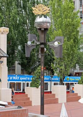
See The Weather Machine, Portland, OR, on the map
Directions to The Weather Machine (Portland, OR) with public transportation
The following transit lines have routes that pass near The Weather Machine
 Bus:
Bus: - Light Rail:
How to get to The Weather Machine by bus?
Click on the bus route to see step by step directions with maps, line arrival times and updated time schedules.
Light Rail stations near The Weather Machine in Portland, OR
- Pioneer Square South,1 min walk,
Bus stations near The Weather Machine in Portland, OR
- Sw 6th & Taylor,1 min walk,
Bus lines to The Weather Machine in Portland, OR
- 1,SW 6th & Harvey Milk (North),
- FX2,NW 5th & Hoyt (South),
- 12,SW 6th & Taylor (North),
- 19,Gateway TC (Drop Off Only Stop) (North),
What are the closest stations to The Weather Machine?
The closest stations to The Weather Machine are:
- Pioneer Square South is 34 yards away, 1 min walk.
- Sw 6th & Taylor is 55 yards away, 1 min walk.
Which bus lines stop near The Weather Machine?
These bus lines stop near The Weather Machine: 105, 20, 4, 9.
Which light rail lines stop near The Weather Machine?
These light rail lines stop near The Weather Machine: MAX BLUE LINE, MAX GREEN LINE, MAX RED LINE.
What’s the nearest light rail station to The Weather Machine in Portland, OR?
The nearest light rail station to The Weather Machine in Portland, OR is Pioneer Square South. It’s a 1 min walk away.
What’s the nearest bus stop to The Weather Machine in Portland, OR?
The nearest bus stop to The Weather Machine in Portland, OR is Sw 6th & Taylor. It’s a 1 min walk away.
See The Weather Machine, Portland, OR, on the map
Public Transit to The Weather Machine in Portland, OR
Wondering how to get to The Weather Machine in Portland, OR, United States? Moovit helps you find the best way to get to The Weather Machine with step-by-step directions from the nearest public transit station.
Moovit provides free maps and live directions to help you navigate through your city. View schedules, routes, timetables, and find out how long does it take to get to The Weather Machine in real time.
Looking for the nearest stop or station to The Weather Machine? Check out this list of stops closest to your destination: Pioneer Square South; Sw 6th & Taylor.
Bus:Light Rail:
Want to see if there’s another route that gets you there at an earlier time? Moovit helps you find alternative routes or times. Get directions from and directions to The Weather Machine easily from the Moovit App or Website.
We make riding to The Weather Machine easy, which is why over 1.5 million users, including users in Portland, OR, trust Moovit as the best app for public transit. You don’t need to download an individual bus app or train app, Moovit is your all-in-one transit app that helps you find the best bus time or train time available.
For information on prices of bus and light rail, costs and ride fares to The Weather Machine, please check the Moovit app.
Use the app to navigate to popular places including to the airport, hospital, stadium, grocery store, mall, coffee shop, school, college, and university.
Location: Portland, OR
Attractions near The Weather Machine
Water Avenue Coffee Company,Coco Donuts,Urban Studio Gallery,Porto Terra Tuscan Grill & Bar,Chase,Potbelly,Pioneer Square South,Potbelly Sandwich Shop,Trimet Stop 7777,The Portland Wine Bar,Cupola,Baghdad Iraqi Grill,Ben & Jerry's,The Portland Wine Bar and Winery,Kgw Studio On The Square,Men's Warehouse,Portland Executive Tower,Pacific First Center- Owned By Harsch Investment Property,TriMet Pioneer Square South MAX Station,Stimson Lumber CompanyHow to get to popular attractions in Portland, OR with public transit
Nike - Michael Jordan Building,Washington Square Mall, Tigard,TriMet Washington / SE 12th Ave MAX Station, Hillsboro,Portland Japanese Garden, Portland,Portland Streetcar SE Water & OMSI, Portland,TriMet Lents Town Center / Foster Rd MAX Station, Portland,Whole Foods Parking Garage, Portland,Clackamas County Jail, Oregon City,TriMet SE Fuller Rd MAX Station,Saburo's Sushi House, Portland,First Tech Federal Credit Union, Portland,Cedar Mill, Beaverton,Clark County Courthouse, Vancouver,Mississippi Pizza Pub, Portland,Paddy's Bar & Grill, Portland,PCC Shuttle Stop, Portland,IHOP, Portland,Bob's Red Mill Whole Grain Store, Milwaukie,Kohl's Portland Gateway, Portland,Lincoln High School, PortlandGet around Portland, OR by public transit!
Traveling around Portland, OR has never been so easy. See step by step directions as you travel to any attraction, street or major public transit station. View bus and train schedules, arrival times, service alerts and detailed routes on a map, so you know exactly how to get to anywhere in Portland, OR.
When traveling to any destination around Portland, OR use Moovit's Live Directions with Get Off Notifications to know exactly where and how far to walk, how long to wait for your line, and how many stops are left. Moovit will alert you when it's time to get off — no need to constantly re-check whether yours is the next stop.
Wondering how to use public transit in Portland, OR or how to pay for public transit in Portland, OR? Moovit public transit app can help you navigate your way with public transit easily, and at minimum cost. It includes public transit fees, ticket prices, and costs. Looking for a map of Portland, OR public transit lines? Moovit public transit app shows all public transit maps in Portland, OR with all bus or light rail routes and stops on an interactive map.
Portland, OR has 2 transit type(s), including: bus or light rail, operated by several transit agencies, including Mount Adams Transportation Service, RiverCities Transit, TriMet , TriMet , TriMet, Portland Streetcar, Portland Aerial Tram, C-TRAN, Multnomah County Job Connector Shuttles, Washington Park Shuttle, SMART, Canby Area Transit, South Clackamas Transportation District, The Wave and Lincoln County Transit