How to get to The Wilson Group by bus?
Click on the bus route to see step by step directions with maps, line arrival times and updated time schedules.
How to get to The Wilson Group by train?
Click on the train route to see step by step directions with maps, line arrival times and updated time schedules.
Bus stops near The Wilson Group in Lawrence
Train station near The Wilson Group in Lawrence
- Lawrence, 38 min walk,VIEW
Bus lines to The Wilson Group in Lawrence
What are the closest stations to The Wilson Group?
The closest stations to The Wilson Group are:
- Haverhill Street & Forest Street is 312 yards away, 4 min walk.
- Broadway & Haverhill Street is 860 yards away, 11 min walk.
- Margin St & Essex St is 943 yards away, 12 min walk.
- Lawrence is 3178 yards away, 38 min walk.
Which bus line stops near The Wilson Group?
24 (Robert B. Kennedy Transfer Center)
Which train line stops near The Wilson Group?
HAVERHILL (#223 | Haverhill)
What’s the nearest bus station to The Wilson Group in Lawrence?
The nearest bus station to The Wilson Group in Lawrence is Haverhill Street & Forest Street. It’s a 4 min walk away.
What time is the first train to The Wilson Group in Lawrence?
The HAVERHILL is the first train that goes to The Wilson Group in Lawrence. It stops nearby at 4:51 AM.
What time is the last train to The Wilson Group in Lawrence?
The HAVERHILL is the last train that goes to The Wilson Group in Lawrence. It stops nearby at 12:38 AM.
What time is the first bus to The Wilson Group in Lawrence?
The 24 is the first bus that goes to The Wilson Group in Lawrence. It stops nearby at 5:07 AM.
What time is the last bus to The Wilson Group in Lawrence?
The 10 is the last bus that goes to The Wilson Group in Lawrence. It stops nearby at 9:47 PM.
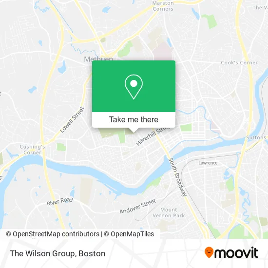
See The Wilson Group, Lawrence, on the map
Public Transit to The Wilson Group in Lawrence
Wondering how to get to The Wilson Group in Lawrence? Moovit helps you find the best way to get to The Wilson Group with step-by-step directions from the nearest public transit station.
Moovit provides free maps and live directions to help you navigate through your city. View schedules, routes, timetables, and find out how long does it take to get to The Wilson Group in real time.
Looking for the nearest stop or station to The Wilson Group? Check out this list of stops closest to your destination: Haverhill Street & Forest Street; Broadway & Haverhill Street; Margin St & Essex St; Lawrence.
Bus: 24, 10, 12, 28, 5.Train: HAVERHILL.
Want to see if there’s another route that gets you there at an earlier time? Moovit helps you find alternative routes or times. Get directions from and directions to The Wilson Group easily from the Moovit App or Website.
We make riding to The Wilson Group easy, which is why over 1.7 million users, including users in Lawrence, trust Moovit as the best app for public transit. You don’t need to download an individual bus app or train app, Moovit is your all-in-one transit app that helps you find the best bus time or train time available.
For information on prices of bus and train, costs and ride fares to The Wilson Group, please check the Moovit app.
Use the app to navigate to popular places including to the airport, hospital, stadium, grocery store, mall, coffee shop, school, college, and university.
The Wilson Group Address: 60 Crescent St Lawrence, MA 01841 street in Lawrence
- Nyssa Allegany Countyjail,
- International Baton Twirlers,
- Ventas de Pasteles en Hojas en Lawrence /Methuen,
- Union Supermarket II,
- Dan the Handy Man,
- Ann's Dry Cleaning,
- West Tire Shop Y Electronica,
- Talaria Logistics,
- Nasamounas Shipping,
- Archer Auto,
- SERVPRO,
- Trinity Ems,
- Intoxalock Ignition Interlock,
- Sanchez Cargo,
- Elizabeth Grocery,
- Abarrotes la Doña,
- K4 Services,
- Lawrence Housing Authority,
- Classic Auto Body,
- El Arca Supermarket
Places Near The Wilson Group (Lawrence)
- Faneuil Hall, Boston,
- Boston Medical Center, Boston,
- Boston Children's Hospital, Boston,
- Museum Of Science, Boston,
- Wang Theater, Boston,
- Cheers, Boston,
- North End, Boston,
- House Of Blues, Boston,
- Seaport District, Boston,
- Boston Convention & Exhibition Center, Boston,
- Castle Island, Boston,
- Quincy Market, Boston,
- Boston Common, Boston,
- Prudential Center, Boston,
- Leader Bank Pavilion (Leader Bank Pavillion), Boston,
- Massachusetts General Hospital, Boston,
- Wilbur Theatre, Boston,
- Td Garden, Boston,
- Mgm Music Hall, Boston,
- Isabella Stewart Gardner Museum, Boston
How to get to popular places in Boston with public transit
Get around Lawrence by public transit!
Traveling around Lawrence has never been so easy. See step by step directions as you travel to any attraction, street or major public transit station. View bus and train schedules, arrival times, service alerts and detailed routes on a map, so you know exactly how to get to anywhere in Lawrence.
When traveling to any destination around Lawrence use Moovit's Live Directions with Get Off Notifications to know exactly where and how far to walk, how long to wait for your line, and how many stops are left. Moovit will alert you when it's time to get off — no need to constantly re-check whether yours is the next stop.
Wondering how to use public transit in Lawrence or how to pay for public transit in Lawrence? Moovit public transit app can help you navigate your way with public transit easily, and at minimum cost. It includes public transit fees, ticket prices, and costs. Looking for a map of Lawrence public transit lines? Moovit public transit app shows all public transit maps in Lawrence with all Bus, Train, Subway and Ferry routes and stops on an interactive map.
Boston has 4 transit type(s), including: Bus, Train, Subway and Ferry, operated by several transit agencies, including MBTA, Southeastern Regional Transit Authority, MetroWest Regional Transit Authority, Rhode Island Public Transit Authority, WRTA, Lowell Regional Transit Authority, Merrimack Valley Transit, Montachusett Regional Transit Authority, Cape Cod Regional Transit Authority, Brockton Area Transit Authority, Martha's Vineyard Transit Authority, the WAVE - Nantucket Regional Transit Authority, GATRA, Cape Ann Transportation Authority and Massport