How to get to The Window People by bus?
Click on the bus route to see step by step directions with maps, line arrival times and updated time schedules.
From Foxwoods, Worcester
171 minFrom Registry Of Motor Vehicles (Rmv) Branch Office, Worcester
145 minFrom Gardner, MA, Gardner
190 minFrom Palladium, Worcester
147 minFrom Worcester, MA, Worcester
141 minFrom South High Community School, Worcester
238 minFrom Quinsigamond Community College, Worcester
159 min
How to get to The Window People by train?
Click on the train route to see step by step directions with maps, line arrival times and updated time schedules.
Bus stops near The Window People in Boston
Train station near The Window People in Boston
- Northampton, 11 min walk,VIEW
Bus lines to The Window People in Boston
What are the closest stations to The Window People?
The closest stations to The Window People are:
- King / Barrett is 142 yards away, 2 min walk.
- King St at Lia Toyota is 164 yards away, 2 min walk.
- Northampton is 914 yards away, 11 min walk.
- Sheldon Field (W) is 938 yards away, 12 min walk.
Which bus lines stop near The Window People?
These bus lines stop near The Window People: 31, B48, G73E.
Which train line stops near The Window People?
VERMONTER (St Albans)
What’s the nearest train station to The Window People in Boston?
The nearest train station to The Window People in Boston is Northampton. It’s a 11 min walk away.
What’s the nearest bus station to The Window People in Boston?
The nearest bus stations to The Window People in Boston are King / Barrett and King St at Lia Toyota. The closest one is a 2 min walk away.
What time is the first train to The Window People in Boston?
The VALLEY FLYER is the first train that goes to The Window People in Boston. It stops nearby at 6:30 AM.
What time is the last train to The Window People in Boston?
The VALLEY FLYER is the last train that goes to The Window People in Boston. It stops nearby at 10:07 PM.
What time is the first bus to The Window People in Boston?
The 31 is the first bus that goes to The Window People in Boston. It stops nearby at 5:39 AM.
What time is the last bus to The Window People in Boston?
The B43 is the last bus that goes to The Window People in Boston. It stops nearby at 11:54 PM.
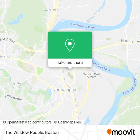
See The Window People, Boston, on the map
Public Transit to The Window People in Boston
Wondering how to get to The Window People in Boston? Moovit helps you find the best way to get to The Window People with step-by-step directions from the nearest public transit station.
Moovit provides free maps and live directions to help you navigate through your city. View schedules, routes, timetables, and find out how long does it take to get to The Window People in real time.
Looking for the nearest stop or station to The Window People? Check out this list of stops closest to your destination: King / Barrett; King St at Lia Toyota; Northampton; Sheldon Field (W).
Bus: 31, B48, G73E, R44, B43.Train: VERMONTER, VALLEY FLYER.
Want to see if there’s another route that gets you there at an earlier time? Moovit helps you find alternative routes or times. Get directions from and directions to The Window People easily from the Moovit App or Website.
We make riding to The Window People easy, which is why over 1.7 million users, including users in Boston, trust Moovit as the best app for public transit. You don’t need to download an individual bus app or train app, Moovit is your all-in-one transit app that helps you find the best bus time or train time available.
For information on prices of bus and train, costs and ride fares to The Window People, please check the Moovit app.
Use the app to navigate to popular places including to the airport, hospital, stadium, grocery store, mall, coffee shop, school, college, and university.
The Window People Address: 193 North St street in Boston
- Czelusniak Funeral Home,
- With These Hands,
- Blue Sky Communications,
- Brad Carmody Solar Consultant,
- Dan Inglis Voice & Piano Studio,
- Eremite,
- Norwottuck Rail Trail,
- Andrew Maciaszek, O.D.,
- Christopher Foley Painting,
- Warner Tree Demeters Garden,
- Platinum Touchless Car Wash,
- Platinum Auto Spa,
- Dalco Custom Works,
- Hair by Lisa,
- Seemo Shuttle,
- Coni Gilman Physical Therapy LLC,
- Revival Homestead Supply,
- Malvern Micr Products,
- Cobalt Design Studio,
- Kfc / Taco Bell
Places Near The Window People (Boston)
- Seaport District, Boston,
- Boston Common, Boston,
- Castle Island, Boston,
- Leader Bank Pavilion (Leader Bank Pavillion), Boston,
- Wilbur Theatre, Boston,
- Cheers, Boston,
- Isabella Stewart Gardner Museum, Boston,
- Td Garden, Boston,
- Boston Medical Center, Boston,
- North End, Boston,
- Massachusetts General Hospital, Boston,
- Prudential Center, Boston,
- Quincy Market, Boston,
- Mgm Music Hall, Boston,
- Museum Of Science, Boston,
- Boston Convention & Exhibition Center, Boston,
- Faneuil Hall, Boston,
- Boston Children's Hospital, Boston,
- House Of Blues, Boston,
- Wang Theater, Boston
How to get to popular places in Boston with public transit
Get around Boston by public transit!
Traveling around Boston has never been so easy. See step by step directions as you travel to any attraction, street or major public transit station. View bus and train schedules, arrival times, service alerts and detailed routes on a map, so you know exactly how to get to anywhere in Boston.
When traveling to any destination around Boston use Moovit's Live Directions with Get Off Notifications to know exactly where and how far to walk, how long to wait for your line, and how many stops are left. Moovit will alert you when it's time to get off — no need to constantly re-check whether yours is the next stop.
Wondering how to use public transit in Boston or how to pay for public transit in Boston? Moovit public transit app can help you navigate your way with public transit easily, and at minimum cost. It includes public transit fees, ticket prices, and costs. Looking for a map of Boston public transit lines? Moovit public transit app shows all public transit maps in Boston with all Bus, Train, Subway and Ferry routes and stops on an interactive map.
Boston has 4 transit type(s), including: Bus, Train, Subway and Ferry, operated by several transit agencies, including MBTA, Southeastern Regional Transit Authority, MetroWest Regional Transit Authority, Rhode Island Public Transit Authority, WRTA, Lowell Regional Transit Authority, Merrimack Valley Transit, Montachusett Regional Transit Authority, Cape Cod Regional Transit Authority, Brockton Area Transit Authority, Martha's Vineyard Transit Authority, the WAVE - Nantucket Regional Transit Authority, GATRA, Cape Ann Transportation Authority and Massport