See Thomas Jefferson Memorial, Washington, on the map
Directions to Thomas Jefferson Memorial (Washington) with public transportation
The following transit lines have routes that pass near Thomas Jefferson Memorial
 Bus:
Bus: - Train:
- Metro:
How to get to Thomas Jefferson Memorial by bus?
Click on the bus route to see step by step directions with maps, line arrival times and updated time schedules.
How to get to Thomas Jefferson Memorial by train?
Click on the train route to see step by step directions with maps, line arrival times and updated time schedules.
How to get to Thomas Jefferson Memorial by metro?
Click on the metro route to see step by step directions with maps, line arrival times and updated time schedules.
Bus stations near Thomas Jefferson Memorial in Washington
- East Basin Drive SW at Jefferson Memorial (Wb),8 min walk,
- 12 St Sw+D St SW,13 min walk,
- 14th St @ Independence Ave Sw,13 min walk,
- Independence Ave & 14th St Sw Wb,14 min walk,
- Independence & 12th St,17 min walk,
- SW Independence Av & SW 12th St,17 min walk,
- Independence St Ave & 12th St,17 min walk,
Metro stations near Thomas Jefferson Memorial in Washington
- Smithsonian Metrorail,17 min walk,
- L'Enfant Plaza,18 min walk,
Bus lines to Thomas Jefferson Memorial in Washington
- NMS,Lincoln Memorial,
- 52,South To L'Enfant Plaza Sta,
- 541,541 - Washington Dc / State Department,
- 563,Pentagon / L'Enfant Plaza / Navy Yard,
- 611,State Department / Washington Dc,
- 612,Pentagon / Gainesville - University Lot,
- 923,Pentagon / L'Enfant / Navy Yard,
- 943,543 - L'Enfant Plaza - Washington, Dc,
- 953,234 Lot / Montclair,
- 971,Horner / Telegraph / Dale City Lots Via Minnieville,
- 981,Pentagon / State Department / Washington Dc,
- 11Y,South To Mt Vernon,
- 16E,East To Franklin Square,
- 230,230/12 Severna Park,
- 250,250/7 Kent Island,
- 630,630/8 La Plata,
- 281,H ST & 4TH ST - Stone Ridge II,
- 481,H ST & 4TH ST - Leesburg P&R,
- 483,H ST & 4TH ST - Harmony Park and Ride,
- 484,H ST & 4TH ST - Harmony Park and Ride,
What are the closest stations to Thomas Jefferson Memorial?
The closest stations to Thomas Jefferson Memorial are:
- East Basin Drive SW at Jefferson Memorial (Wb) is 628 yards away, 8 min walk.
- 12 St Sw+D St SW is 1042 yards away, 13 min walk.
- 14th St @ Independence Ave Sw is 1049 yards away, 13 min walk.
- Independence Ave & 14th St Sw Wb is 1136 yards away, 14 min walk.
- Independence & 12th St is 1347 yards away, 17 min walk.
- SW Independence Av & SW 12th St is 1354 yards away, 17 min walk.
- Smithsonian Metrorail is 1354 yards away, 17 min walk.
- Independence St Ave & 12th St is 1390 yards away, 17 min walk.
- L'Enfant Plaza is 1426 yards away, 18 min walk.
Which bus lines stop near Thomas Jefferson Memorial?
These bus lines stop near Thomas Jefferson Memorial: 11Y, 563, 601, 981, NMS.
Which train lines stop near Thomas Jefferson Memorial?
These train lines stop near Thomas Jefferson Memorial: FREDERICKSBURG LINE, MANASSAS LINE.
Which metro lines stop near Thomas Jefferson Memorial?
These metro lines stop near Thomas Jefferson Memorial: METRORAIL GREEN LINE, METRORAIL ORANGE LINE, METRORAIL SILVER LINE, METRORAIL YELLOW LINE.
What’s the nearest metro station to Thomas Jefferson Memorial in Washington?
The nearest metro station to Thomas Jefferson Memorial in Washington is Smithsonian Metrorail. It’s a 17 min walk away.
What’s the nearest bus stop to Thomas Jefferson Memorial in Washington?
The nearest bus stop to Thomas Jefferson Memorial in Washington is East Basin Drive SW at Jefferson Memorial (Wb). It’s a 8 min walk away.
What time is the first metro to Thomas Jefferson Memorial in Washington?
The METRORAIL GREEN LINE is the first metro that goes to Thomas Jefferson Memorial in Washington. It stops nearby at 5:18 AM.
What time is the last metro to Thomas Jefferson Memorial in Washington?
The METRORAIL GREEN LINE is the last metro that goes to Thomas Jefferson Memorial in Washington. It stops nearby at 12:16 AM.
What time is the first train to Thomas Jefferson Memorial in Washington?
The MANASSAS LINE is the first train that goes to Thomas Jefferson Memorial in Washington. It stops nearby at 6:12 AM.
What time is the last train to Thomas Jefferson Memorial in Washington?
The MANASSAS LINE is the last train that goes to Thomas Jefferson Memorial in Washington. It stops nearby at 7:08 PM.
What time is the first bus to Thomas Jefferson Memorial in Washington?
The 52 is the first bus that goes to Thomas Jefferson Memorial in Washington. It stops nearby at 3:05 AM.
What time is the last bus to Thomas Jefferson Memorial in Washington?
The 52 is the last bus that goes to Thomas Jefferson Memorial in Washington. It stops nearby at 3:28 AM.
How much is the metro fare to Thomas Jefferson Memorial?
The metro fare to Thomas Jefferson Memorial costs about $2.00 - $6.75.
How much is the bus fare to Thomas Jefferson Memorial?
The bus fare to Thomas Jefferson Memorial costs about $2.00.
See Thomas Jefferson Memorial, Washington, on the map
Public Transit to Thomas Jefferson Memorial in Washington
Wondering how to get to Thomas Jefferson Memorial in Washington, United States? Moovit helps you find the best way to get to Thomas Jefferson Memorial with step-by-step directions from the nearest public transit station.
Moovit provides free maps and live directions to help you navigate through your city. View schedules, routes, timetables, and find out how long does it take to get to Thomas Jefferson Memorial in real time.
Looking for the nearest stop or station to Thomas Jefferson Memorial? Check out this list of stops closest to your destination: East Basin Drive SW at Jefferson Memorial (Wb); 12 St Sw+D St SW; 14th St @ Independence Ave Sw; Independence Ave & 14th St Sw Wb; Independence & 12th St; SW Independence Av & SW 12th St; Smithsonian Metrorail; Independence St Ave & 12th St; L'Enfant Plaza.
Bus:Train:Metro:
Want to see if there’s another route that gets you there at an earlier time? Moovit helps you find alternative routes or times. Get directions from and directions to Thomas Jefferson Memorial easily from the Moovit App or Website.
We make riding to Thomas Jefferson Memorial easy, which is why over 1.5 million users, including users in Washington, trust Moovit as the best app for public transit. You don’t need to download an individual bus app or train app, Moovit is your all-in-one transit app that helps you find the best bus time or train time available.
For information on prices of bus, metro and train, costs and ride fares to Thomas Jefferson Memorial, please check the Moovit app.
Use the app to navigate to popular places including to the airport, hospital, stadium, grocery store, mall, coffee shop, school, college, and university.
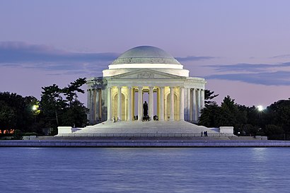
Thomas Jefferson Memorial Address: 900 Ohio Dr SW street in Washington
Attractions near Thomas Jefferson Memorial
George Mason Memorial (African American Civil War Memorial),Ohio Dr,Interstate 395,DC Bike Repair,Washington DC Mandarin Oriental,Salamander Washington DC,I-395 Express I-395,Mandarin Oriental, Washington DC,Mandarin Oriental Washington DC,Tidal Basin Tour,1331 Maryland,Jessie Taylor Seafood,East Potomac Park,1331,Captain White Seafood City,Jesse Taylor Seafood,The Portals,Maine Avenue Fish Market,Tidal Basin,U.S. Department of the Treasury's Bureau of the Fiscal ServiceHow to get to popular attractions in Washington with public transit
Sweetwater Tavern, Fairfax County,I-95 Exit 158: Prince William Pkwy, Prince William County,Columbia, MD, Howard County,Herndon, Virginia, Fairfax County,Towson, MD, Baltimore County,Daniel O'Connell's Irish Restaurant & Bar, Alexandria,Manassas, VA, Manassas,Pearl Dive Oyster Palace, Washington,Buffalo Wild Wings, Anne Arundel County,White Flint Metro Station, Montgomery County,Tunnicliff's Tavern, Washington,O'Sullivan's Irish Pub & Restaurant, Arlington County,Cross Street Market, Baltimore,Baltimore Farmers' Market & Bazaar, Baltimore,Little Havana, Baltimore,Miss Shirley's Cafe, Baltimore,Canton, Baltimore,Penn Quarter Sports Tavern, Washington,Walmart Supercenter, Baltimore County,Rasika, WashingtonGet around Washington by public transit!
Traveling around Washington has never been so easy. See step by step directions as you travel to any attraction, street or major public transit station. View bus and train schedules, arrival times, service alerts and detailed routes on a map, so you know exactly how to get to anywhere in Washington.
When traveling to any destination around Washington use Moovit's Live Directions with Get Off Notifications to know exactly where and how far to walk, how long to wait for your line, and how many stops are left. Moovit will alert you when it's time to get off — no need to constantly re-check whether yours is the next stop.
Wondering how to use public transit in Washington or how to pay for public transit in Washington? Moovit public transit app can help you navigate your way with public transit easily, and at minimum cost. It includes public transit fees, ticket prices, and costs. Looking for a map of Washington public transit lines? Moovit public transit app shows all public transit maps in Washington with all bus, metro or train routes and stops on an interactive map.
Washington has 3 transit type(s), including: bus, metro or train, operated by several transit agencies, including WMATA, WMATA, Montgomery County Ride On, Fairfax Connector, TheBus, DC Circulator, MDOT MTA, Marc, MDOT MTA, MDOT MTA, Virginia Railway Express (VRE), PRTC, DASH - Alexandria, Arlington Transit (ART) and DC Streetcar