See Thunder Bay International Airport on the map
Directions to Thunder Bay International Airport with public transportation
The following transit lines have routes that pass near Thunder Bay International Airport
 Bus:
Bus:
How to get to Thunder Bay International Airport by bus?
Click on the bus route to see step by step directions with maps, line arrival times and updated time schedules.
Bus stations near Thunder Bay International Airport
- College Aviation Centre,5 min walk,
- Arthur & Sifton,13 min walk,
Bus lines to Thunder Bay International Airport
- 14,Arthur To Airport,
- 4,Neebing,
What are the closest stations to Thunder Bay International Airport?
The closest stations to Thunder Bay International Airport are:
- College Aviation Centre is 330 meters away, 5 min walk.
- Arthur & Sifton is 955 meters away, 13 min walk.
Which bus line stops near Thunder Bay International Airport?
14
What’s the nearest bus stop to Thunder Bay International Airport?
The nearest bus stop to Thunder Bay International Airport is College Aviation Centre. It’s a 5 min walk away.
See Thunder Bay International Airport on the map
Public Transportation to Thunder Bay International Airport
Wondering how to get to Thunder Bay International Airport, Canada? Moovit helps you find the best way to get to Thunder Bay International Airport with step-by-step directions from the nearest public transit station.
Moovit provides free maps and live directions to help you navigate through your city. View schedules, routes, timetables, and find out how long does it take to get to Thunder Bay International Airport in real time.
Looking for the nearest stop or station to Thunder Bay International Airport? Check out this list of stops closest to your destination: College Aviation Centre; Arthur & Sifton.
Bus:
Want to see if there’s another route that gets you there at an earlier time? Moovit helps you find alternative routes or times. Get directions from and directions to Thunder Bay International Airport easily from the Moovit App or Website.
We make riding to Thunder Bay International Airport easy, which is why over 1.5 million users, including users in Thunder Bay, trust Moovit as the best app for public transit. You don’t need to download an individual bus app or train app, Moovit is your all-in-one transit app that helps you find the best bus time or train time available.
For information on prices of bus, costs and ride fares to Thunder Bay International Airport, please check the Moovit app.
Use the app to navigate to popular places including to the airport, hospital, stadium, grocery store, mall, coffee shop, school, college, and university.
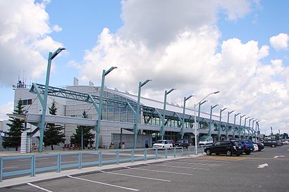
Thunder Bay International Airport Address: Thunder Bay International Airport (YQT), 100 Princess St, Thunder Bay, ON P7E 6S2, Canada street in Thunder Bay
Attractions near Thunder Bay International Airport
North Star Air Hangar,Air Canada Flight AC 8536,Air Canada Flight AC 8538,Thunder Bay Airport,Gate 2,Wasaya Hanger,Wasaya Airways LP,Confederation College ACE,Thunder Bay Flight Refueling (Esso),Canadian Flight Centre,Wasaya Training Center,Porter Flight,wasaya cargo,Flight AC8534,Bearskin Airlines Hangar,Gate 2 Thunder Bay International Airport,FedEx,Gate 5,Gate 3 Thunder Bay Airport,Gate 4How to get to popular attractions in Thunder Bay with public transit
Man Shield Construction Inc, Thunder Bay,Cardinal Custom Tackle, Thunder Bay,Dawson General Store, Thunder Bay,Buset & Buset Chartered Accountants, Thunder Bay,Ronin Martial Arts, Thunder Bay,Oshki-Pimache-O-Win Education and Training Institute, Thunder Bay,Sister Bear Designs, Thunder Bay,Tony Sgambelluri-Freedom55 Financial, Thunder Bay,Family Memorials, Thunder Bay,Shamrock Lottery, Thunder Bay,Arthur & Lillie, Thunder Bay,Intertek Commodities Division, Thunder Bay,Castlegreen Co-Operative, Thunder Bay,Salon, Thunder Bay,Picnicki, Thunder Bay,Labour and delivery dept, thunder bay regional, Thunder Bay,Victoria & Waterloo, Thunder Bay,That Shane Guy, Thunder Bay,JFT Contracting, Thunder Bay,Donna K. Scott Dentist, Thunder BayGet around Thunder Bay by public transit!
Traveling around Thunder Bay has never been so easy. See step by step directions as you travel to any attraction, street or major public transit station. View bus and train schedules, arrival times, service alerts and detailed routes on a map, so you know exactly how to get to anywhere in Thunder Bay.
When traveling to any destination around Thunder Bay use Moovit's Live Directions with Get Off Notifications to know exactly where and how far to walk, how long to wait for your line, and how many stops are left. Moovit will alert you when it's time to get off — no need to constantly re-check whether yours is the next stop.
Wondering how to use public transit in Thunder Bay or how to pay for public transit in Thunder Bay? Moovit public transit app can help you navigate your way with public transit easily, and at minimum cost. It includes public transit fees, ticket prices, and costs. Looking for a map of Thunder Bay public transit lines? Moovit public transit app shows all public transit maps in Thunder Bay with all bus routes and stops on an interactive map.
Thunder Bay has 1 transit type(s), including: bus, operated by several transit agencies, including Thunder Bay Transit