See Tiptoplofts, Toronto, on the map
Directions to Tiptoplofts (Toronto) with public transportation
The following transit lines have routes that pass near Tiptoplofts
 Bus:
Bus: - Train:
- Subway:
- Streetcar:
How to get to Tiptoplofts by bus?
Click on the bus route to see step by step directions with maps, line arrival times and updated time schedules.
How to get to Tiptoplofts by train?
Click on the train route to see step by step directions with maps, line arrival times and updated time schedules.
How to get to Tiptoplofts by subway?
Click on the subway route to see step by step directions with maps, line arrival times and updated time schedules.
Streetcar stations near Tiptoplofts in Toronto
- Fleet St At Bathurst St West Side,4 min walk,
What are the closest stations to Tiptoplofts?
The closest stations to Tiptoplofts are:
- Fleet St At Bathurst St West Side is 231 meters away, 4 min walk.
Which bus lines stop near Tiptoplofts?
These bus lines stop near Tiptoplofts: 121, 145, 511.
Which train lines stop near Tiptoplofts?
These train lines stop near Tiptoplofts: LW, UP.
Which subway line stops near Tiptoplofts?
1
Which Streetcar line stops near Tiptoplofts?
509
What’s the nearest Streetcar station to Tiptoplofts in Toronto?
The nearest Streetcar station to Tiptoplofts in Toronto is Fleet St At Bathurst St West Side. It’s a 4 min walk away.
See Tiptoplofts, Toronto, on the map
Public Transit to Tiptoplofts in Toronto
Wondering how to get to Tiptoplofts in Toronto, Canada? Moovit helps you find the best way to get to Tiptoplofts with step-by-step directions from the nearest public transit station.
Moovit provides free maps and live directions to help you navigate through your city. View schedules, routes, timetables, and find out how long does it take to get to Tiptoplofts in real time.
Looking for the nearest stop or station to Tiptoplofts? Check out this list of stops closest to your destination: Fleet St At Bathurst St West Side.
Bus:Train:Subway:Streetcar:
Want to see if there’s another route that gets you there at an earlier time? Moovit helps you find alternative routes or times. Get directions from and directions to Tiptoplofts easily from the Moovit App or Website.
We make riding to Tiptoplofts easy, which is why over 1.5 million users, including users in Toronto, trust Moovit as the best app for public transit. You don’t need to download an individual bus app or train app, Moovit is your all-in-one transit app that helps you find the best bus time or train time available.
For information on prices of bus, subway, Streetcar and train, costs and ride fares to Tiptoplofts, please check the Moovit app.
Use the app to navigate to popular places including to the airport, hospital, stadium, grocery store, mall, coffee shop, school, college, and university.
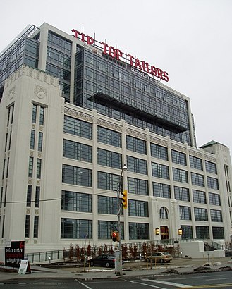
Tiptoplofts Address: Stadium Road street in Toronto
Attractions near Tiptoplofts
Tip Top Lofts,637 Lake Shore Boulevard West,1877 Junk Two GO,Spencer Xiong Photography,Six0Seven Models,Perfect Burger,G4 Tech TV studio,Le stade,Toronto Harbour Western Gap,Malibu Rooftop Tanning Deck,Thriftys,Fairweather Stores Inc,OnHerCam.com,HMCS York,Quay West At Tip Top Lofts,90 Stadium Road,BannerBuzz,Quay West @ Tip Top,Jackson Park,Wal-mart CMNHow to get to popular attractions in Toronto with public transit
City of Hamilton, Hamilton,Outlet Collection at Niagara, Niagara-On-The-Lake,The Junction, Toronto,Cambridge, Ontario, Cambridge,City of St. Catharines, St. Catharines,Starbucks, Toronto,Vaughan Mills, Vaughan,Niagara College, Welland,Canada's Wonderland, Vaughan,Burlington Bay James N. Allan Skyway, Hamilton,Pacific Mall, Markham,Humber College - Lakeshore Campus, Toronto,Starbucks, Toronto,GoodLife Fitness Centres, Toronto,TTC 505 Dundas Streetcar, Toronto,TTC 512 St. Clair Streetcar, Toronto,Whitby GO Station, Whitby,Oliver & Bonacini Café Grill, Yonge and Front, Toronto,Newmarket, Ontario, Newmarket,GoodLife Fitness Centres, TorontoGet around Toronto by public transit!
Traveling around Toronto has never been so easy. See step by step directions as you travel to any attraction, street or major public transit station. View bus and train schedules, arrival times, service alerts and detailed routes on a map, so you know exactly how to get to anywhere in Toronto.
When traveling to any destination around Toronto use Moovit's Live Directions with Get Off Notifications to know exactly where and how far to walk, how long to wait for your line, and how many stops are left. Moovit will alert you when it's time to get off — no need to constantly re-check whether yours is the next stop.
Wondering how to use public transit in Toronto or how to pay for public transit in Toronto? Moovit public transit app can help you navigate your way with public transit easily, and at minimum cost. It includes public transit fees, ticket prices, and costs. Looking for a map of Toronto public transit lines? Moovit public transit app shows all public transit maps in Toronto with all bus, subway, Streetcar or train routes and stops on an interactive map.
Toronto has 4 transit type(s), including: bus, subway, Streetcar or train, operated by several transit agencies, including TTC, TTC Streetcar, Toronto Subway, GO Transit Bus, GO Transit, Amtrak, York Region Transit, Grand River Transit, Guelph Transit, grt, Hamilton Street Railway, MiWay, Brampton Transit, Burlington Transit and Oakville Transit