Directions to Toronto Congress Centre with public transportation
The following transit lines have routes that pass near Toronto Congress Centre
How to get to Toronto Congress Centre by bus?
Click on the bus route to see step by step directions with maps, line arrival times and updated time schedules.
How to get to Toronto Congress Centre by train?
Click on the train route to see step by step directions with maps, line arrival times and updated time schedules.
Bus stops near Toronto Congress Centre
- Dixon Rd At Kelfield St, 1 min walk,
- Dixon Rd At City View Dr, 1 min walk,
- Dixon Rd At Martin Grove Rd, 7 min walk,
Bus lines to Toronto Congress Centre
- 52, Eglinton Station,
- 352, Pearson Airport Terminal 1 - Ground Level Column R4,
- 52A, Pearson Airport Terminal 1 - Ground Level Column R4,
- 52B, Westwood Square Bus Terminal at Morning Star Dr,
- 52D, Victory Cres at Mcnaughton Ave,
- 952, Eglinton Station,
What are the closest stations to Toronto Congress Centre?
The closest stations to Toronto Congress Centre are:
- Dixon Rd At Kelfield St is 34 meters away, 1 min walk.
- Dixon Rd At City View Dr is 64 meters away, 1 min walk.
- Dixon Rd At Martin Grove Rd is 485 meters away, 7 min walk.
Which bus lines stop near Toronto Congress Centre?
These bus lines stop near Toronto Congress Centre: 46, 52.
Which train line stops near Toronto Congress Centre?
KI
What’s the nearest bus stop to Toronto Congress Centre?
The nearest bus stops to Toronto Congress Centre are Dixon Rd At Kelfield St and Dixon Rd At City View Dr. The closest one is a 1 min walk away.
See Toronto Congress Centre on the map
Public Transportation to Toronto Congress Centre
Wondering how to get to Toronto Congress Centre, Canada? Moovit helps you find the best way to get to Toronto Congress Centre with step-by-step directions from the nearest public transit station.
Moovit provides free maps and live directions to help you navigate through your city. View schedules, routes, timetables, and find out how long does it take to get to Toronto Congress Centre in real time.
Looking for the nearest stop or station to Toronto Congress Centre? Check out this list of stops closest to your destination: Dixon Rd At Kelfield St; Dixon Rd At City View Dr; Dixon Rd At Martin Grove Rd.
Bus: 46, 52, 352, 52A, 52B, 52D, 952.Train: KI.
Want to see if there’s another route that gets you there at an earlier time? Moovit helps you find alternative routes or times. Get directions from and directions to Toronto Congress Centre easily from the Moovit App or Website.
We make riding to Toronto Congress Centre easy, which is why over 1.5 million users, including users in Toronto, trust Moovit as the best app for public transit. You don’t need to download an individual bus app or train app, Moovit is your all-in-one transit app that helps you find the best bus time or train time available.
For information on prices of bus, train and subway, costs and ride fares to Toronto Congress Centre, please check the Moovit app.
Use the app to navigate to popular places including to the airport, hospital, stadium, grocery store, mall, coffee shop, school, college, and university.
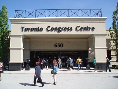
Toronto Congress Centre Address: 650 Dixon Road street in Toronto
Attractions near Toronto Congress Centre
Anime North 2017,Canada's Baking and Sweets Show,Radisson Suite Hotel - Toronto Airport,Adi,Discount Car and Truck Rentals,Anime North Office,Dixon Rd at Kelfield St,Staff Registration Office,Doubletree By Hilton - Toronto,Doubletree By Hilton Toronto Airport,Discount,655 Dixon Road,6 City View Dr,Harvey's,Quesada,Doubletree International Plaza Hotel Toronto Airport,Party Room,Elfe Juvenile Products,Direct Flight Parking,Swansea House of FashionHow to get to popular attractions in Toronto with public transit
Cirque Du Soleil - Alegria, Lake Ontario,Hwy 401 & Homer Watson, Kitchener,Eglinton East, Toronto,Hwy 401 at Victoria Park, Toronto,Vaughan Mills Shopping Centre, Vaughan,Regional Road 25 at Highway 401 Park-and-Ride, Milton,Bayview Avenue & Sheppard Avenue East, Toronto,Woodbine Park, Toronto,Hwy 407 & Mississauga Rd, Brampton,Humber College - Lakeshore Campus, Toronto,Hockey Hall Of Fame, Toronto,The McMichael Canadian Art Collection, Vaughan,Long Branch GO Station, Toronto,Pickering Town Centre, Pickering,Hwy 401 at Avenue Road, Toronto,Molson Canadian Amphitheatre, Toronto,Firstontario Centre, Hamilton,Jane & Wilson, Toronto,Dundas Peak, Hamilton,Toronto Premium Outlets, Halton HillsGet around Toronto by public transit!
Traveling around Toronto has never been so easy. See step by step directions as you travel to any attraction, street or major public transit station. View bus and train schedules, arrival times, service alerts and detailed routes on a map, so you know exactly how to get to anywhere in Toronto.
When traveling to any destination around Toronto use Moovit's Live Directions with Get Off Notifications to know exactly where and how far to walk, how long to wait for your line, and how many stops are left. Moovit will alert you when it's time to get off — no need to constantly re-check whether yours is the next stop.
Wondering how to use public transit in Toronto or how to pay for public transit in Toronto? Moovit public transit app can help you navigate your way with public transit easily, and at minimum cost. It includes public transit fees, ticket prices, and costs. Looking for a map of Toronto public transit lines? Moovit public transit app shows all public transit maps in Toronto with all Bus, Train, Subway, Streetcar and Ferry routes and stops on an interactive map.
Toronto has 5 transit type(s), including: Bus, Train, Subway, Streetcar and Ferry, operated by several transit agencies, including TTC, TTC Streetcar, Toronto Subway, Brampton Transit, MiWay, York Region Transit, GO Transit Bus, GO Transit, Durham Region Transit, UP Express, Grand River Transit, Guelph Transit, grt, Hamilton Street Railway, Burlington Transit