See Towners Station, Patterson, Ny, on the map
Directions to Towners Station (Patterson, Ny) with public transportation
The following transit lines have routes that pass near Towners Station
 Train:
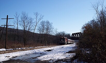
Train stations near Towners Station in Patterson, Ny
- Patterson ,72 min walk,
What are the closest stations to Towners Station?
The closest stations to Towners Station are:
- Patterson is 6176 yards away, 72 min walk.
Which train line stops near Towners Station?
HARLEM
See Towners Station, Patterson, Ny, on the map
Public Transit to Towners Station in Patterson, Ny
Wondering how to get to Towners Station in Patterson, Ny, United States? Moovit helps you find the best way to get to Towners Station with step-by-step directions from the nearest public transit station.
Moovit provides free maps and live directions to help you navigate through your city. View schedules, routes, timetables, and find out how long does it take to get to Towners Station in real time.
Looking for the nearest stop or station to Towners Station? Check out this list of stops closest to your destination: Patterson .
Train:
Want to see if there’s another route that gets you there at an earlier time? Moovit helps you find alternative routes or times. Get directions from and directions to Towners Station easily from the Moovit App or Website.
We make riding to Towners Station easy, which is why over 1.5 million users, including users in Patterson, Ny, trust Moovit as the best app for public transit. You don’t need to download an individual bus app or train app, Moovit is your all-in-one transit app that helps you find the best bus time or train time available.
For information on prices of train and bus, costs and ride fares to Towners Station, please check the Moovit app.
Use the app to navigate to popular places including to the airport, hospital, stadium, grocery store, mall, coffee shop, school, college, and university.
Location: Patterson, Ny, New York - New Jersey
Attractions near Towners Station
1,Four Corners,Towners,215 Route 164,215,Route 164 Route 164,675 Bullet Hole Rd,215 New York 164,Bullet Hole Rd,Bullet Hole Rd (bullet hole rd 164),188 RT-164,215 RT-164,215,RT-164 RT-164,20 Mountain View Rd,Mountain View Rd (mountainview rd chestnut),45 Locust Way,3 Pleasant View Ct (Pleasantview Ct),3 Pleasant View Ct,Industrial Power & Electric Motor Co,Janecek Bros Inc,164 / Cornwall Hill RdHow to get to popular attractions in Patterson, Ny with public transit
Barrage, Manhattan,Virgin America Ticket Counter, Elizabeth, Nj,Tacombi at Fonda Nolita, Manhattan,Great Lawn, Manhattan,Joe's Shanghai 鹿嗚春, Manhattan,Upper West Side, Manhattan,Atlantic City, NJ, Atlantic City, Nj,Smith Haven Mall, Lake Grove, Ny,MTA Subway - 30th Ave (N/W), Queens,MTA Subway - 42nd St / Bryant Park (B / D/F / M/7), Manhattan,Stout, Manhattan,Red Rooster, Manhattan,Lombardi's Coal Oven Pizza, Manhattan,Cookshop, Manhattan,The Dutch, Manhattan,The Plaza Hotel, Manhattan,Ulysses Folk House, Manhattan,Burger Joint, Manhattan,Hair of the Dog, Manhattan,24 Hour Fitness, ManhattanGet around Patterson, Ny by public transit!
Traveling around Patterson, Ny has never been so easy. See step by step directions as you travel to any attraction, street or major public transit station. View bus and train schedules, arrival times, service alerts and detailed routes on a map, so you know exactly how to get to anywhere in Patterson, Ny.
When traveling to any destination around Patterson, Ny use Moovit's Live Directions with Get Off Notifications to know exactly where and how far to walk, how long to wait for your line, and how many stops are left. Moovit will alert you when it's time to get off — no need to constantly re-check whether yours is the next stop.
Wondering how to use public transit in Patterson, Ny or how to pay for public transit in Patterson, Ny? Moovit public transit app can help you navigate your way with public transit easily, and at minimum cost. It includes public transit fees, ticket prices, and costs. Looking for a map of Patterson, Ny public transit lines? Moovit public transit app shows all public transit maps in Patterson, Ny with all train or bus routes and stops on an interactive map.
Patterson, Ny has 2 transit type(s), including: train or bus, operated by several transit agencies, including MTA Subway, Metro-North Railroad, LIRR, PATH, Shore Line East, MTA Bus Company, MTA New York City Transit - Express routes, MTA Bus, NJ Transit, NYC Ferry, NICE bus, Bee-Line Bus, NJ Transit Rail, NJ Transit Rail and Norwalk Transit District