Directions to Travis County Exposition Center (Austin) with public transportation
The following transit lines have routes that pass near Travis County Exposition Center
How to get to Travis County Exposition Center by bus?
Click on the bus route to see step by step directions with maps, line arrival times and updated time schedules.
Bus stations near Travis County Exposition Center in Austin
- Colony Loop/Decker,8 min walk,
- 8515 Loyola/Decker,13 min walk,
Bus lines to Travis County Exposition Center in Austin
- 337,337 Mopac Wb,
- 233,233 Decker Eb,
- 237,237 Tannehill Eb,
What are the closest stations to Travis County Exposition Center?
The closest stations to Travis County Exposition Center are:
- Colony Loop/Decker is 618 yards away, 8 min walk.
- 8515 Loyola/Decker is 1086 yards away, 13 min walk.
Which bus line stops near Travis County Exposition Center?
337
What’s the nearest bus stop to Travis County Exposition Center in Austin?
The nearest bus stop to Travis County Exposition Center in Austin is Colony Loop/Decker. It’s a 8 min walk away.
See Travis County Exposition Center, Austin, on the map
Public Transit to Travis County Exposition Center in Austin
Wondering how to get to Travis County Exposition Center in Austin, United States? Moovit helps you find the best way to get to Travis County Exposition Center with step-by-step directions from the nearest public transit station.
Moovit provides free maps and live directions to help you navigate through your city. View schedules, routes, timetables, and find out how long does it take to get to Travis County Exposition Center in real time.
Looking for the nearest stop or station to Travis County Exposition Center? Check out this list of stops closest to your destination: Colony Loop/Decker; 8515 Loyola/Decker.
Bus:337233237
Want to see if there’s another route that gets you there at an earlier time? Moovit helps you find alternative routes or times. Get directions from and directions to Travis County Exposition Center easily from the Moovit App or Website.
We make riding to Travis County Exposition Center easy, which is why over 1.5 million users, including users in Austin, trust Moovit as the best app for public transit. You don’t need to download an individual bus app or train app, Moovit is your all-in-one transit app that helps you find the best bus time or train time available.
For information on prices of bus, costs and ride fares to Travis County Exposition Center, please check the Moovit app.
Use the app to navigate to popular places including to the airport, hospital, stadium, grocery store, mall, coffee shop, school, college, and university.
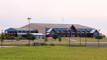
Travis County Exposition Center Address: 7311 Decker Ln street in Austin
Attractions near Travis County Exposition Center
7311 Decker Ln,Phillips General Maintenance C,Kids Palace Day Care,Crystal Mountain Bbs,Gardens of Decker Lake,Rosas Residence Cleaners,Rodeo Austin,Ironman 70.3 Austin,Blacklight Run - Austin,Whole Center,Lonestar Press,Country Living Fair, Austin,Sweets To Eat,Isom Enterprises,Angel Ghetto,Classic Floor Works,Austin Lonestar Roundup Car Show,Decker Challenge,Valleyfield Drive,Lonestar Round UpHow to get to popular attractions in Austin with public transit
Zilker Park Polo Tables Picnic Area, Austin,MLK And I-35, Austin,Loyola at Springdale Rd, Austin,The Mane Express in Dobie Mall, Austin,William Cannon and IH 35, Austin,Whitaker Intramural Fields, Austin,UTC 2.102A, Austin,LYC, Austin,Happy Cooks Cafeteria, Austin,Valentina's Tex Mex BBQ, Austin,Navarro Early College High School, Austin,Alamo Drafthouse Cinema - Mueller, Austin,Capital Plaza, Austin,Picnic Food Trailer Park, Austin,NVIDIA, Austin,Dkr Memorial Stadium, Austin,UT Facilities Services J. J. Pickle Research Campus, Austin,Chicas Bonitas, Austin,Auguste Escoffier School Of Culinary Arts, Austin,Seton Northwest Hospital : Seton Heart Institute, AustinGet around Austin by public transit!
Traveling around Austin has never been so easy. See step by step directions as you travel to any attraction, street or major public transit station. View bus and train schedules, arrival times, service alerts and detailed routes on a map, so you know exactly how to get to anywhere in Austin.
When traveling to any destination around Austin use Moovit's Live Directions with Get Off Notifications to know exactly where and how far to walk, how long to wait for your line, and how many stops are left. Moovit will alert you when it's time to get off — no need to constantly re-check whether yours is the next stop.
Wondering how to use public transit in Austin or how to pay for public transit in Austin? Moovit public transit app can help you navigate your way with public transit easily, and at minimum cost. It includes public transit fees, ticket prices, and costs. Looking for a map of Austin public transit lines? Moovit public transit app shows all public transit maps in Austin with all bus routes and stops on an interactive map.
Austin has 1 transit type(s), including: bus, operated by several transit agencies, including Capital Metro-Bus, Capital Metro-Tram, CARTS, Capital Area Rural Transportation System, San Marcos Transit, Greyhound-us, Megabus, FlixBus-us and Bobcat Shuttle