Directions to Tremont Temple (Boston) with public transportation
The following transit lines have routes that pass near Tremont Temple
How to get to Tremont Temple by bus?
Click on the bus route to see step by step directions with maps, line arrival times and updated time schedules.
How to get to Tremont Temple by train?
Click on the train route to see step by step directions with maps, line arrival times and updated time schedules.
How to get to Tremont Temple by subway?
Click on the subway route to see step by step directions with maps, line arrival times and updated time schedules.
Bus stations near Tremont Temple in Boston
- Beacon St @ Park St,2 min walk,
- Tremont St @ Beacon St,3 min walk,
- Congress St @ State St,4 min walk,
- Park Street - Tremont St Opp Hamilton Pl,4 min walk,
- Park Street - Tremont St @ Winter St,5 min walk,
- Franklin St @ Devonshire St,5 min walk,
- Tremont St Opp Temple Pl,5 min walk,
- Temple Pl @ Washington St,6 min walk,
- Cambridge St @ Government Ctr Sta,7 min walk,
- State St @ Washington Mall - State St Sta,8 min walk,
Subway stations near Tremont Temple in Boston
- State Street,3 min walk,
- Downtown Crossing,5 min walk,
- Government Center,5 min walk,
Bus lines to Tremont Temple in Boston
- 43,Park St & Tremont St,
- 15,Haymarket Via Fields Corner & Nubian,
- 39,Haymarket Via Forest Hills,
- 57,Haymarket Via Kenmore,
- RED LINE SHUTTLE,Harvard (Shuttle),
- RED LINE SHUTTLE,Kendall/MIT (Shuttle),
- 4,North Station,
- 92,Sullivan,
- 93,Sullivan Via Navy Yard,
- RED LINE SHUTTLE,Alewife - Park Street,
- RED LINE SHUTTLE,JFK/UMass - Park Street,
- RED LINE SHUTTLE,Harvard - Park Street,
- RED LINE SHUTTLE,Park Street (Shuttle),
- RED LINE SHUTTLE,Broadway (Shuttle),
- 7,Otis & Summer,
- GREEN LINE E SHUTTLE,Heath Street - Park Street,
- GREEN LINE SHUTTLE,Boston University East - Park Street,
- RED LINE SHUTTLE,Harvard - South Station,
- RED LINE SHUTTLE,Ashmont - Park Street via Post Office,
- RED LINE SHUTTLE,JFK/UMass - Park Street via Post Office,
What are the closest stations to Tremont Temple?
The closest stations to Tremont Temple are:
- Beacon St @ Park St is 112 yards away, 2 min walk.
- State Street is 185 yards away, 3 min walk.
- Tremont St @ Beacon St is 227 yards away, 3 min walk.
- Congress St @ State St is 283 yards away, 4 min walk.
- Park Street - Tremont St Opp Hamilton Pl is 303 yards away, 4 min walk.
- Downtown Crossing is 327 yards away, 5 min walk.
- Park Street - Tremont St @ Winter St is 336 yards away, 5 min walk.
- Government Center is 341 yards away, 5 min walk.
- Franklin St @ Devonshire St is 378 yards away, 5 min walk.
- Tremont St Opp Temple Pl is 386 yards away, 5 min walk.
- Temple Pl @ Washington St is 460 yards away, 6 min walk.
- Cambridge St @ Government Ctr Sta is 512 yards away, 7 min walk.
- State St @ Washington Mall - State St Sta is 622 yards away, 8 min walk.
Which bus lines stop near Tremont Temple?
These bus lines stop near Tremont Temple: 39, 426, 450, 57, 92, SL5.
Which train lines stop near Tremont Temple?
These train lines stop near Tremont Temple: FITCHBURG, FRAMINGHAM/WORCESTER, NEWBURYPORT/ROCKPORT.
Which subway lines stop near Tremont Temple?
These subway lines stop near Tremont Temple: BLUE LINE, GREEN LINE B, GREEN LINE D, RED LINE.
What’s the nearest subway station to Tremont Temple in Boston?
The nearest subway station to Tremont Temple in Boston is State Street. It’s a 3 min walk away.
What’s the nearest bus stop to Tremont Temple in Boston?
The nearest bus stop to Tremont Temple in Boston is Beacon St @ Park St. It’s a 2 min walk away.
What time is the first subway to Tremont Temple in Boston?
The GREEN LINE E is the first subway that goes to Tremont Temple in Boston. It stops nearby at 5:04 AM.
What time is the last subway to Tremont Temple in Boston?
The GREEN LINE E is the last subway that goes to Tremont Temple in Boston. It stops nearby at 1:19 AM.
What time is the first bus to Tremont Temple in Boston?
The 57 is the first bus that goes to Tremont Temple in Boston. It stops nearby at 5:01 AM.
What time is the last bus to Tremont Temple in Boston?
The 117 is the last bus that goes to Tremont Temple in Boston. It stops nearby at 1:15 AM.
How much is the subway fare to Tremont Temple?
The subway fare to Tremont Temple costs about $2.40.
How much is the bus fare to Tremont Temple?
The bus fare to Tremont Temple costs about $1.70.
See Tremont Temple, Boston, on the map
Public Transit to Tremont Temple in Boston
Wondering how to get to Tremont Temple in Boston, United States? Moovit helps you find the best way to get to Tremont Temple with step-by-step directions from the nearest public transit station.
Moovit provides free maps and live directions to help you navigate through your city. View schedules, routes, timetables, and find out how long does it take to get to Tremont Temple in real time.
Looking for the nearest stop or station to Tremont Temple? Check out this list of stops closest to your destination: Beacon St @ Park St; State Street; Tremont St @ Beacon St; Congress St @ State St; Park Street - Tremont St Opp Hamilton Pl; Downtown Crossing; Park Street - Tremont St @ Winter St; Government Center; Franklin St @ Devonshire St; Tremont St Opp Temple Pl; Temple Pl @ Washington St; Cambridge St @ Government Ctr Sta; State St @ Washington Mall - State St Sta.
Bus:394264505792SL54315RED LINE SHUTTLERED LINE SHUTTLERED LINE SHUTTLE4Train:FITCHBURGFRAMINGHAM/WORCESTERNEWBURYPORT/ROCKPORTSubway:BLUE LINEGREEN LINE BGREEN LINE DRED LINEORANGE LINEGREEN LINE CGREEN LINE E
Want to see if there’s another route that gets you there at an earlier time? Moovit helps you find alternative routes or times. Get directions from and directions to Tremont Temple easily from the Moovit App or Website.
We make riding to Tremont Temple easy, which is why over 1.5 million users, including users in Boston, trust Moovit as the best app for public transit. You don’t need to download an individual bus app or train app, Moovit is your all-in-one transit app that helps you find the best bus time or train time available.
For information on prices of bus, subway and train, costs and ride fares to Tremont Temple, please check the Moovit app.
Use the app to navigate to popular places including to the airport, hospital, stadium, grocery store, mall, coffee shop, school, college, and university.
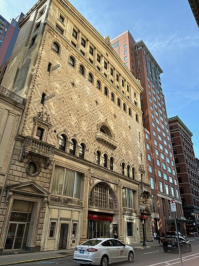
Tremont Temple Address: Tremont Street street in Boston
Attractions near Tremont Temple
Good Friday Boston,Tremont Temple Baptist Church (Cafe Tremont),Tremont Temple,Park Street MBTA Station - Green & Red Line,Laz Nine Zero Hotel (Kimpton Nine Zero),Hotel Aka Boston Common,90 Tremont Street,60 School Street,Kimpton Nine Zero an IHG Hotel Boston,Omni Parker House,Beehive,Laz Parking,Star Processing Inc,Suffolk Sargent Hal (Suffolk University Ram Print Shop),Miracles & Other Deceptions: the Close Up Magic of Paul Gertner,Starbucks Partner Event,Morsel's Coffee Shop ,Next Generation Rna Therapeutics,The Freedom Trail,45 Province Boston CondosHow to get to popular attractions in Boston with public transit
Hull, MA, Hull,Canton, MA,Tufts Dental School, Boston,Bedford, MA,Centre St, Boston,Royale Boston, Boston,Salem, Massachusetts, Salem,Piers Park, Boston,Children's Hospital, Boston,Maverick St. Resident Gate East Boston, Boston,Cambridgeside, Cambridge,Hyatt Centric Faneuil, Boston,Walpole, MA, Walpole,Worcester, MA, Worcester,Encore, Boston,LMA Shuttle to Longwood Medical Area, Boston,Found Hotel Boston Common, Boston,North Shore Community College, Danvers,Twin Rivers Casino, Boston,Brandeis University, WalthamGet around Boston by public transit!
Traveling around Boston has never been so easy. See step by step directions as you travel to any attraction, street or major public transit station. View bus and train schedules, arrival times, service alerts and detailed routes on a map, so you know exactly how to get to anywhere in Boston.
When traveling to any destination around Boston use Moovit's Live Directions with Get Off Notifications to know exactly where and how far to walk, how long to wait for your line, and how many stops are left. Moovit will alert you when it's time to get off — no need to constantly re-check whether yours is the next stop.
Wondering how to use public transit in Boston or how to pay for public transit in Boston? Moovit public transit app can help you navigate your way with public transit easily, and at minimum cost. It includes public transit fees, ticket prices, and costs. Looking for a map of Boston public transit lines? Moovit public transit app shows all public transit maps in Boston with all bus, subway or train routes and stops on an interactive map.
Boston has 3 transit type(s), including: bus, subway or train, operated by several transit agencies, including MBTA, MBTA, MBTA, Southeastern Regional Transit Authority, MetroWest Regional Transit Authority, Rhode Island Public Transit Authority, WRTA, Lowell Regional Transit Authority, Merrimack Valley Transit, Montachusett Regional Transit Authority, Cape Cod Regional Transit Authority, Brockton Area Transit Authority, Cape Cod Regional Transit Authority, Martha's Vineyard Transit Authority and the WAVE - Nantucket Regional Transit Authority