How to get to Tri State Metal Works by bus?
Click on the bus route to see step by step directions with maps, line arrival times and updated time schedules.
From Eatontown, NJ, Eatontown, Nj
108 minFrom Park & Ride-PNC Bank Arts Center, Holmdel, Nj
210 minFrom Umiya Dham Hindu Temple, Edison, Nj
100 minFrom Edison NJ, Edison, Nj
133 minFrom Baps Shri Swaminarayan Mandir, Edison, NJ, USA, Edison, Nj
130 minFrom PNC Bank Arts Center, Holmdel, Nj
219 minFrom Staten Island, NY, Staten Island
245 minFrom Manalapan, NJ, Manalapan, Nj
211 minFrom Woodbridge, NJ, Woodbridge, Nj
72 minFrom Staten Island Mall, Staten Island
221 min
How to get to Tri State Metal Works by train?
Click on the train route to see step by step directions with maps, line arrival times and updated time schedules.
Bus stops near Tri State Metal Works in Union Beach, Nj
Train station near Tri State Metal Works in Union Beach, Nj
- Hazlet, 49 min walk,VIEW
Bus lines to Tri State Metal Works in Union Beach, Nj
What are the closest stations to Tri State Metal Works?
The closest stations to Tri State Metal Works are:
- Florence Ave at Edmunds Ave is 9 yards away, 1 min walk.
- Hazlet - Rt 36 @ Poole Ave (Northbound) is 993 yards away, 12 min walk.
- Hazlet is 4196 yards away, 49 min walk.
Which bus lines stop near Tri State Metal Works?
These bus lines stop near Tri State Metal Works: 133, 817.
Which train line stops near Tri State Metal Works?
NJCL (Long Branch)
What’s the nearest bus station to Tri State Metal Works in Union Beach, Nj?
The nearest bus station to Tri State Metal Works in Union Beach, Nj is Florence Ave at Edmunds Ave. It’s a 1 min walk away.
What time is the first train to Tri State Metal Works in Union Beach, Nj?
The NJCL is the first train that goes to Tri State Metal Works in Union Beach, Nj. It stops nearby at 4:19 AM.
What time is the last train to Tri State Metal Works in Union Beach, Nj?
The NJCL is the last train that goes to Tri State Metal Works in Union Beach, Nj. It stops nearby at 2:09 AM.
What time is the first bus to Tri State Metal Works in Union Beach, Nj?
The 602 is the first bus that goes to Tri State Metal Works in Union Beach, Nj. It stops nearby at 4:24 AM.
What time is the last bus to Tri State Metal Works in Union Beach, Nj?
The 817 is the last bus that goes to Tri State Metal Works in Union Beach, Nj. It stops nearby at 7:06 PM.
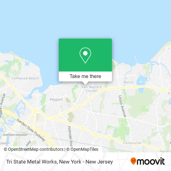
See Tri State Metal Works, Union Beach, Nj, on the map
Public Transit to Tri State Metal Works in Union Beach, Nj
Wondering how to get to Tri State Metal Works in Union Beach, Nj? Moovit helps you find the best way to get to Tri State Metal Works with step-by-step directions from the nearest public transit station.
Moovit provides free maps and live directions to help you navigate through your city. View schedules, routes, timetables, and find out how long does it take to get to Tri State Metal Works in real time.
Looking for the nearest stop or station to Tri State Metal Works? Check out this list of stops closest to your destination: Florence Ave at Edmunds Ave; Hazlet - Rt 36 @ Poole Ave (Northbound); Hazlet.
Bus: 133, 817, 602, 604.Train: NJCL.
Want to see if there’s another route that gets you there at an earlier time? Moovit helps you find alternative routes or times. Get directions from and directions to Tri State Metal Works easily from the Moovit App or Website.
We make riding to Tri State Metal Works easy, which is why over 1.5 million users, including users in Union Beach, Nj, trust Moovit as the best app for public transit. You don’t need to download an individual bus app or train app, Moovit is your all-in-one transit app that helps you find the best bus time or train time available.
For information on prices of bus and train, costs and ride fares to Tri State Metal Works, please check the Moovit app.
Use the app to navigate to popular places including to the airport, hospital, stadium, grocery store, mall, coffee shop, school, college, and university.
Tri State Metal Works Address: 408 Harrison Ave Union Beach, NJ 07735 street in Union Beach, Nj
- Naples on Florence,
- Union Beach,
- Quick Lane,
- Union Beach,
- Poole Ave Liqours Karaoke,
- Hackensack Meridian Urgent Care,
- Bayshore Regional Sewerage Authority,
- Ruisi Auto Sales,
- Wickswashes,
- 1185 NJ-36 Parking,
- Shoprite,
- Union Ave Auto Sales,
- Cycles at 117,
- Dymanica Sandblasting and Painting,
- Kolibas,
- Cedar Street Park,
- VFW Post. 4247,
- Hi Tech Properties, LLC.,
- FedEx,
- Ben Terry Park
Places Near Tri State Metal Works (Union Beach, Nj)
- 26 Federal Plaza, Manhattan,
- 3 Stone St, Manhattan,
- qqqq, Manhattan,
- SoHo, Manhattan,
- 111 Centre New York City Supreme Court, Manhattan,
- 376 Hudson Street, Manhattan,
- Pier 83, Manhattan,
- Queens Center Mall, Queens,
- San Gennaro Feast, Manhattan,
- Mountainside Hospital, Glen Ridge,
- Wall Street, Manhattan,
- Hudson Yards, Manhattan,
- Bellevue Hospital, Manhattan,
- 66 John Street, Manhattan,
- Chinatown, Manhattan,
- 911 Memorial, Manhattan,
- Times Square, Manhattan,
- 1 Police Plaza, Manhattan,
- Katz's Deli, Manhattan,
- Rockefeller Center, Manhattan
How to get to popular places in New York - New Jersey with public transit
Get around Union Beach, Nj by public transit!
Traveling around Union Beach, Nj has never been so easy. See step by step directions as you travel to any attraction, street or major public transit station. View bus and train schedules, arrival times, service alerts and detailed routes on a map, so you know exactly how to get to anywhere in Union Beach, Nj.
When traveling to any destination around Union Beach, Nj use Moovit's Live Directions with Get Off Notifications to know exactly where and how far to walk, how long to wait for your line, and how many stops are left. Moovit will alert you when it's time to get off — no need to constantly re-check whether yours is the next stop.
Wondering how to use public transit in Union Beach, Nj or how to pay for public transit in Union Beach, Nj? Moovit public transit app can help you navigate your way with public transit easily, and at minimum cost. It includes public transit fees, ticket prices, and costs. Looking for a map of Union Beach, Nj public transit lines? Moovit public transit app shows all public transit maps in Union Beach, Nj with all Bus, Train, Subway, Light Rail, Ferry and Cable Car routes and stops on an interactive map.
New York - New Jersey has 6 transit type(s), including: Bus, Train, Subway, Light Rail, Ferry and Cable Car, operated by several transit agencies, including MTA Subway, Metro-North Railroad, LIRR, PATH, MTA New York City Transit - Express routes, MTA Bus, NJ Transit, NYC Ferry, NICE bus, Bee-Line Bus, NJ Transit Rail, Norwalk Transit District, Hartford Line, River Valley Transit and HART