How to get to Trifecta Optometry by bus?
Click on the bus route to see step by step directions with maps, line arrival times and updated time schedules.
From Laurel, Edmonton
43 minFrom 에드먼튼 순복음 교회 - Ekfgc, Edmonton
84 minFrom Argyll Casino, Edmonton
87 minFrom Union Hall Events Centre, Edmonton
73 minFrom Old Strathcona Shopping Centre, Edmonton
104 minFrom Windermere, Edmonton
58 minFrom Cabela's, Edmonton
39 minFrom Bmb International Recruitment, Edmonton
74 minFrom King Edward Park, Edmonton
93 minFrom Grandview Stairs, Edmonton
100 min
Bus stops near Trifecta Optometry in Edmonton
Bus lines to Trifecta Optometry in Edmonton
What are the closest stations to Trifecta Optometry?
The closest stations to Trifecta Optometry are:
- Parsons Road & 10 Avenue SW is 123 meters away, 2 min walk.
- Parsons Road & Ellerslie Road SW is 312 meters away, 5 min walk.
- Parsons Road & Ellwood Drive SW is 792 meters away, 11 min walk.
Which bus lines stop near Trifecta Optometry?
These bus lines stop near Trifecta Optometry: 518, 519.
What’s the nearest bus station to Trifecta Optometry in Edmonton?
The nearest bus station to Trifecta Optometry in Edmonton is Parsons Road & 10 Avenue SW. It’s a 2 min walk away.
What time is the first bus to Trifecta Optometry in Edmonton?
The 519 is the first bus that goes to Trifecta Optometry in Edmonton. It stops nearby at 5:54 AM.
What time is the last bus to Trifecta Optometry in Edmonton?
The 519 is the last bus that goes to Trifecta Optometry in Edmonton. It stops nearby at 12:11 AM.
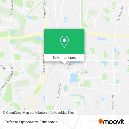
See Trifecta Optometry, Edmonton, on the map
Public Transit to Trifecta Optometry in Edmonton
Wondering how to get to Trifecta Optometry in Edmonton? Moovit helps you find the best way to get to Trifecta Optometry with step-by-step directions from the nearest public transit station.
Moovit provides free maps and live directions to help you navigate through your city. View schedules, routes, timetables, and find out how long does it take to get to Trifecta Optometry in real time.
Looking for the nearest stop or station to Trifecta Optometry? Check out this list of stops closest to your destination: Parsons Road & 10 Avenue SW; Parsons Road & Ellerslie Road SW; Parsons Road & Ellwood Drive SW.
Bus: 518, 519, 521, 664, 665.
Want to see if there’s another route that gets you there at an earlier time? Moovit helps you find alternative routes or times. Get directions from and directions to Trifecta Optometry easily from the Moovit App or Website.
We make riding to Trifecta Optometry easy, which is why over 1.5 million users, including users in Edmonton, trust Moovit as the best app for public transit. You don’t need to download an individual bus app or train app, Moovit is your all-in-one transit app that helps you find the best bus time or train time available.
For information on prices of bus and light rail, costs and ride fares to Trifecta Optometry, please check the Moovit app.
Use the app to navigate to popular places including to the airport, hospital, stadium, grocery store, mall, coffee shop, school, college, and university.
Trifecta Optometry Address: 1031 Parsons Rd SW Edmonton, AB T6X street in Edmonton
- Brew and Bloom,
- Beststart Daycare,
- Papa Murphy's Pizza,
- Makchang Dodook,
- Space Tea,
- G2gents Barbershop,
- Liquor Barrel,
- Mary Brown's Famous Chicken,
- Bg Liquor,
- Alberta Myofunctional Therapy,
- Pacific Coastcomtelus,
- Muscle Mechanics Massage Therapy,
- Ma-Arteh Beauty Studio,
- Jackson Law,
- Funky Petals,
- Oil Country Engineering Service LTD,
- Relax & Rejuvenate Spa,
- Seabird Immigration Consultancy,
- save on foods,
- Origins
Places Near Trifecta Optometry (Edmonton)
- Borden Park, Edmonton,
- Cross Cancer Institute, Edmonton,
- West Edmonton Mall, Edmonton,
- University of Alberta, Edmonton,
- Londonderry Mall, Edmonton,
- MacEwan University, Edmonton,
- Kaye Edmonton Clinic, Edmonton,
- Alberta Legislature Building, Edmonton,
- Canada Place Service Canada Centre, Edmonton,
- Edmonton Commonwealth Stadium, Edmonton,
- Edmonton VIA Rail Station, Edmonton,
- Northgate Centre, Edmonton,
- Edmonton EXPO Centre, Edmonton,
- Royal Alexandra Hospital, Edmonton,
- Rogers Place, Edmonton,
- Fort Edmonton Park, Edmonton,
- Grey Nuns Community Hospital, Edmonton,
- Whyte Avenue, Edmonton,
- Edmonton Valley Zoo, Edmonton,
- Kingsway Mall, Edmonton
How to get to popular places in Edmonton with public transit
Get around Edmonton by public transit!
Traveling around Edmonton has never been so easy. See step by step directions as you travel to any attraction, street or major public transit station. View bus and train schedules, arrival times, service alerts and detailed routes on a map, so you know exactly how to get to anywhere in Edmonton.
When traveling to any destination around Edmonton use Moovit's Live Directions with Get Off Notifications to know exactly where and how far to walk, how long to wait for your line, and how many stops are left. Moovit will alert you when it's time to get off — no need to constantly re-check whether yours is the next stop.
Wondering how to use public transit in Edmonton or how to pay for public transit in Edmonton? Moovit public transit app can help you navigate your way with public transit easily, and at minimum cost. It includes public transit fees, ticket prices, and costs. Looking for a map of Edmonton public transit lines? Moovit public transit app shows all public transit maps in Edmonton with all Bus and Light Rail routes and stops on an interactive map.
Edmonton has 2 transit type(s), including: Bus and Light Rail, operated by several transit agencies, including ETS LRT, ETS, Strathcona County Transit, St. Albert Transit, Spruce Grove Transit, Fort Saskatchewan Transit, Beaumont Transit and Leduc Transit