Directions to Tugatog (Kalookan City) with public transportation
The following transit lines have routes that pass near Tugatog
How to get to Tugatog by bus?
Click on the bus route to see step by step directions with maps, line arrival times and updated time schedules.
Bus stops near Tugatog in Kalookan City
- M H Del Pilar, Malabon City, 3 min walk,
- Samson Road / Buklod Ng Nayon Intersection, Malabon City, 7 min walk,
Bus lines to Tugatog in Kalookan City
- JEEP, Caloocan City Police Station, Samson Road, Malabon City,
- BUS, Pala - pala Dasmarinas Cavite - Navotas Terminal via Edsa,
- BUS, Navotas Terminal Pacita Complex via EDSA,
- BUS, Baclaran Malabon (Letre) via EDSA,
- BUS, Baclaran Navotas via Ayala,
- BUS, Baclaran-Navotas Terminal via Edsa Ayala,
- BUS, Ayala UE Caloocan via EDSA,
- BUS, Alabang Navotas,
- BUS, FTI - Navotas Terminal via EDSA,
- BUS, Pacita Complex (SP, Lag) - Letre via EDSA,
- BUS, Ayala Malabon via EDSA,
- BUS, Alabang Malabon (Letre) via EDSA,
- BUS, Taguig City Navotas,
- JEEP, Monumento - Navotas via Letre,
- JEEP, Malabon - Monumento via Letre,
- JEEP, MONUMENTO-MALABON via LETRE,
What are the closest stations to Tugatog?
The closest stations to Tugatog are:
- M H Del Pilar, Malabon City is 169 meters away, 3 min walk.
- Samson Road / Buklod Ng Nayon Intersection, Malabon City is 519 meters away, 7 min walk.
Which bus lines stop near Tugatog?
These bus lines stop near Tugatog: LTFRB-PUB1126, LTFRB-PUJ2395, LTFRB-PUJ2396.
What’s the nearest bus stop to Tugatog in Kalookan City?
The nearest bus stop to Tugatog in Kalookan City is M H Del Pilar, Malabon City. It’s a 3 min walk away.
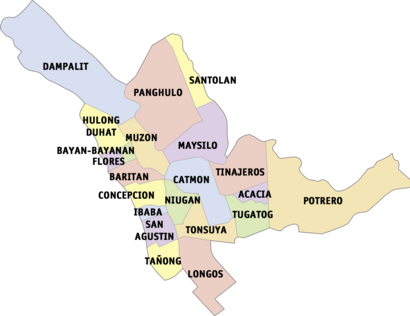
See Tugatog, Kalookan City, on the map
Public Transit to Tugatog in Kalookan City
Wondering how to get to Tugatog in Kalookan City, Philippines? Moovit helps you find the best way to get to Tugatog with step-by-step directions from the nearest public transit station.
Moovit provides free maps and live directions to help you navigate through your city. View schedules, routes, timetables, and find out how long does it take to get to Tugatog in real time.
Looking for the nearest stop or station to Tugatog? Check out this list of stops closest to your destination: M H Del Pilar; Samson Road / Buklod Ng Nayon Intersection.
Bus: LTFRB-PUB1126, LTFRB-PUJ2395, LTFRB-PUJ2396, JEEP, BUS, BUS, BUS, BUS, BUS.
Want to see if there’s another route that gets you there at an earlier time? Moovit helps you find alternative routes or times. Get directions from and directions to Tugatog easily from the Moovit App or Website.
We make riding to Tugatog easy, which is why over 1.5 million users, including users in Kalookan City, trust Moovit as the best app for public transit. You don’t need to download an individual bus app or train app, Moovit is your all-in-one transit app that helps you find the best bus time or train time available.
For information on prices of bus, costs and ride fares to Tugatog, please check the Moovit app.
Use the app to navigate to popular places including to the airport, hospital, stadium, grocery store, mall, coffee shop, school, college, and university.
Tugatog Address: Paz street in Kalookan City
Tugatog is a barangay (or district) of Malabon in Metro Manila in the Philippines.Wiki
Attractions near Tugatog
Malabon City Cemetery,Tugatog Cemetery,Dr. Lacsono,Police Station,Dr. Lascano,19 Aluminio Street,Malabon Municipal Cemetery,Tugatog Barangay Hall,Motolite,smart Choice Laundry,Happy Chaplin,19 Aluminio,Max's Restaurant,Hapchan Restaurant, SM North EDSA,36 MH Del Pilar,Floresco Memorial Services,Jimmigs Refreshments,Robbin's Auto Grooming Centre,42 Marcelo H. Del Pilar Street,M. H. del Pilar / PurezaHow to get to popular attractions in Kalookan City with public transit
CaviteX Las Piñas Toll Barrier, Las Piñas,Newport City,Doña Manuela Subdivision, Las Piñas,College of Tourism and Hospitality Management (CTHM) Building, Dasmariñas,Divisoria, Manila,Fairview, Quezon City,Philippine Airlines Inflight Center, Parañaque,Starbucks Coffee, Bulacan,Fitness First, Manila,Robinsons MovieWorld, Manila,The SM Store,Valenzuela City, Valenzuela,Southwest Integrated Provincial Transport Terminal, Parañaque,Malate, Manila,Petron Service Station, Bulacan,SM Mall of Asia Passenger Terminal,Coastal Road Foot Bridge, Parañaque,LRT 1 (Jose Abad Santos Station), Manila,C5 Waterfun, Taguig,Remington Hotel ManilaGet around Manila by public transit!
Traveling around Manila has never been so easy. See step by step directions as you travel to any attraction, street or major public transit station. View bus and train schedules, arrival times, service alerts and detailed routes on a map, so you know exactly how to get to anywhere in Manila.
When traveling to any destination around Manila use Moovit's Live Directions with Get Off Notifications to know exactly where and how far to walk, how long to wait for your line, and how many stops are left. Moovit will alert you when it's time to get off — no need to constantly re-check whether yours is the next stop.
Wondering how to use public transit in Manila or how to pay for public transit in Manila? Moovit public transit app can help you navigate your way with public transit easily, and at minimum cost. It includes public transit fees, ticket prices, and costs. Looking for a map of Manila public transit lines? Moovit public transit app shows all public transit maps in Manila with all Bus and Train routes and stops on an interactive map.
Manila has 2 transit type(s), including: Bus and Train, operated by several transit agencies, including MRTC, LRTA, PNR, LTFRB, BGC Bus, P2P, UV Express