How to get to Tulcingo Azteca Restaurant Corp. by bus?
Click on the bus route to see step by step directions with maps, line arrival times and updated time schedules.
From E 84th St, Manhattan
36 minFrom Columbia University, Manhattan
54 minFrom Metropolitan Hospital, Manhattan
30 minFrom St. Raymond's Cemetery, Bronx
64 minFrom Central Park - Conservatory Garden, Manhattan
43 minFrom The Met, Manhattan
41 minFrom Apollo Theater, Manhattan
57 minFrom The Metropolitan Museum of Art (Metropolitan Museum of Art), Manhattan
41 minFrom MTA - 81st Street - Museum of Natural History, Manhattan
53 minFrom 125 Worth Street, Manhattan
54 min
How to get to Tulcingo Azteca Restaurant Corp. by train?
Click on the train route to see step by step directions with maps, line arrival times and updated time schedules.
How to get to Tulcingo Azteca Restaurant Corp. by subway?
Click on the subway route to see step by step directions with maps, line arrival times and updated time schedules.
From E 84th St, Manhattan
56 minFrom Columbia University, Manhattan
19 minFrom Metropolitan Hospital, Manhattan
58 minFrom Central Park - Conservatory Garden, Manhattan
40 minFrom The Met, Manhattan
43 minFrom Apollo Theater, Manhattan
27 minFrom The Metropolitan Museum of Art (Metropolitan Museum of Art), Manhattan
43 minFrom MTA - 81st Street - Museum of Natural History, Manhattan
32 minFrom 125 Worth Street, Manhattan
33 min
Bus stops near Tulcingo Azteca Restaurant Corp. in Manhattan
Subway stations near Tulcingo Azteca Restaurant Corp. in Manhattan
Train station near Tulcingo Azteca Restaurant Corp. in Manhattan
- University Heights, 8 min walk,VIEW
Bus lines to Tulcingo Azteca Restaurant Corp. in Manhattan
What are the closest stations to Tulcingo Azteca Restaurant Corp.?
The closest stations to Tulcingo Azteca Restaurant Corp. are:
- 10 Av/W 207 St is 27 yards away, 1 min walk.
- W 207 St/10 Av is 62 yards away, 1 min walk.
- 207 St is 95 yards away, 2 min walk.
- Inwood-207 St is 516 yards away, 7 min walk.
- Broadway/W 207 St is 522 yards away, 7 min walk.
- University Heights is 635 yards away, 8 min walk.
Which bus lines stop near Tulcingo Azteca Restaurant Corp.?
These bus lines stop near Tulcingo Azteca Restaurant Corp.: BX12-SBS, BXM1, M100.
Which train line stops near Tulcingo Azteca Restaurant Corp.?
1 (740#| Grand Central)
Which subway line stops near Tulcingo Azteca Restaurant Corp.?
1 (Uptown & The Bronx)
What’s the nearest subway station to Tulcingo Azteca Restaurant Corp. in Manhattan?
The nearest subway station to Tulcingo Azteca Restaurant Corp. in Manhattan is 207 St. It’s a 2 min walk away.
What’s the nearest train station to Tulcingo Azteca Restaurant Corp. in Manhattan?
The nearest train station to Tulcingo Azteca Restaurant Corp. in Manhattan is University Heights. It’s a 8 min walk away.
What’s the nearest bus station to Tulcingo Azteca Restaurant Corp. in Manhattan?
The nearest bus stations to Tulcingo Azteca Restaurant Corp. in Manhattan are 10 Av/W 207 St and W 207 St/10 Av. The closest one is a 1 min walk away.
What time is the first subway to Tulcingo Azteca Restaurant Corp. in Manhattan?
The 1 is the first subway that goes to Tulcingo Azteca Restaurant Corp. in Manhattan. It stops nearby at 3:01 AM.
What time is the last subway to Tulcingo Azteca Restaurant Corp. in Manhattan?
The A is the last subway that goes to Tulcingo Azteca Restaurant Corp. in Manhattan. It stops nearby at 4:35 AM.
What time is the first train to Tulcingo Azteca Restaurant Corp. in Manhattan?
The 1 is the first train that goes to Tulcingo Azteca Restaurant Corp. in Manhattan. It stops nearby at 5:54 AM.
What time is the last train to Tulcingo Azteca Restaurant Corp. in Manhattan?
The 1 is the last train that goes to Tulcingo Azteca Restaurant Corp. in Manhattan. It stops nearby at 2:11 AM.
What time is the first bus to Tulcingo Azteca Restaurant Corp. in Manhattan?
The BX12 is the first bus that goes to Tulcingo Azteca Restaurant Corp. in Manhattan. It stops nearby at 3:21 AM.
What time is the last bus to Tulcingo Azteca Restaurant Corp. in Manhattan?
The BX12 is the last bus that goes to Tulcingo Azteca Restaurant Corp. in Manhattan. It stops nearby at 3:23 AM.
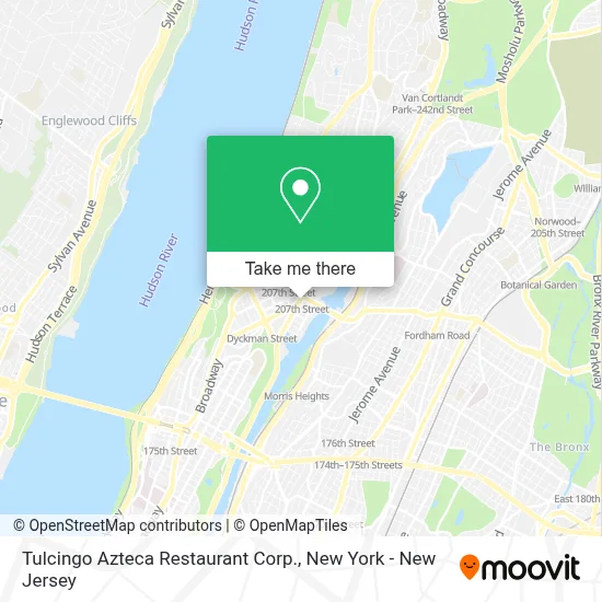
See Tulcingo Azteca Restaurant Corp., Manhattan, on the map
Public Transit to Tulcingo Azteca Restaurant Corp. in Manhattan
Wondering how to get to Tulcingo Azteca Restaurant Corp. in Manhattan? Moovit helps you find the best way to get to Tulcingo Azteca Restaurant Corp. with step-by-step directions from the nearest public transit station.
Moovit provides free maps and live directions to help you navigate through your city. View schedules, routes, timetables, and find out how long does it take to get to Tulcingo Azteca Restaurant Corp. in real time.
Looking for the nearest stop or station to Tulcingo Azteca Restaurant Corp.? Check out this list of stops closest to your destination: 10 Av/W 207 St; W 207 St/10 Av; 207 St; Inwood-207 St; Broadway/W 207 St; University Heights.
Bus: BX12-SBS, BXM1, M100, BX12.Train: 1.Subway: 1, A.
Want to see if there’s another route that gets you there at an earlier time? Moovit helps you find alternative routes or times. Get directions from and directions to Tulcingo Azteca Restaurant Corp. easily from the Moovit App or Website.
We make riding to Tulcingo Azteca Restaurant Corp. easy, which is why over 1.5 million users, including users in Manhattan, trust Moovit as the best app for public transit. You don’t need to download an individual bus app or train app, Moovit is your all-in-one transit app that helps you find the best bus time or train time available.
For information on prices of subway, bus and train, costs and ride fares to Tulcingo Azteca Restaurant Corp., please check the Moovit app.
Use the app to navigate to popular places including to the airport, hospital, stadium, grocery store, mall, coffee shop, school, college, and university.
Tulcingo Azteca Restaurant Corp. Address: 3861 10th Ave street in Manhattan
- Franyi Ztyl Barber Shop,
- Iglesia Nuevos Comienzos,
- La Cocina De Yala,
- Raffy Downtown,
- Floridita,
- Johan Hernandez Tailor,
- The Famous Jimbo's Hamburger Palace,
- Desire Thursdays at Euro El Tina,
- Antillana Supermarket,
- 10th Ave (207th 10th av),
- 10th Ave (w 207th st and 10th av),
- Tina Lounge,
- Clubfix.Net,
- Proservetax,
- Disfruta Juice Bar,
- Global Choice Communication,
- Los Taxi Barbershop 2,
- The Playpen Daycare,
- Bliss Line Spa,
- MTA - 207th Street Yard / Maintenance Facility / Overhaul Shop
Places Near Tulcingo Azteca Restaurant Corp. (Manhattan)
- Hudson Yards, Manhattan,
- 26 Federal Plaza, Manhattan,
- qqqq, Manhattan,
- 111 Centre New York City Supreme Court, Manhattan,
- 66 John Street, Manhattan,
- Chinatown, Manhattan,
- 1 Police Plaza, Manhattan,
- Wall Street, Manhattan,
- 3 Stone St, Manhattan,
- Rockefeller Center, Manhattan,
- Bellevue Hospital, Manhattan,
- Pier 83, Manhattan,
- Queens Center Mall, Queens,
- 376 Hudson Street, Manhattan,
- Mountainside Hospital, Glen Ridge,
- SoHo, Manhattan,
- Times Square, Manhattan,
- San Gennaro Feast, Manhattan,
- 911 Memorial, Manhattan,
- Katz's Deli, Manhattan
How to get to popular places in New York - New Jersey with public transit
Get around Manhattan by public transit!
Traveling around Manhattan has never been so easy. See step by step directions as you travel to any attraction, street or major public transit station. View bus and train schedules, arrival times, service alerts and detailed routes on a map, so you know exactly how to get to anywhere in Manhattan.
When traveling to any destination around Manhattan use Moovit's Live Directions with Get Off Notifications to know exactly where and how far to walk, how long to wait for your line, and how many stops are left. Moovit will alert you when it's time to get off — no need to constantly re-check whether yours is the next stop.
Wondering how to use public transit in Manhattan or how to pay for public transit in Manhattan? Moovit public transit app can help you navigate your way with public transit easily, and at minimum cost. It includes public transit fees, ticket prices, and costs. Looking for a map of Manhattan public transit lines? Moovit public transit app shows all public transit maps in Manhattan with all Bus, Train, Subway, Light Rail, Ferry and Cable Car routes and stops on an interactive map.
New York - New Jersey has 6 transit type(s), including: Bus, Train, Subway, Light Rail, Ferry and Cable Car, operated by several transit agencies, including MTA Subway, Metro-North Railroad, LIRR, PATH, MTA New York City Transit - Express routes, MTA Bus, NJ Transit, NYC Ferry, NICE bus, Bee-Line Bus, NJ Transit Rail, Norwalk Transit District, Hartford Line, River Valley Transit and HART