Directions to Tunjuelito with public transportation
The following transit lines have routes that pass near Tunjuelito
How to get to Tunjuelito by SITP?
Click on the SITP route to see step by step directions with maps, line arrival times and updated time schedules.
Sitp stations near Tunjuelito
- Br. Verona (Av. V/cio - Kr 48) (A), 2 min walk,
- Br. Candelaria La Nueva (Av. V/cio - Kr 45a) (A), 4 min walk,
- Br. Arborizadora Baja (Av. V/cio - Kr 44a) (B), 5 min walk,
Sitp lines to Tunjuelito
- P39, Zona Franca,
- P44, Bosa Santa Fe,
- 6-1, Candelaria,
- 143, Germania,
- K318, Fontibón Brisas,
- K327, Puente Grande,
- G521, San Bernardino,
- G530, Metrovivienda,
- H602, Galicia,
- D607, Morato,
- H613, Perdomo,
- F615, Estación Biblioteca Tintal,
- H620, La Estancia,
- K627, Salitre,
- G712, Bosa La Estación,
- SE14, Diana Turbay Cultivos,
- 271, Lomas,
- H318, El Uval,
- H327, Acacias,
- H521, Usme - Chiguaza,
What are the closest stations to Tunjuelito?
The closest stations to Tunjuelito are:
- Br. Verona (Av. V/cio - Kr 48) (A) is 109 meters away, 2 min walk.
- Br. Candelaria La Nueva (Av. V/cio - Kr 45a) (A) is 241 meters away, 4 min walk.
- Br. Arborizadora Baja (Av. V/cio - Kr 44a) (B) is 302 meters away, 5 min walk.
Which SITP lines stop near Tunjuelito?
These SITP lines stop near Tunjuelito: 148, 6-1, 703, C13, C27, P39.
What’s the nearest SITP stop to Tunjuelito?
The nearest SITP stop to Tunjuelito is Br. Verona (Av. V/cio - Kr 48) (A). It’s a 2 min walk away.
See Tunjuelito on the map
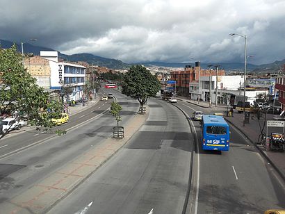
Public Transportation to Tunjuelito
Wondering how to get to Tunjuelito, Colombia? Moovit helps you find the best way to get to Tunjuelito with step-by-step directions from the nearest public transit station.
Moovit provides free maps and live directions to help you navigate through your city. View schedules, routes, timetables, and find out how long does it take to get to Tunjuelito in real time.
Looking for the nearest stop or station to Tunjuelito? Check out this list of stops closest to your destination: Br. Verona (Av. V/cio - Kr 48) (A); Br. Candelaria La Nueva (Av. V/cio - Kr 45a) (A); Br. Arborizadora Baja (Av. V/cio - Kr 44a) (B).
SITP: 148, 6-1, 703, C13, C27, P39, P44, 143, K318, SE14, 271, H318, H327, H521, SE14, 6-3, 271, A605, B609.
Want to see if there’s another route that gets you there at an earlier time? Moovit helps you find alternative routes or times. Get directions from and directions to Tunjuelito easily from the Moovit App or Website.
We make riding to Tunjuelito easy, which is why over 1.5 million users, including users in Tunjuelito, trust Moovit as the best app for public transit. You don’t need to download an individual bus app or train app, Moovit is your all-in-one transit app that helps you find the best bus time or train time available.
For information on prices of SITP and Transmilenio, costs and ride fares to Tunjuelito, please check the Moovit app.
Use the app to navigate to popular places including to the airport, hospital, stadium, grocery store, mall, coffee shop, school, college, and university.
Tunjuelito Address: Avenida Villavicencio calle 68 # 47 - 10 sur, Bogotá, Colombia street in Tunjuelito
Attractions near Tunjuelito
Club de Excursiones,Calle 60a Sur #47-16,Candelaria La Nueva,Centro Comercial Candelaria La Nueva,Avenida Calle 68 S / Avenida Calle 68 Sur 46A,Carrera 47 60A S / Avenida Calle 68 Sur 46A,Calle 68 Sur 46a25,Calle 68 47,Billares Mixtos La Caponera,Avenida Calle 68 Sur 47a10,UNIMINUTO Bogotá Sur,El Tiempo de Su Gloria,77bis no,Divertronic,Diagonal 62 Sur # Calle 61 S,Ferreterias-Ferretería La Esmeralda,Carrera 48 # Calle 61 S,15 Carrera 48 68 S,Carrera 46 59c Sur59,Avenida Calle 68 Sur 46 / Calle 68 Sur 45CHow to get to popular attractions in Tunjuelito with public transit
Centro Comercial Cedritos, Usaquén,Universidad De San Buenaventura, Usaquén,Torre Empresarial Arturo Calle, Suba,Cafam, Barrios Unidos,Parque Metropolitano Simón Bolívar, Teusaquillo,Calle 93 # Carrera 15, Chapinero,Éxito Chapinero, Chapinero,Plaza Imperial, Suba,Universidad Distrital Sede Macarena A, Santa Fe,Calle 85 # Carrera 15, Chapinero,Clínica De Occidente, Kennedy,Parque Publico San Jose De Bavaria, Suba,Centro Comercial Parque La Colina, Suba,Metrópolis, Engativá,Carrera 7a # Avenida Callejas - Calle 127, Usaquén,Tintal Plaza, Kennedy,Calle 94 # Carrera 15, Chapinero,Universidad Pedagógica Nacional, Chapinero,Aeropuerto El Dorado # Aeropuerto El Dorardo, Engativá,Clínica Reina Sofia, UsaquénGet around Bogota by public transit!
Traveling around Bogota has never been so easy. See step by step directions as you travel to any attraction, street or major public transit station. View bus and train schedules, arrival times, service alerts and detailed routes on a map, so you know exactly how to get to anywhere in Bogota.
When traveling to any destination around Bogota use Moovit's Live Directions with Get Off Notifications to know exactly where and how far to walk, how long to wait for your line, and how many stops are left. Moovit will alert you when it's time to get off — no need to constantly re-check whether yours is the next stop.
Wondering how to use public transit in Bogota or how to pay for public transit in Bogota? Moovit public transit app can help you navigate your way with public transit easily, and at minimum cost. It includes public transit fees, ticket prices, and costs. Looking for a map of Bogota public transit lines? Moovit public transit app shows all public transit maps in Bogota with all SITP, Transmilenio and Funicular routes and stops on an interactive map.
Bogota has 3 transit type(s), including: SITP, Transmilenio and Funicular, operated by several transit agencies, including Buses Troncales, Buses Alimentadores, Buses Urbanos, Buses Complementarios, Buses Especiales, TransMiCable, Cerro de Monserrate, Aeropuerto El Dorado, Flota Chia LTDA, Auto Servicio Chía LTDA, Politécnico Grancolombiano