Tustin Metrolink Station station - Tuesday schedule
| Line | Direction | Time |
|---|---|---|
| IE-OC LINE | #801| Laguna Niguel / Mission Viejo | 5:15 AM |
| OC LINE | #601| L.A. Union Station | 5:20 AM |
| IE-OC LINE | #803| Oceanside | 6:15 AM |
| OC LINE | #603| L.A. Union Station | 6:20 AM |
| OC LINE | #602| Laguna Niguel / Mission Viejo | 6:41 AM |
| IE-OC LINE | #800| Riverside - Downtown | 6:45 AM |
| IE-OC LINE | #805| Laguna Niguel / Mission Viejo | 7:15 AM |
| OC LINE | #605| L.A. Union Station | 7:20 AM |
| OC LINE | #604| Laguna Niguel / Mission Viejo | 7:41 AM |
| IE-OC LINE | #807| Laguna Niguel / Mission Viejo | 8:15 AM |
| OC LINE | #607| L.A. Union Station | 8:20 AM |
| OC LINE | #606| Laguna Niguel / Mission Viejo | 8:41 AM |
| IE-OC LINE | #804| Riverside - Downtown | 8:45 AM |
| OC LINE | #609| L.A. Union Station | 9:20 AM |
| OC LINE | #608| Oceanside | 9:41 AM |
| IE-OC LINE | #811| Laguna Niguel / Mission Viejo | 10:15 AM |
| OC LINE | #611| L.A. Union Station | 10:20 AM |
| IE-OC LINE | #808| Riverside - Downtown | 10:45 AM |
| OC LINE | #612| Laguna Niguel / Mission Viejo | 11:41 AM |
| IE-OC LINE | #815| Laguna Niguel / Mission Viejo | 12:15 PM |
| IE-OC LINE | #812| Riverside - Downtown | 12:45 PM |
| OC LINE | #617| L.A. Union Station | 1:20 PM |
| OC LINE | #616| Laguna Niguel / Mission Viejo | 1:41 PM |
| IE-OC LINE | #819| Laguna Niguel / Mission Viejo | 2:15 PM |
| OC LINE | #618| Oceanside | 2:25 PM |
Directions to Tustin Metrolink Station with public transportation
The following transit lines have routes that pass near Tustin Metrolink Station
How to get to Tustin Metrolink Station by bus?
Click on the bus route to see step by step directions with maps, line arrival times and updated time schedules.
How to get to Tustin Metrolink Station by train?
Click on the train route to see step by step directions with maps, line arrival times and updated time schedules.
Bus stops near Tustin Metrolink Station
- Tustin Metrolink Station-Dock 3, 1 min walk,
- Tustin Metrolink Station-Dock 4, 1 min walk,
- Tustin Metrolink Station-Dock 6, 1 min walk,
- Tustin Metrolink Station-Dock 2, 1 min walk,
- Tustin Metrolink Station-Dock 1, 1 min walk,
- Tustin Metrolink Station-Dock 5, 1 min walk,
- Tustin Metrolink Station-Dock 8, 1 min walk,
- Walnut-Myford, 11 min walk,
Bus lines to Tustin Metrolink Station
- 72, Tustin Metrolink Station,
- 472, Tustin Metrolink Station,
- 70, Fountain Valley - Lilac and Harbor,
- 401, Tustin Metrolink Station,
- 400, Tustin Metrolink Station,
- 473, UC Irvine,
- 90, Dana Point Harbor,
- 66, Golden West Transp Center,
What are the closest stations to Tustin Metrolink Station?
The closest stations to Tustin Metrolink Station are:
- Tustin Metrolink Station-Dock 3 is 4 yards away, 1 min walk.
- Tustin Metrolink Station-Dock 4 is 14 yards away, 1 min walk.
- Tustin Metrolink Station-Dock 6 is 19 yards away, 1 min walk.
- Tustin Metrolink Station-Dock 2 is 23 yards away, 1 min walk.
- Tustin Metrolink Station-Dock 1 is 32 yards away, 1 min walk.
- Tustin Metrolink Station-Dock 5 is 34 yards away, 1 min walk.
- Tustin Metrolink Station-Dock 8 is 69 yards away, 1 min walk.
- Walnut-Myford is 855 yards away, 11 min walk.
Which bus lines stop near Tustin Metrolink Station?
These bus lines stop near Tustin Metrolink Station: 400, 70, 72, 90.
Which train lines stop near Tustin Metrolink Station?
These train lines stop near Tustin Metrolink Station: INLAND EMPIRE - ORANGE COUNTY LINE, ORANGE COUNTY LINE.
What’s the nearest bus stop to Tustin Metrolink Station?
The nearest bus stops to Tustin Metrolink Station are Tustin Metrolink Station-Dock 3, Tustin Metrolink Station-Dock 4, Tustin Metrolink Station-Dock 6, Tustin Metrolink Station-Dock 2, Tustin Metrolink Station-Dock 1, Tustin Metrolink Station-Dock 5 and Tustin Metrolink Station-Dock 8. The closest one is a 1 min walk away.
What time is the first bus to Tustin Metrolink Station?
The 70 is the first bus that goes to Tustin Metrolink Station. It stops nearby at 4:06 AM.
What time is the last bus to Tustin Metrolink Station?
The 70 is the last bus that goes to Tustin Metrolink Station. It stops nearby at 1:02 AM.
See Tustin Metrolink Station on the map
Public transit to Tustin Metrolink Station station
Looking for directions to Tustin Metrolink Station in Tustin, United States?
Download the Moovit App to find the current schedule and step-by-step directions for Bus or Train routes that pass through Tustin Metrolink Station.
Looking for the nearest stops closest to Tustin Metrolink Station ? Check out this list of closest stops to your destination: Tustin Metrolink Station-Dock 3; Tustin Metrolink Station-Dock 4; Tustin Metrolink Station-Dock 6; Tustin Metrolink Station-Dock 2; Tustin Metrolink Station-Dock 1; Tustin Metrolink Station-Dock 5; Tustin Metrolink Station-Dock 8; Walnut-Myford.
Bus: 400, 70, 72, 90, 472, 401, 473.Train: INLAND EMPIRE - ORANGE COUNTY LINE, ORANGE COUNTY LINE.
We make riding on public transit to Tustin Metrolink Station easy, which is why over 1.5 million users, including users in Tustin trust Moovit as the best app for public transit.
Use the app to navigate to popular places including to the airport, hospital, stadium, grocery store, mall, coffee shop, school, college, and university.
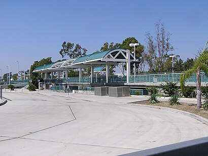
The station has the following entrances: Road Entrance and Parking Lot Entrance
The first line to this station is IE-OC LINE, at 5:15 AM, and the last line is OC LINE at 10:41 PM.
2975 Edinger Avenue, Tustin, CA, USA
This station serves Metrolink Trains’s lines
Bus stops near Tustin Metrolink Station
Popular public transit stations in Tustin
Get around Tustin by public transit!
Traveling around Tustin has never been so easy. See step by step directions as you travel to any attraction, street or major public transit station. View bus and train schedules, arrival times, service alerts and detailed routes on a map, so you know exactly how to get to anywhere in Tustin.
When traveling to any destination around Tustin use Moovit's Live Directions with Get Off Notifications to know exactly where and how far to walk, how long to wait for your line, and how many stops are left. Moovit will alert you when it's time to get off — no need to constantly re-check whether yours is the next stop.
Wondering how to use public transit in Tustin or how to pay for public transit in Tustin? Moovit public transit app can help you navigate your way with public transit easily, and at minimum cost. It includes public transit fees, ticket prices, and costs. Looking for a map of Tustin public transit lines? Moovit public transit app shows all public transit maps in Tustin with all Bus, Train, Subway, Light Rail, Ferry and Funicular routes and stops on an interactive map.
Los Angeles has 6 transit type(s), including: Bus, Train, Subway, Light Rail, Ferry and Funicular, operated by several transit agencies, including METRO, OCTA, Metrolink Trains, Big Blue Bus, LAX FlyAway, PVPTA, Burbank Bus, Laguna Beach Transit, Thousand Oaks Transit, Amtrak, OMNITRANS, Foothill Transit, Culver City Bus, Glendale Beeline and Long Beach Transit