Directions to Tyler Park Historic District (Lowell) with public transportation
The following transit lines have routes that pass near Tyler Park Historic District
How to get to Tyler Park Historic District by bus?
Click on the bus route to see step by step directions with maps, line arrival times and updated time schedules.
How to get to Tyler Park Historic District by train?
Click on the train route to see step by step directions with maps, line arrival times and updated time schedules.
Bus stations near Tyler Park Historic District in Lowell
- Westford St & Tyler Park, 1 min walk,
Bus lines to Tyler Park Historic District in Lowell
- 5, Kennedy Center,
What are the closest stations to Tyler Park Historic District?
The closest stations to Tyler Park Historic District are:
- Westford St & Tyler Park is 38 yards away, 1 min walk.
Which bus line stops near Tyler Park Historic District?
5
Which train line stops near Tyler Park Historic District?
LOWELL LINE
What’s the nearest bus stop to Tyler Park Historic District in Lowell?
The nearest bus stop to Tyler Park Historic District in Lowell is Westford St & Tyler Park. It’s a 1 min walk away.
See Tyler Park Historic District, Lowell, on the map
Public Transit to Tyler Park Historic District in Lowell
Wondering how to get to Tyler Park Historic District in Lowell, United States? Moovit helps you find the best way to get to Tyler Park Historic District with step-by-step directions from the nearest public transit station.
Moovit provides free maps and live directions to help you navigate through your city. View schedules, routes, timetables, and find out how long does it take to get to Tyler Park Historic District in real time.
Looking for the nearest stop or station to Tyler Park Historic District? Check out this list of stops closest to your destination: Westford St & Tyler Park.
Bus: 5.Train: LOWELL LINE.
Want to see if there’s another route that gets you there at an earlier time? Moovit helps you find alternative routes or times. Get directions from and directions to Tyler Park Historic District easily from the Moovit App or Website.
We make riding to Tyler Park Historic District easy, which is why over 1.5 million users, including users in Lowell, trust Moovit as the best app for public transit. You don’t need to download an individual bus app or train app, Moovit is your all-in-one transit app that helps you find the best bus time or train time available.
For information on prices of bus and train, costs and ride fares to Tyler Park Historic District, please check the Moovit app.
Use the app to navigate to popular places including to the airport, hospital, stadium, grocery store, mall, coffee shop, school, college, and university.
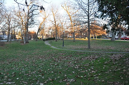
Tyler Park Historic District Address: Tyler Park street in Lowell
Attractions near Tyler Park Historic District
Tyler Park,Skala Realty Inc,Tyler Park,Martha O'Brien Interiors,Westford St & Rutland St,Buchanan Construction,Jehovah's Witnesses,14 Holden St,01851,30 Holden Street,10 Sanders Ave,345 Princeton Blvd,American Legion,Macdonald Enterprises,264 Princeton Blvd,264 Princeton Boulevard,115 Georgia Ave,42 Lincoln Pkwy,43 Staples St,26 Monadnock AveHow to get to popular attractions in Lowell with public transit
North Quincy Station, Quincy,111 Huntington Ave, Boston,Tremont St, Boston,Registry of Motor Vehicles Haymarket (Boston), Boston,Hilton-Boston Downtown Faneuil Hall (Hilton Boston / Financial District), Boston,braintree mall,Littleton/Route 495,Hyatt Regency-Boston Harbor (Hyatt Harborside At Boston's Logan International Airport Hotel Boston), Boston,Boston Common, Boston,Massachusetts General Hospital, Waltham,200 Atlantic Avenue, Boston,Brookline, MA, Brookline,Eataly, Boston,Revere, MA, Revere,West Roxbury VA Medical Center, Boston,I-90 Mass Pike, Exit 17, Newton,Hopkinton, MA, Hopkinton,Tufts Medical Center MBTA Station - Orange & Silver Line, Boston,Natick Mall,St. Elizabeth's, BostonGet around Boston by public transit!
Traveling around Boston has never been so easy. See step by step directions as you travel to any attraction, street or major public transit station. View bus and train schedules, arrival times, service alerts and detailed routes on a map, so you know exactly how to get to anywhere in Boston.
When traveling to any destination around Boston use Moovit's Live Directions with Get Off Notifications to know exactly where and how far to walk, how long to wait for your line, and how many stops are left. Moovit will alert you when it's time to get off — no need to constantly re-check whether yours is the next stop.
Wondering how to use public transit in Boston or how to pay for public transit in Boston? Moovit public transit app can help you navigate your way with public transit easily, and at minimum cost. It includes public transit fees, ticket prices, and costs. Looking for a map of Boston public transit lines? Moovit public transit app shows all public transit maps in Boston with all Bus, Train, Subway and Ferry routes and stops on an interactive map.
Boston has 4 transit type(s), including: Bus, Train, Subway and Ferry, operated by several transit agencies, including MBTA, Southeastern Regional Transit Authority, MetroWest Regional Transit Authority, Rhode Island Public Transit Authority, WRTA, Lowell Regional Transit Authority, Merrimack Valley Transit, Montachusett Regional Transit Authority, Cape Cod Regional Transit Authority, Brockton Area Transit Authority, Martha's Vineyard Transit Authority, the WAVE - Nantucket Regional Transit Authority, GATRA, Cape Ann Transportation Authority, Massport