Tyler Vernon Station stop - Sunday schedule
| Line | Direction | Time |
|---|---|---|
| 219 | South - Tyler/Vernon Station | 5:00 AM |
| 219 | South - Tyler/Vernon Station | 5:30 AM |
| 219 | North - SW Med Dist/Parkland Station | 5:36 AM |
| 226 | West - Cockrell Hill Transfer Location | 5:40 AM |
| 226 | East - 8th & Corinth Station | 6:03 AM |
| 219 | South - Tyler/Vernon Station | 6:30 AM |
| 219 | North - SW Med Dist/Parkland Station | 6:36 AM |
| 226 | West - Cockrell Hill Transfer Location | 6:40 AM |
| 226 | East - 8th & Corinth Station | 7:04 AM |
| 219 | South - Tyler/Vernon Station | 7:31 AM |
| 219 | North - SW Med Dist/Parkland Station | 7:36 AM |
| 226 | West - Cockrell Hill Transfer Location | 7:41 AM |
| 226 | East - 8th & Corinth Station | 8:04 AM |
| 219 | South - Tyler/Vernon Station | 8:31 AM |
| 219 | North - SW Med Dist/Parkland Station | 8:36 AM |
| 226 | West - Cockrell Hill Transfer Location | 8:41 AM |
| 226 | East - 8th & Corinth Station | 9:04 AM |
| 219 | South - Tyler/Vernon Station | 9:31 AM |
| 219 | North - SW Med Dist/Parkland Station | 9:36 AM |
| 226 | West - Cockrell Hill Transfer Location | 9:41 AM |
| 226 | East - 8th & Corinth Station | 10:04 AM |
| 219 | South - Tyler/Vernon Station | 10:31 AM |
| 219 | North - SW Med Dist/Parkland Station | 10:36 AM |
| 226 | West - Cockrell Hill Transfer Location | 10:41 AM |
| 226 | East - 8th & Corinth Station | 11:04 AM |
Directions to Tyler Vernon Station (Dallas) with public transportation
The following transit lines have routes that pass near Tyler Vernon Station
How to get to Tyler Vernon Station by bus?
Click on the bus route to see step by step directions with maps, line arrival times and updated time schedules.
Bus stops near Tyler Vernon Station in Dallas
- Tyler @ Lebanon - S - Ns, 1 min walk,
- Polk @ Nolte - S - FS, 3 min walk,
Cable Car station near Tyler Vernon Station in Dallas
- Bishop Arts Station, 14 min walk,
Light Rail stations near Tyler Vernon Station in Dallas
- Hampton Station, 19 min walk,
Bus lines to Tyler Vernon Station in Dallas
- 47, South - Wheatland,
- 219, South - Tyler/Vernon Station,
- 226, East - 8th & Corinth Station,
What are the closest stations to Tyler Vernon Station?
The closest stations to Tyler Vernon Station are:
- Tyler @ Lebanon - S - Ns is 51 yards away, 1 min walk.
- Polk @ Nolte - S - FS is 215 yards away, 3 min walk.
- Bishop Arts Station is 1158 yards away, 14 min walk.
- Hampton Station is 1593 yards away, 19 min walk.
Which bus lines stop near Tyler Vernon Station?
These bus lines stop near Tyler Vernon Station: 219, 226, 47.
Which light rail line stops near Tyler Vernon Station?
RED
What’s the nearest light rail station to Tyler Vernon Station in Dallas?
The nearest light rail station to Tyler Vernon Station in Dallas is Hampton Station. It’s a 19 min walk away.
What’s the nearest bus station to Tyler Vernon Station in Dallas?
The nearest bus station to Tyler Vernon Station in Dallas is Tyler @ Lebanon - S - Ns. It’s a 1 min walk away.
What’s the nearest cable car station to Tyler Vernon Station in Dallas?
The nearest cable car station to Tyler Vernon Station in Dallas is Bishop Arts Station. It’s a 14 min walk away.
What time is the first light rail to Tyler Vernon Station in Dallas?
The RED is the first light rail that goes to Tyler Vernon Station in Dallas. It stops nearby at 4:13 AM.
What time is the last light rail to Tyler Vernon Station in Dallas?
The RED is the last light rail that goes to Tyler Vernon Station in Dallas. It stops nearby at 12:58 AM.
What time is the first bus to Tyler Vernon Station in Dallas?
The 226 is the first bus that goes to Tyler Vernon Station in Dallas. It stops nearby at 4:33 AM.
What time is the last bus to Tyler Vernon Station in Dallas?
The 219 is the last bus that goes to Tyler Vernon Station in Dallas. It stops nearby at 1:07 AM.
What time is the first cable car to Tyler Vernon Station in Dallas?
The 620 is the first cable car that goes to Tyler Vernon Station in Dallas. It stops nearby at 5:40 AM.
What time is the last cable car to Tyler Vernon Station in Dallas?
The 620 is the last cable car that goes to Tyler Vernon Station in Dallas. It stops nearby at 11:49 PM.
How much is the bus fare to Tyler Vernon Station?
The bus fare to Tyler Vernon Station costs about $2.00.
How much is the tram fare to Tyler Vernon Station?
The tram fare to Tyler Vernon Station costs about $2.00 - $3.00.
See Tyler Vernon Station, Dallas, on the map
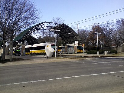
Public transit to Tyler Vernon Station stop (ID: 33265) in Dallas
Looking for directions to Tyler Vernon Station in Dallas, United States?
Download the Moovit App to find the current schedule and step-by-step directions for Bus or Light Rail routes that pass through Tyler Vernon Station.
Looking for the nearest stops closest to Tyler Vernon Station ? Check out this list of closest stops to your destination: Tyler @ Lebanon - S - Ns; Polk @ Nolte - S - FS; Bishop Arts Station; Hampton Station.
Bus: 219, 226, 47.Light Rail: RED.Cable Car: 620.
We make riding on public transit to Tyler Vernon Station easy, which is why over 1.5 million users, including users in Dallas trust Moovit as the best app for public transit.
Use the app to navigate to popular places including to the airport, hospital, stadium, grocery store, mall, coffee shop, school, college, and university.
Tyler Vernon Station stop’s code is 33265
The first line to this stop is 219, at 5:00 AM, and the last line is 226 at 4:35 AM.
1215 S Tyler St, Dallas, TX, USA
This stop serves DART’s lines
Popular routes from Tyler Vernon Station, Dallas
Cable Car station near Tyler Vernon Station
Light Rail station near Tyler Vernon Station
Popular public transit stations in Dallas
Get around Dallas by public transit!
Traveling around Dallas has never been so easy. See step by step directions as you travel to any attraction, street or major public transit station. View bus and train schedules, arrival times, service alerts and detailed routes on a map, so you know exactly how to get to anywhere in Dallas.
When traveling to any destination around Dallas use Moovit's Live Directions with Get Off Notifications to know exactly where and how far to walk, how long to wait for your line, and how many stops are left. Moovit will alert you when it's time to get off — no need to constantly re-check whether yours is the next stop.
Wondering how to use public transit in Dallas or how to pay for public transit in Dallas? Moovit public transit app can help you navigate your way with public transit easily, and at minimum cost. It includes public transit fees, ticket prices, and costs. Looking for a map of Dallas public transit lines? Moovit public transit app shows all public transit maps in Dallas with all Bus, Train, Light Rail and Cable Car routes and stops on an interactive map.
Dallas - Fort Worth, TX has 4 transit type(s), including: Bus, Train, Light Rail and Cable Car, operated by several transit agencies, including DART Light Rail, DART Commuter Rail, Trinity Metro, DART, Denton County Transportation Authority, DART Streetcar, Amtrak, STAR Transit, DFW Transportation Services, FlixBus-us and Greyhound-us