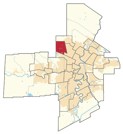
See Tyndall Park, Winnipeg, on the map
Directions to Tyndall Park (Winnipeg) with public transportation
The following transit lines have routes that pass near Tyndall Park
 Bus:
Bus:
How to get to Tyndall Park by bus?
Click on the bus route to see step by step directions with maps, line arrival times and updated time schedules.
Bus stations near Tyndall Park in Winnipeg
- Westbound Burrows at King Edward,2 min walk,
- Southbound King Edward at Burrows,2 min walk,
- Southbound Dexter at Ostafiew Farm,7 min walk,
Bus lines to Tyndall Park in Winnipeg
- 16,Selkirk & Mcphillips,
- 31,Meadows West,
- 77,Kildonan Place,
What are the closest stations to Tyndall Park?
The closest stations to Tyndall Park are:
- Westbound Burrows at King Edward is 71 meters away, 2 min walk.
- Southbound King Edward at Burrows is 106 meters away, 2 min walk.
- Southbound Dexter at Ostafiew Farm is 465 meters away, 7 min walk.
Which bus lines stop near Tyndall Park?
These bus lines stop near Tyndall Park: 16, 77.
What’s the nearest bus stop to Tyndall Park in Winnipeg?
The nearest bus stops to Tyndall Park in Winnipeg are Westbound Burrows at King Edward and Southbound King Edward at Burrows. The closest one is a 2 min walk away.
What time is the first bus to Tyndall Park in Winnipeg?
The 16 is the first bus that goes to Tyndall Park in Winnipeg. It stops nearby at 5:32 AM.
What time is the last bus to Tyndall Park in Winnipeg?
The 16 is the last bus that goes to Tyndall Park in Winnipeg. It stops nearby at 1:43 AM.
How much is the bus fare to Tyndall Park?
The bus fare to Tyndall Park costs about $3.25.
See Tyndall Park, Winnipeg, on the map
Public Transit to Tyndall Park in Winnipeg
Wondering how to get to Tyndall Park in Winnipeg, Canada? Moovit helps you find the best way to get to Tyndall Park with step-by-step directions from the nearest public transit station.
Moovit provides free maps and live directions to help you navigate through your city. View schedules, routes, timetables, and find out how long does it take to get to Tyndall Park in real time.
Looking for the nearest stop or station to Tyndall Park? Check out this list of stops closest to your destination: Westbound Burrows at King Edward; Southbound King Edward at Burrows; Southbound Dexter at Ostafiew Farm.
Bus:
Want to see if there’s another route that gets you there at an earlier time? Moovit helps you find alternative routes or times. Get directions from and directions to Tyndall Park easily from the Moovit App or Website.
We make riding to Tyndall Park easy, which is why over 1.5 million users, including users in Winnipeg, trust Moovit as the best app for public transit. You don’t need to download an individual bus app or train app, Moovit is your all-in-one transit app that helps you find the best bus time or train time available.
For information on prices of bus, costs and ride fares to Tyndall Park, please check the Moovit app.
Use the app to navigate to popular places including to the airport, hospital, stadium, grocery store, mall, coffee shop, school, college, and university.
Tyndall Park Address: Burrows Avenue street in Winnipeg
Attractions near Tyndall Park
Garden Grove Park,Tyndall Park Community School,MBS Barbershop,Winnserv Inc,Eastbound Kinver at King Edward,Asessippi Ski Area & Resort,Wiebe MP Environmental Engineering,Wiebe MP Environmental Engineering,A N D Contracting,Basement Renovations Winnipeg,Pal Mobile Wash,Garden Grove School,Santos Carpet Cleaning,Sheryll Zamora - TD Financial Planner,Gain Therapeutic Massage Clinic,Marlin Travel,Ranger Roofing,Manitoba Liquor Mart,Happy Joe's Lottery,Shobhit Shukla - TD Financial PlannerHow to get to popular attractions in Winnipeg with public transit
Calvary Place Personal Care Home, Winnipeg,River Park South, Winnipeg,Helen Betty Osborne Building, Winnipeg,Amre Supply, Winnipeg,Island Lakes, Winnipeg,Westboine Park Housing Co-Op, Winnipeg,Adonis Men's Spa, Winnipeg,Dominion Centre, Winnipeg,Winnipeg Art Gallery, Winnipeg,Bell MTS Centre, Winnipeg,Health Sciences Centre, Winnipeg,Arthur V. Mauro Student Residence, Winnipeg,Osborne Station, Winnipeg,South Pointe, Winnipeg,Syds Carousel, Winnipeg,Winnipeg (The Forks), Winnipeg,Building 129 (17 Wing), Winnipeg,East st Paul CC, Winnipeg,All About Cakes Pastry Shop, Winnipeg,Charleswood Parkway, WinnipegGet around Winnipeg by public transit!
Traveling around Winnipeg has never been so easy. See step by step directions as you travel to any attraction, street or major public transit station. View bus and train schedules, arrival times, service alerts and detailed routes on a map, so you know exactly how to get to anywhere in Winnipeg.
When traveling to any destination around Winnipeg use Moovit's Live Directions with Get Off Notifications to know exactly where and how far to walk, how long to wait for your line, and how many stops are left. Moovit will alert you when it's time to get off — no need to constantly re-check whether yours is the next stop.
Wondering how to use public transit in Winnipeg or how to pay for public transit in Winnipeg? Moovit public transit app can help you navigate your way with public transit easily, and at minimum cost. It includes public transit fees, ticket prices, and costs. Looking for a map of Winnipeg public transit lines? Moovit public transit app shows all public transit maps in Winnipeg with all bus routes and stops on an interactive map.
Winnipeg has 1 transit type(s), including: bus, operated by several transit agencies, including Winnipeg Transit