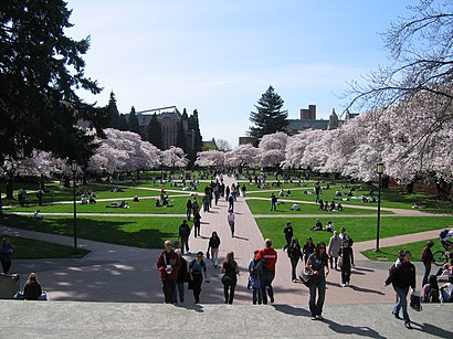
See UW Quad, Seattle, on the map
Directions to UW Quad (Seattle) with public transportation
The following transit lines have routes that pass near UW Quad
 Bus:
Bus: - Light Rail:
How to get to UW Quad by bus?
Click on the bus route to see step by step directions with maps, line arrival times and updated time schedules.
Bus stations near UW Quad in Seattle
- Stevens Way & Pend Oreille Rd,4 min walk,
- E Stevens Wy NE & Pend Oreille Rd NE,4 min walk,
- 15th Ave NE & NE 42nd St,6 min walk,
- 15th Ave NE & NE Campus Pkwy,7 min walk,
- NE 45th St & 19th Ave NE,7 min walk,
- University Way NE & NE 41st St,8 min walk,
Light Rail stations near UW Quad in Seattle
- South Lake Union Streetcar & Terry Ave N,18 min walk,
- Roosevelt Station,32 min walk,
Bus lines to UW Quad in Seattle
- 75,Northgate Station Sand Point,
- 372,UW Bothell/Cascadia College Kenmore,
- 45,Loyal Heights Greenwood,
- 67,Northgate Station Roosevelt Station,
- 20,Lake City Green Lake,
- 44,University of Washington Medical Center Wallingford,
- 48,University District Central District,
- 49,To Route 49 Via Broadway,
- 70,U-District Station Eastlake,
- 271,University District,
- 542,Redmond,
- 556,U-District Station,
- 43,Downtown Seattle University of Washington Medical Center,
- 586,UW Station,
- 31,Central Magnolia Fremont,
- 32,Seattle Center Fremont,
- 73,Jackson Park Maple Leaf,
- 79,Roosevelt Station Sand Point,
What are the closest stations to UW Quad?
The closest stations to UW Quad are:
- Stevens Way & Pend Oreille Rd is 276 yards away, 4 min walk.
- E Stevens Wy NE & Pend Oreille Rd NE is 287 yards away, 4 min walk.
- 15th Ave NE & NE 42nd St is 478 yards away, 6 min walk.
- 15th Ave NE & NE Campus Pkwy is 546 yards away, 7 min walk.
- NE 45th St & 19th Ave NE is 580 yards away, 7 min walk.
- University Way NE & NE 41st St is 636 yards away, 8 min walk.
- South Lake Union Streetcar & Terry Ave N is 1471 yards away, 18 min walk.
- Roosevelt Station is 2694 yards away, 32 min walk.
Which bus lines stop near UW Quad?
These bus lines stop near UW Quad: 255, 372, 44, 49, 70.
Which light rail line stops near UW Quad?
1 LINE
What’s the nearest light rail station to UW Quad in Seattle?
The nearest light rail station to UW Quad in Seattle is South Lake Union Streetcar & Terry Ave N. It’s a 18 min walk away.
What’s the nearest bus stop to UW Quad in Seattle?
The nearest bus stops to UW Quad in Seattle are Stevens Way & Pend Oreille Rd and E Stevens Wy NE & Pend Oreille Rd NE. The closest one is a 4 min walk away.
What time is the first light rail to UW Quad in Seattle?
The 1 LINE is the first light rail that goes to UW Quad in Seattle. It stops nearby at 4:50 AM.
What time is the last light rail to UW Quad in Seattle?
The 1 LINE is the last light rail that goes to UW Quad in Seattle. It stops nearby at 12:49 AM.
What time is the first bus to UW Quad in Seattle?
The 44 is the first bus that goes to UW Quad in Seattle. It stops nearby at 3:00 AM.
What time is the last bus to UW Quad in Seattle?
The 49 is the last bus that goes to UW Quad in Seattle. It stops nearby at 3:26 AM.
How much is the light rail fare to UW Quad?
The light rail fare to UW Quad costs about $2.25 - $3.50.
How much is the bus fare to UW Quad?
The bus fare to UW Quad costs about $2.75.
See UW Quad, Seattle, on the map
Public Transit to UW Quad in Seattle
Wondering how to get to UW Quad in Seattle, United States? Moovit helps you find the best way to get to UW Quad with step-by-step directions from the nearest public transit station.
Moovit provides free maps and live directions to help you navigate through your city. View schedules, routes, timetables, and find out how long does it take to get to UW Quad in real time.
Looking for the nearest stop or station to UW Quad? Check out this list of stops closest to your destination: Stevens Way & Pend Oreille Rd; E Stevens Wy NE & Pend Oreille Rd NE; 15th Ave NE & NE 42nd St; 15th Ave NE & NE Campus Pkwy; NE 45th St & 19th Ave NE; University Way NE & NE 41st St; South Lake Union Streetcar & Terry Ave N; Roosevelt Station.
Bus:Light Rail:
Want to see if there’s another route that gets you there at an earlier time? Moovit helps you find alternative routes or times. Get directions from and directions to UW Quad easily from the Moovit App or Website.
We make riding to UW Quad easy, which is why over 1.5 million users, including users in Seattle, trust Moovit as the best app for public transit. You don’t need to download an individual bus app or train app, Moovit is your all-in-one transit app that helps you find the best bus time or train time available.
For information on prices of bus and light rail, costs and ride fares to UW Quad, please check the Moovit app.
Use the app to navigate to popular places including to the airport, hospital, stadium, grocery store, mall, coffee shop, school, college, and university.
UW Quad Address: University of Washington street in Seattle
Attractions near UW Quad
The Quad,The Brechemin Auditorium University of Washington,UW: Savery Hall,Burke Museum Assoc,Meany Theatre-Univ of Washington,Burke Museum Cafe,Hub Lawn,Kane Hall,University of Washington,Suzzallo Library (Uw: Suzzallo Reading Room),UW: Suzzallo Library,Kane Hall,Uw Libraries Data Services,Hansee Hall,Hensel Phelps Construction Uw,UW: Padelford Hall,University of Washington - Mary Gates Hall (Uw Mary Gates Hall),Foster School of Business,University of Washington College of Engineering,University of Washington - Mary Gates HallHow to get to popular attractions in Seattle with public transit
Bellevue Square, Bellevue,Downtown Olympia, Olympia,B&I Public Marketplace, Lakewood,Doc's Marina Grill in Bainbridge Island, Bainbridge Island,Red Robin Gourmet Burgers, Bothell,Costco Wholesale, Federal Way,Bellevue Transit Center, Bellevue,Fluke Park, Everett,City of SeaTac, Seatac,Industrial District, Seattle,Costco Wholesale, Everett,Virginia Mason Hospital, Seattle,Boeing Field / King County International Airport (BFI), Seattle,Fred Meyer, Everett,Alderwood Mall, Lynnwood,Dick's Drive-In, Seattle,VA Hospital American Lake Bldg 81, North Fort Lewis,Marysville, WA,TCC Transit Center, Tacoma,Regal Cinemas Lakewood 15 & RPX, LakewoodGet around Seattle by public transit!
Traveling around Seattle has never been so easy. See step by step directions as you travel to any attraction, street or major public transit station. View bus and train schedules, arrival times, service alerts and detailed routes on a map, so you know exactly how to get to anywhere in Seattle.
When traveling to any destination around Seattle use Moovit's Live Directions with Get Off Notifications to know exactly where and how far to walk, how long to wait for your line, and how many stops are left. Moovit will alert you when it's time to get off — no need to constantly re-check whether yours is the next stop.
Wondering how to use public transit in Seattle or how to pay for public transit in Seattle? Moovit public transit app can help you navigate your way with public transit easily, and at minimum cost. It includes public transit fees, ticket prices, and costs. Looking for a map of Seattle public transit lines? Moovit public transit app shows all public transit maps in Seattle with all bus or light rail routes and stops on an interactive map.
Seattle has 2 transit type(s), including: bus or light rail, operated by several transit agencies, including Sound Transit, Seattle Streetcar, Sound Transit, Metro Transit, Metro Transit, Sound Transit, Whatcom Transportation Authority, Mason Transit Authority, Snoqualmie Valley Transportation (SVT), Snoqualmie Valley Transportation, Amtrak, Island Transit, Kitsap Transit, Intercity Transit and Everett Transit