Directions to U.S. Autoforce (North Las Vegas) with public transportation
The following transit lines have routes that pass near U.S. Autoforce
 Bus: 219.
How to get to U.S. Autoforce by bus?
Click on the bus route to see step by step directions with maps, line arrival times and updated time schedules.
From Target, Las Vegas
52 minFrom Southern Nevada Health District, Las Vegas
71 minFrom Little Darlings Totally Nude 18+, Las Vegas
67 minFrom Cheyenne & Tenaya, Las Vegas
52 minFrom Foremaster Lane & North Las Vegas Boulevard, Las Vegas
46 minFrom Lamarre Theater, Las Vegas
56 minFrom Las Vegas Paiute Tribal Smoke Shop, Las Vegas
39 minFrom Macy's, Las Vegas
84 minFrom Circa Resort & Casino, Las Vegas
37 minFrom Nellis Air Force Base, Nellis Afb
55 min
Bus stop near U.S. Autoforce in North Las Vegas
- Wb Craig After Goldfield, 7 min walk,VIEW
Bus lines to U.S. Autoforce in North Las Vegas
- 219, 219 Craig Eastbound,VIEW
What are the closest stations to U.S. Autoforce?
The closest stations to U.S. Autoforce are:
- Wb Craig After Goldfield is 529 yards away, 7 min walk.
Which bus line stops near U.S. Autoforce?
219 (219 Craig Eastbound)
What’s the nearest bus station to U.S. Autoforce in North Las Vegas?
The nearest bus station to U.S. Autoforce in North Las Vegas is Wb Craig After Goldfield. It’s a 7 min walk away.
What time is the first bus to U.S. Autoforce in North Las Vegas?
The 219 is the first bus that goes to U.S. Autoforce in North Las Vegas. It stops nearby at 4:28 AM.
What time is the last bus to U.S. Autoforce in North Las Vegas?
The 219 is the last bus that goes to U.S. Autoforce in North Las Vegas. It stops nearby at 1:27 AM.
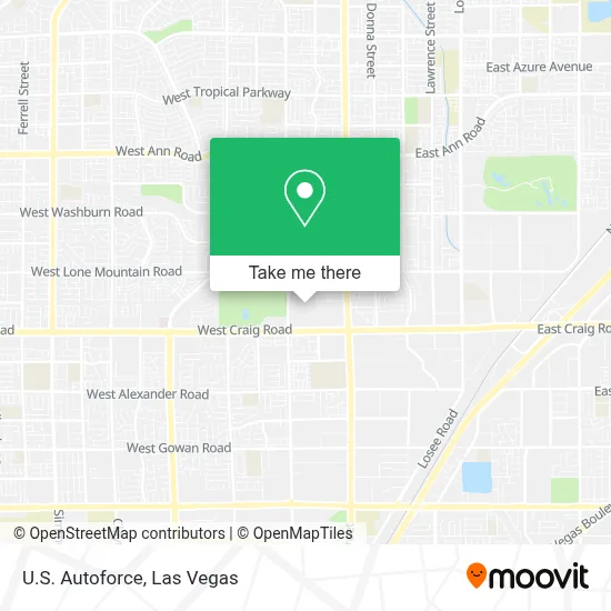
See U.S. Autoforce, North Las Vegas, on the map
Public Transit to U.S. Autoforce in North Las Vegas
Wondering how to get to U.S. Autoforce in North Las Vegas? Moovit helps you find the best way to get to U.S. Autoforce with step-by-step directions from the nearest public transit station.
Moovit provides free maps and live directions to help you navigate through your city. View schedules, routes, timetables, and find out how long does it take to get to U.S. Autoforce in real time.
Looking for the nearest stop or station to U.S. Autoforce? Check out this list of stops closest to your destination: Wb Craig After Goldfield.
Bus: 219.
Want to see if there’s another route that gets you there at an earlier time? Moovit helps you find alternative routes or times. Get directions from and directions to U.S. Autoforce easily from the Moovit App or Website.
We make riding to U.S. Autoforce easy, which is why over 1.7 million users, including users in North Las Vegas, trust Moovit as the best app for public transit. You don’t need to download an individual bus app or train app, Moovit is your all-in-one transit app that helps you find the best bus time or train time available.
For information on prices of bus, costs and ride fares to U.S. Autoforce, please check the Moovit app.
Use the app to navigate to popular places including to the airport, hospital, stadium, grocery store, mall, coffee shop, school, college, and university.
U.S. Autoforce Address: 78 W Craig Rd Bldg Ste 3 street in North Las Vegas
- Prestige Window Cleaning,
- U-Haul Moving & Storage at West Craig Rd,
- Rebel Convenience Stores,
- Arco,
- W Craig Rd / N Commerce St,
- Starbucks- Craig & Scott Robinson,
- Chevron,
- Terrible's,
- Western Union,
- Cheba Hut "Toasted" Subs,
- Ritab_Nails,
- Raul P Elizondo Elementary,
- Wyko Tramms Salvador - Thrivent,
- 116,
- Air Force Recruiting Office,
- Blue Rhino Propane Exchange,
- 6th Brigade Commander,
- N 5th St,
- Revere Marketplace,
- Iglesia Pentecostal Puerta De Salvacion
Places Near U.S. Autoforce (North Las Vegas)
- Las Vegas South Premium Outlets, Enterprise,
- The Neon Museum, Las Vegas,
- Walmart Supercenter, Las Vegas,
- Meow Wolf - Las Vegas (Meow Wolf's Omega Mart), Las Vegas,
- The Deuce Bus Stop at Fremont St, Las Vegas,
- Allegiant Stadium, Paradise,
- Trump International Hotel Las Vegas, Paradise,
- Zak Bagans Haunted Museum, Las Vegas,
- Las Vegas North Premium Outlets, Las Vegas,
- Gold & Silver Pawn Shop, Las Vegas,
- Walmart, Las Vegas,
- Town Square, Enterprise,
- Lee Canyon, Las Vegas,
- Welcome To Fabulous Las Vegas Sign, Paradise,
- The Palms Casino Resort, Paradise,
- Koolsville Tattoos, Las Vegas,
- Arte Museum Las Vegas, Paradise,
- Omega Mart, Las Vegas,
- Las Vegas Premium Outlets-North, Enterprise,
- Area15, Las Vegas
How to get to popular places in Las Vegas with public transit
Get around North Las Vegas by public transit!
Traveling around North Las Vegas has never been so easy. See step by step directions as you travel to any attraction, street or major public transit station. View bus and train schedules, arrival times, service alerts and detailed routes on a map, so you know exactly how to get to anywhere in North Las Vegas.
When traveling to any destination around North Las Vegas use Moovit's Live Directions with Get Off Notifications to know exactly where and how far to walk, how long to wait for your line, and how many stops are left. Moovit will alert you when it's time to get off — no need to constantly re-check whether yours is the next stop.
Wondering how to use public transit in North Las Vegas or how to pay for public transit in North Las Vegas? Moovit public transit app can help you navigate your way with public transit easily, and at minimum cost. It includes public transit fees, ticket prices, and costs. Looking for a map of North Las Vegas public transit lines? Moovit public transit app shows all public transit maps in North Las Vegas with all Bus and Monorail routes and stops on an interactive map.
Las Vegas has 2 transit type(s), including: Bus and Monorail, operated by several transit agencies, including RTCSNV, City of Las Vegas, Alvand Transportation, Vegas Airporter, Las Vegas Monorail, FlixBus-us and Greyhound-us