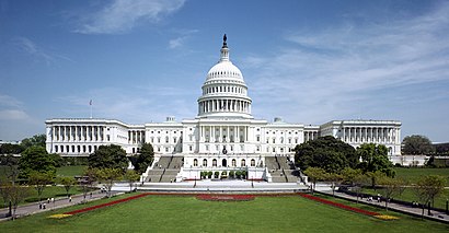
See U.S. Capitol, Washington, on the map
Directions to U.S. Capitol (Washington) with public transportation
The following transit lines have routes that pass near U.S. Capitol
 Bus:
Bus: - Train:
- Metro:
How to get to U.S. Capitol by bus?
Click on the bus route to see step by step directions with maps, line arrival times and updated time schedules.
How to get to U.S. Capitol by train?
Click on the train route to see step by step directions with maps, line arrival times and updated time schedules.
How to get to U.S. Capitol by metro?
Click on the metro route to see step by step directions with maps, line arrival times and updated time schedules.
Metro stations near U.S. Capitol in Washington
- Union Station,1 min walk,
- Capital South,9 min walk,
Train stations near U.S. Capitol in Washington
- Union Station,1 min walk,
Bus stations near U.S. Capitol in Washington
- Columbus Cir Ne+Delaware Av NE,3 min walk,
- N Capitol St & E St Nb,3 min walk,
- 3rd Street Near Madison Drive NW (Nb),5 min walk,
- SW Independence Av & SW Capital Pz,5 min walk,
- Independence Ave & 1st St Se Wb,7 min walk,
Bus lines to U.S. Capitol in Washington
- D6,East To Stadium-Armory,
- X8,East To Carver Terrace,
- 96,East To Capitol Heights,
- 230,230/10 Severna Park,
- 250,250/7 Kent Island,
- 735,735/7 Charlotte Hall,
- 850,850/2 Suitland / Washington Dc,
- NMS,Lincoln Memorial,
- 32,East To Southern Av,
- 36,West To Potomac Park,
- 305,305/9 Columbia,
- 325,325/4 Columbia,
- 335,335/6 Clarksville,
- 345,345/6 Long Gate Park & Ride,
- 630,630/8 La Plata,
- 725,725/4 California,
- 810,810/5 Pindell,
- 820,820/15 Pg Equestrian Center,
- 830,830/7 Washington Dc,
- 840,840/2 Washington Dc,
What are the closest stations to U.S. Capitol?
The closest stations to U.S. Capitol are:
- Union Station is 71 yards away, 1 min walk.
- Columbus Cir Ne+Delaware Av NE is 179 yards away, 3 min walk.
- N Capitol St & E St Nb is 212 yards away, 3 min walk.
- 3rd Street Near Madison Drive NW (Nb) is 386 yards away, 5 min walk.
- SW Independence Av & SW Capital Pz is 401 yards away, 5 min walk.
- Independence Ave & 1st St Se Wb is 542 yards away, 7 min walk.
- Capital South is 740 yards away, 9 min walk.
Which bus lines stop near U.S. Capitol?
These bus lines stop near U.S. Capitol: 32, 36.
Which train line stops near U.S. Capitol?
MANASSAS LINE
Which metro lines stop near U.S. Capitol?
These metro lines stop near U.S. Capitol: METRORAIL BLUE LINE, METRORAIL ORANGE LINE, METRORAIL RED LINE.
What’s the nearest metro station to U.S. Capitol in Washington?
The nearest metro station to U.S. Capitol in Washington is Union Station. It’s a 1 min walk away.
What’s the nearest train station to U.S. Capitol in Washington?
The nearest train station to U.S. Capitol in Washington is Union Station. It’s a 1 min walk away.
What’s the nearest bus stop to U.S. Capitol in Washington?
The nearest bus stops to U.S. Capitol in Washington are Columbus Cir Ne+Delaware Av NE and N Capitol St & E St Nb. The closest one is a 3 min walk away.
What time is the first metro to U.S. Capitol in Washington?
The METRORAIL BLUE LINE is the first metro that goes to U.S. Capitol in Washington. It stops nearby at 5:15 AM.
What time is the last metro to U.S. Capitol in Washington?
The METRORAIL BLUE LINE is the last metro that goes to U.S. Capitol in Washington. It stops nearby at 12:14 AM.
What time is the first train to U.S. Capitol in Washington?
The ACELA is the first train that goes to U.S. Capitol in Washington. It stops nearby at 5:00 AM.
What time is the last train to U.S. Capitol in Washington?
The NORTHEAST REGIONAL is the last train that goes to U.S. Capitol in Washington. It stops nearby at 11:20 PM.
What time is the first bus to U.S. Capitol in Washington?
The 32 is the first bus that goes to U.S. Capitol in Washington. It stops nearby at 3:02 AM.
What time is the last bus to U.S. Capitol in Washington?
The MEGABUS is the last bus that goes to U.S. Capitol in Washington. It stops nearby at 6:50 AM.
How much is the metro fare to U.S. Capitol?
The metro fare to U.S. Capitol costs about $2.00 - $6.00.
See U.S. Capitol, Washington, on the map
Public Transit to U.S. Capitol in Washington
Wondering how to get to U.S. Capitol in Washington, United States? Moovit helps you find the best way to get to U.S. Capitol with step-by-step directions from the nearest public transit station.
Moovit provides free maps and live directions to help you navigate through your city. View schedules, routes, timetables, and find out how long does it take to get to U.S. Capitol in real time.
Looking for the nearest stop or station to U.S. Capitol? Check out this list of stops closest to your destination: Union Station; Columbus Cir Ne+Delaware Av NE; N Capitol St & E St Nb; 3rd Street Near Madison Drive NW (Nb); SW Independence Av & SW Capital Pz; Independence Ave & 1st St Se Wb; Capital South.
Bus:Train:Metro:
Want to see if there’s another route that gets you there at an earlier time? Moovit helps you find alternative routes or times. Get directions from and directions to U.S. Capitol easily from the Moovit App or Website.
We make riding to U.S. Capitol easy, which is why over 1.5 million users, including users in Washington, trust Moovit as the best app for public transit. You don’t need to download an individual bus app or train app, Moovit is your all-in-one transit app that helps you find the best bus time or train time available.
For information on prices of bus, metro and train, costs and ride fares to U.S. Capitol, please check the Moovit app.
Use the app to navigate to popular places including to the airport, hospital, stadium, grocery store, mall, coffee shop, school, college, and university.
U.S. Capitol Address: Capitol Service Access street in Washington
Attractions near U.S. Capitol
Capitol Visitor Center Loading Dock,U.S. Senate,U.S. Capitol Visitor Center,Emancipation Hall,US Capitol Visitor Center (The Capitol Building),Armed Freedom (Statue of Freedom),U S Capitol Visitor Center,United States Capitol (Police du Capitole des Etats-Unis),First Street and East Capitol Street NE,HVC 201 Conference Room,Us Capitol,HVC-215, Capitol Visitors Center,165,Delaware NE Constitution Ave NW,Russell,Russell Senate Office Building,H-140 The Capitol,100mph 1st St NE,U.S. Capitol Complex SVC-209,2 Constitution Avenue NortheastHow to get to popular attractions in Washington with public transit
Maryland State Fairgrounds, Baltimore County,Lyon Hall, Arlington County,Columbia, MD, Howard County,Urbana, Washington,Biergarten Haus, Washington,Tunnicliff's Tavern, Washington,Ebenezers Coffeehouse, Washington,G&M Restaurant and Lounge, Anne Arundel County,BWI Rental Car Facility, Anne Arundel County,Coastal Flats, Fairfax County,Odenton MARC Station, Anne Arundel County,I-270, Montgomery County,Waterfront Hotel, Baltimore,Matchbox Vintage Pizza Bistro, Washington,Shaw's Tavern, Washington,Duffy's Irish Pub, Washington,Hank's Oyster Bar, Washington,P.J. Clarke's, Washington,Smith Commons, Washington,Toki Underground, WashingtonGet around Washington by public transit!
Traveling around Washington has never been so easy. See step by step directions as you travel to any attraction, street or major public transit station. View bus and train schedules, arrival times, service alerts and detailed routes on a map, so you know exactly how to get to anywhere in Washington.
When traveling to any destination around Washington use Moovit's Live Directions with Get Off Notifications to know exactly where and how far to walk, how long to wait for your line, and how many stops are left. Moovit will alert you when it's time to get off — no need to constantly re-check whether yours is the next stop.
Wondering how to use public transit in Washington or how to pay for public transit in Washington? Moovit public transit app can help you navigate your way with public transit easily, and at minimum cost. It includes public transit fees, ticket prices, and costs. Looking for a map of Washington public transit lines? Moovit public transit app shows all public transit maps in Washington with all bus, metro or train routes and stops on an interactive map.
Washington has 3 transit type(s), including: bus, metro or train, operated by several transit agencies, including WMATA, WMATA, Montgomery County Ride On, Fairfax Connector, TheBus, DC Circulator, MDOT MTA, Marc, MDOT MTA, MDOT MTA, Virginia Railway Express (VRE), PRTC, DASH - Alexandria, Arlington Transit (ART) and DC Streetcar