Directions to Umn Landscape Architecture Program (Minneapolis) with public transportation
The following transit lines have routes that pass near Umn Landscape Architecture Program
 Bus: 2, 3, METRO E LINE, 122, 33.
- Light Rail: METRO GREEN LINE.
How to get to Umn Landscape Architecture Program by bus?
Click on the bus route to see step by step directions with maps, line arrival times and updated time schedules.
From 755 53rd Ave NE Parking, Fridley
47 minFrom Park Nicollet Clinic, St. Louis Park
52 minFrom Lake Harriet Bandshell, Minneapolis
49 minFrom Roseville Area High School, Roseville
51 minFrom St. Paul College, St. Paul
57 minFrom Allianz Field, St. Paul
48 minFrom Portland Ave S & #6244, Richfield
54 minFrom Mitchell Hamline School of Law, St. Paul
44 minFrom Como Park Zoo, St. Paul
36 min
Bus stops near Umn Landscape Architecture Program in Minneapolis
Light Rail stations near Umn Landscape Architecture Program in Minneapolis
Bus lines to Umn Landscape Architecture Program in Minneapolis
- METRO E LINE, Henn-France / Southdale,VIEW
- 2, Franklin Av / To Central / U Of M,VIEW
- 122, University Av / Circulator,VIEW
- 3, Como / To Snelling / Energy Park,VIEW
- 33, Elm-Kasota / Westgate Sta,VIEW
- 113, Ltd Stop / Grand / Lyndale-56th,VIEW
- 114, Ltd Stop / Hennepin-36 / Bryant-38st,VIEW
- 252, Express / 95ave P&R,VIEW
- 465, Burnsville-Minneapolis-U of M,VIEW
- 475, Apple Valley-Cedar Grove-Mpls/U of M,VIEW
- 490, Prior Lake-Shakopee-Minneapolis,VIEW
- 695, Express / Uofm / SW Sta / SW Vill / East Crk,VIEW
- 698, Express / Ecrk / Swvill / Swsta / Mpls / Uofm,VIEW
- 774, Plymouth / Sta73 / Greenway,VIEW
- 789, Trip 1 / Maple Grove / Transit Sta,VIEW
- 795, East Town / Mpls / Sta73 / Plymouth,VIEW
- 121, Campus Connector,VIEW
What are the closest stations to Umn Landscape Architecture Program?
The closest stations to Umn Landscape Architecture Program are:
- University & U Of M Rec Center Station is 308 yards away, 4 min walk.
- 15th Ave SE & 4th St SE is 357 yards away, 5 min walk.
- 4th St & 15th Ave Station is 431 yards away, 6 min walk.
- Washington Av SE at Coffman Union N Corn is 495 yards away, 6 min walk.
- Washington Ave & Coffman Union (Northrop) is 499 yards away, 6 min walk.
- Washington Ave & Coffman Union is 499 yards away, 6 min walk.
- East Bank is 2213 yards away, 27 min walk.
- Cedar-Riverside is 2978 yards away, 35 min walk.
Which bus lines stop near Umn Landscape Architecture Program?
These bus lines stop near Umn Landscape Architecture Program: 2, 3, METRO E LINE.
Which light rail line stops near Umn Landscape Architecture Program?
METRO GREEN LINE (Mpls-Target Field)
What’s the nearest light rail station to Umn Landscape Architecture Program in Minneapolis?
The nearest light rail station to Umn Landscape Architecture Program in Minneapolis is East Bank. It’s a 27 min walk away.
What’s the nearest bus station to Umn Landscape Architecture Program in Minneapolis?
The nearest bus station to Umn Landscape Architecture Program in Minneapolis is University & U Of M Rec Center Station. It’s a 4 min walk away.
What time is the first light rail to Umn Landscape Architecture Program in Minneapolis?
The METRO BLUE LINE is the first light rail that goes to Umn Landscape Architecture Program in Minneapolis. It stops nearby at 3:19 AM.
What time is the last light rail to Umn Landscape Architecture Program in Minneapolis?
The METRO BLUE LINE is the last light rail that goes to Umn Landscape Architecture Program in Minneapolis. It stops nearby at 12:40 AM.
What time is the first bus to Umn Landscape Architecture Program in Minneapolis?
The 3 is the first bus that goes to Umn Landscape Architecture Program in Minneapolis. It stops nearby at 4:18 AM.
What time is the last bus to Umn Landscape Architecture Program in Minneapolis?
The 3 is the last bus that goes to Umn Landscape Architecture Program in Minneapolis. It stops nearby at 1:52 AM.
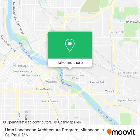
See Umn Landscape Architecture Program, Minneapolis, on the map
Public Transit to Umn Landscape Architecture Program in Minneapolis
Wondering how to get to Umn Landscape Architecture Program in Minneapolis? Moovit helps you find the best way to get to Umn Landscape Architecture Program with step-by-step directions from the nearest public transit station.
Moovit provides free maps and live directions to help you navigate through your city. View schedules, routes, timetables, and find out how long does it take to get to Umn Landscape Architecture Program in real time.
Looking for the nearest stop or station to Umn Landscape Architecture Program? Check out this list of stops closest to your destination: University & U Of M Rec Center Station; 15th Ave SE & 4th St SE; 4th St & 15th Ave Station; Washington Av SE at Coffman Union N Corn; Washington Ave & Coffman Union (Northrop); Washington Ave & Coffman Union; East Bank; Cedar-Riverside.
Bus: 2, 3, METRO E LINE, 122, 33, 113, 114, 252, 465, 475, 490, 695, 698, 774, 789, 795, 121.Light Rail: METRO GREEN LINE.
Want to see if there’s another route that gets you there at an earlier time? Moovit helps you find alternative routes or times. Get directions from and directions to Umn Landscape Architecture Program easily from the Moovit App or Website.
We make riding to Umn Landscape Architecture Program easy, which is why over 1.7 million users, including users in Minneapolis, trust Moovit as the best app for public transit. You don’t need to download an individual bus app or train app, Moovit is your all-in-one transit app that helps you find the best bus time or train time available.
For information on prices of bus and light rail, costs and ride fares to Umn Landscape Architecture Program, please check the Moovit app.
Use the app to navigate to popular places including to the airport, hospital, stadium, grocery store, mall, coffee shop, school, college, and university.
Umn Landscape Architecture Program Address: 89 Church St SE street in Minneapolis
- University Honors Program - University of Minnesota,
- University of Minnesota Twin Cities Campus,
- Walter Library Computer Lab,
- Mechanical Engineering Building,
- Post office,
- Armory,
- Northrop Auditorium,
- Minnesota Transport Observatory (MTO - Minnesota Traffic Observatory),
- University of Minnesota Armory,
- Bell Museum Of Natural History,
- Northrop Mall,
- Fraternity Row,
- University of Minnesota - Twin Cities ,
- Jones Hall - University Of Minnesota,
- Folwell Hall,
- Washington Avenue Parking Ramp,
- 17th Avenue Residence Hall,
- The Pumpkin Patch,
- Cynthia L. Scott Memorial CCLRT ATI Honorary Intersection,
- Coffman Memorial Union Station
Places Near Umn Landscape Architecture Program (Minneapolis)
- Bishop Henry Whipple Federal Building,
- Surly Brewing Co., Minneapolis,
- Huntington Bank Stadium, Minneapolis,
- Minnehaha Falls, Minneapolis,
- Harriet Island Regional Park, St. Paul,
- Minnesota State Capitol, St. Paul,
- St. Paul College, St. Paul,
- Mpls. Convention Center, Minneapolis,
- Abbott Northwestern Piper Building, Minneapolis,
- Orpheum Theatre (Minneapolis, Minnesota), Minneapolis,
- Xcel Energy Center, St. Paul,
- 3m Arena at Mariucci, Minneapolis,
- Mystic lake casino bus, Minneapolis,
- Grand Casino Hinckley,MN, Minneapolis,
- Target Center, Minneapolis,
- Minneapolis Institute of Art, Minneapolis,
- Target Field, Minneapolis,
- Treasure Island Resort & Casino, St. Paul,
- Northrop Auditorium, Minneapolis,
- Minneapolis Sculpture Garden, Minneapolis
How to get to popular places in Minneapolis - St. Paul, MN with public transit
Get around Minneapolis by public transit!
Traveling around Minneapolis has never been so easy. See step by step directions as you travel to any attraction, street or major public transit station. View bus and train schedules, arrival times, service alerts and detailed routes on a map, so you know exactly how to get to anywhere in Minneapolis.
When traveling to any destination around Minneapolis use Moovit's Live Directions with Get Off Notifications to know exactly where and how far to walk, how long to wait for your line, and how many stops are left. Moovit will alert you when it's time to get off — no need to constantly re-check whether yours is the next stop.
Wondering how to use public transit in Minneapolis or how to pay for public transit in Minneapolis? Moovit public transit app can help you navigate your way with public transit easily, and at minimum cost. It includes public transit fees, ticket prices, and costs. Looking for a map of Minneapolis public transit lines? Moovit public transit app shows all public transit maps in Minneapolis with all Bus, Train and Light Rail routes and stops on an interactive map.
Minneapolis - St. Paul, MN has 3 transit type(s), including: Bus, Train and Light Rail, operated by several transit agencies, including Metro Transit , Metro Transit, MVTA, Plymouth Metrolink, SouthWest Transit, Maple Grove, University of Minnesota, Airport (MAC), Amtrak, Mankato Transit System, SMART, FlixBus-us and Greyhound-us