See Universidad Autónoma de Chapingo, Texcoco, on the map
Directions to Universidad Autónoma de Chapingo (Texcoco) with public transportation
The following transit lines have routes that pass near Universidad Autónoma de Chapingo
 Bus:
Bus:
How to get to Universidad Autónoma de Chapingo by bus?
Click on the bus route to see step by step directions with maps, line arrival times and updated time schedules.
Bus stations near Universidad Autónoma de Chapingo in Texcoco
- Carretera Chapingo-Issste El Cooperativo San Nicolás Huexotla Texcoco Estado de México 56227 México,13 min walk,
Bus lines to Universidad Autónoma de Chapingo in Texcoco
- 256,Boulevard Puerto Aéreo (Metro),
What are the closest stations to Universidad Autónoma de Chapingo?
The closest stations to Universidad Autónoma de Chapingo are:
- Carretera Chapingo-Issste El Cooperativo San Nicolás Huexotla Texcoco Estado de México 56227 México is 951 meters away, 13 min walk.
Which bus lines stop near Universidad Autónoma de Chapingo?
These bus lines stop near Universidad Autónoma de Chapingo: 379, BOSQUES - ESTACIÓN DE METRO LA PAZ, JARDINES DE MORELOS - ESTACIÓN DE METRO LA PAZ, MEXIBÚS ECATEPEC - ESTACIÓN DE METRO LA PAZ, TERRANOVA - ESTACIÓN DE METRO LA PAZ.
What’s the nearest bus stop to Universidad Autónoma de Chapingo in Texcoco?
The nearest bus stop to Universidad Autónoma de Chapingo in Texcoco is Carretera Chapingo-Issste El Cooperativo San Nicolás Huexotla Texcoco Estado de México 56227 México. It’s a 13 min walk away.
What time is the first bus to Universidad Autónoma de Chapingo in Texcoco?
The 256 is the first bus that goes to Universidad Autónoma de Chapingo in Texcoco. It stops nearby at 6:00 AM.
What time is the last bus to Universidad Autónoma de Chapingo in Texcoco?
The 256 is the last bus that goes to Universidad Autónoma de Chapingo in Texcoco. It stops nearby at 10:30 PM.
How much is the bus fare to Universidad Autónoma de Chapingo?
The bus fare to Universidad Autónoma de Chapingo costs about $6.00 - $9.00.
See Universidad Autónoma de Chapingo, Texcoco, on the map
Public Transit to Universidad Autónoma de Chapingo in Texcoco
Wondering how to get to Universidad Autónoma de Chapingo in Texcoco, México? Moovit helps you find the best way to get to Universidad Autónoma de Chapingo with step-by-step directions from the nearest public transit station.
Moovit provides free maps and live directions to help you navigate through your city. View schedules, routes, timetables, and find out how long does it take to get to Universidad Autónoma de Chapingo in real time.
Looking for the nearest stop or station to Universidad Autónoma de Chapingo? Check out this list of stops closest to your destination: Carretera Chapingo-Issste El Cooperativo San Nicolás Huexotla Texcoco Estado de México 56227 México.
Bus:
Want to see if there’s another route that gets you there at an earlier time? Moovit helps you find alternative routes or times. Get directions from and directions to Universidad Autónoma de Chapingo easily from the Moovit App or Website.
We make riding to Universidad Autónoma de Chapingo easy, which is why over 1.5 million users, including users in Texcoco, trust Moovit as the best app for public transit. You don’t need to download an individual bus app or train app, Moovit is your all-in-one transit app that helps you find the best bus time or train time available.
For information on prices of bus, costs and ride fares to Universidad Autónoma de Chapingo, please check the Moovit app.
Use the app to navigate to popular places including to the airport, hospital, stadium, grocery store, mall, coffee shop, school, college, and university.
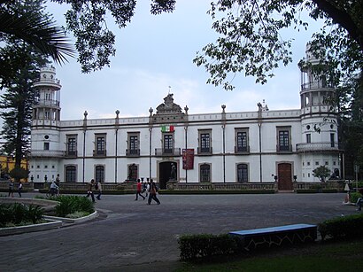
Universidad Autónoma de Chapingo Address: Calle Diego Rivera Universidad Autónoma de Chapingo street in Texcoco
Attractions near Universidad Autónoma de Chapingo
Univ Autónoma Chapingo Agroecologia,Fraccionamiento Los Espejos.,San Mateo Huexotla,Crucero Chapingo,Casa de Cultura Ixtapaluca,Carretera Coatlinchan-Texcoco,Tianguis Orgánico Chapingo,Calle 22 Carretera México-Texco,STAUACH Centro Cultural Ahuehuete,Escuela de Bellas Artes,Auditorio Emiliano Zapata,escuela de bellas artes Texcoco,Universidad Autónoma Chapingo,Museo de Geología Dr. José Guadalupe Aguilera Serrano,Uma Orquideario Chapingo,Módulo de Licencias Texcoco,Universidad Autónoma Chapingo - Oficial,La uni-k 89.3 FM estacion de radio,Motel Jardín,Instituto Tzapin de Medicinas ComplementariasHow to get to popular attractions in Texcoco with public transit
RCI Latinoamérica, Naucalpan De Juárez,P.F. Chang's Asian Restaurant, Atizapán De Zaragoza,Vips, Atizapán De Zaragoza,Secretaría de Economía (picacho), Cuajimalpa De Morelos,Entre Fuegos, Atizapán De Zaragoza,Hospital Multimedica, Atizapán De Zaragoza,El Portón, Naucalpan De Juárez,Corporativo Atlas, Naucalpan De Juárez,Balcones de la herradura, Naucalpan De Juárez,SENS, Naucalpan De Juárez,Johnny Rockets, Naucalpan De Juárez,Sports World, Naucalpan De Juárez,Corporativo Polanco, Naucalpan De Juárez,El Charco de las Ranas, Cuajimalpa De Morelos,Chili's Satélite, Atizapán De Zaragoza,Corporativo Horizonte, Naucalpan De Juárez,Tulyehualco, Tláhuac,Starbucks, Naucalpan De Juárez,La Casa de Toño, Cuautitlán Izcalli,Starbucks, Cuautitlán IzcalliGet around Texcoco by public transit!
Traveling around Texcoco has never been so easy. See step by step directions as you travel to any attraction, street or major public transit station. View bus and train schedules, arrival times, service alerts and detailed routes on a map, so you know exactly how to get to anywhere in Texcoco.
When traveling to any destination around Texcoco use Moovit's Live Directions with Get Off Notifications to know exactly where and how far to walk, how long to wait for your line, and how many stops are left. Moovit will alert you when it's time to get off — no need to constantly re-check whether yours is the next stop.
Wondering how to use public transit in Texcoco or how to pay for public transit in Texcoco? Moovit public transit app can help you navigate your way with public transit easily, and at minimum cost. It includes public transit fees, ticket prices, and costs. Looking for a map of Texcoco public transit lines? Moovit public transit app shows all public transit maps in Texcoco with all bus routes and stops on an interactive map.
Texcoco has 1 transit type(s), including: bus, operated by several transit agencies, including STC (Metro CDMX), Metrobús, RTP, Trolebús elevado, Trolebús, Tren Ligero, Corredores Concesionados, Ferrocarriles Suburbanos, Mexibus, Mexicable, Cablebús, Puma Bus, Peseros and Autobuses / Combis