Directions to University Way NE (Seattle) with public transportation
The following transit lines have routes that pass near University Way NE
How to get to University Way NE by bus?
Click on the bus route to see step by step directions with maps, line arrival times and updated time schedules.
Bus stations near University Way NE in Seattle
- University Way Ne & Ne 45th St, 1 min walk,
- Ne 45th St & University Way Ne, 1 min walk,
Bus lines to University Way NE in Seattle
- 45, Loyal Heights Greenwood,
- 73, Jackson Park Maple Leaf,
- 79, University District Sand Point,
- 75, Northgate Station Sand Point,
- 586, UW Station,
- 20, Lake City - Northgate - University District,
- 31, Children's Hospital - Fremont - Central Magnolia,
- 32, Children's Hospital - Fremont -Seattle Center West,
- 43, Univ Dist-Montlake-Capitol Hill-Downtown Seattle,
- 44, Ballard - Montlake,
- 48, Mt Baker - University District,
- 49, Univ District - Broadway - Downtown Seattle,
- 70, University District - Eastlake - Downtown Seattle,
- 372, UW/Cascadia College - University District,
What are the closest stations to University Way NE?
The closest stations to University Way NE are:
- University Way Ne & Ne 45th St is 20 yards away, 1 min walk.
- Ne 45th St & University Way Ne is 79 yards away, 1 min walk.
Which bus lines stop near University Way NE?
These bus lines stop near University Way NE: 44, 45, 49, 880.
What’s the nearest bus stop to University Way NE in Seattle?
The nearest bus stops to University Way NE in Seattle are University Way Ne & Ne 45th St and Ne 45th St & University Way Ne. The closest one is a 1 min walk away.
See University Way NE, Seattle, on the map
Public Transit to University Way NE in Seattle
Wondering how to get to University Way NE in Seattle, United States? Moovit helps you find the best way to get to University Way NE with step-by-step directions from the nearest public transit station.
Moovit provides free maps and live directions to help you navigate through your city. View schedules, routes, timetables, and find out how long does it take to get to University Way NE in real time.
Looking for the nearest stop or station to University Way NE? Check out this list of stops closest to your destination: University Way Ne & Ne 45th St; Ne 45th St & University Way Ne.
Bus: 44, 45, 49, 880, 73, 79, 75, 586, 20, 31, 32, 43.
Want to see if there’s another route that gets you there at an earlier time? Moovit helps you find alternative routes or times. Get directions from and directions to University Way NE easily from the Moovit App or Website.
We make riding to University Way NE easy, which is why over 1.5 million users, including users in Seattle, trust Moovit as the best app for public transit. You don’t need to download an individual bus app or train app, Moovit is your all-in-one transit app that helps you find the best bus time or train time available.
For information on prices of bus and light rail, costs and ride fares to University Way NE, please check the Moovit app.
Use the app to navigate to popular places including to the airport, hospital, stadium, grocery store, mall, coffee shop, school, college, and university.
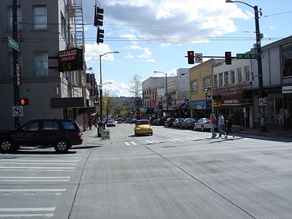
University Way NE Address: Seattle, WA 98105 street in Seattle
Attractions near University Way NE
Rite Aid Pharmacies,Neighborhood Svc Ctr,Maui Wowi Hawaiian Coffee & Smoothies,Garam Masala Exotic Indian Cuisine,Sweet Iron Waffles,4518 Arcade,KUOW Public Radio,Wing Central on the Ave,T' Latte,Deep Roots Tattoo & Body Piercing,The Continental,Veggie Veggie,Urban Outfitters,U:DON Fresh Japanese Noodle Station,Pitaya,Metro Bus Stop #9584,Don Eduardo Family Mexican,University Way Ne & Ne 45th St,University Smoke Shop,King County Metro #73 Downtown to Jackson ParkHow to get to popular attractions in Seattle with public transit
Marysville, WA,Eastgate Freeway Station, Bellevue,Fluke Park, Everett,I90, Bellevue,Seattle-Tacoma International Airport, Seatac,Boeing Flight Test & Delivery Center, Seattle,Loews Hotel 1000, Seattle, Seattle,Westlake Center, Seattle,Pike Place Market, Seattle,Coupeville Ferry Terminal,City of Puyallup, Puyallup,Phinney Ridge Neighborhood, Seattle,Alderwood Mall, Lynnwood,Space Needle, Seattle,Alaska Airlines Gold Coast Center, Seatac,University Village, Seattle,Industrial District, Seattle,BJ's Restaurant and Brewhouse, Tacoma,VA Hospital American Lake, North Fort Lewis,Walmart Supercenter, LakewoodGet around Seattle - Tacoma, WA by public transit!
Traveling around Seattle - Tacoma, WA has never been so easy. See step by step directions as you travel to any attraction, street or major public transit station. View bus and train schedules, arrival times, service alerts and detailed routes on a map, so you know exactly how to get to anywhere in Seattle - Tacoma, WA.
When traveling to any destination around Seattle - Tacoma, WA use Moovit's Live Directions with Get Off Notifications to know exactly where and how far to walk, how long to wait for your line, and how many stops are left. Moovit will alert you when it's time to get off — no need to constantly re-check whether yours is the next stop.
Wondering how to use public transit in Seattle - Tacoma, WA or how to pay for public transit in Seattle - Tacoma, WA? Moovit public transit app can help you navigate your way with public transit easily, and at minimum cost. It includes public transit fees, ticket prices, and costs. Looking for a map of Seattle - Tacoma, WA public transit lines? Moovit public transit app shows all public transit maps in Seattle - Tacoma, WA with all Bus, Train, Light Rail and Ferry routes and stops on an interactive map.
Seattle - Tacoma, WA has 4 transit type(s), including: Bus, Train, Light Rail and Ferry, operated by several transit agencies, including Sound Transit, Seattle Streetcar, Metro Transit, Whatcom Transportation Authority, Mason Transit Authority, Snoqualmie Valley Transportation (SVT), Snoqualmie Valley Transportation, Amtrak, Island Transit, Kitsap Transit, Intercity Transit, Everett Transit, Community Transit, Skagit Transit, Pierce Transit