How to get to Ups Access Point Location by bus?
Click on the bus route to see step by step directions with maps, line arrival times and updated time schedules.
From Amazon Fulfillment Center-DGR8, Walker
35 minFrom Pilgrims Run Golf Club, Grand Rapids
31 minFrom Studio 2 Digital Dental Design, Kentwood
65 minFrom Crosspoint Baptist Church, Wyoming
42 minFrom Funk Appraisals, Kentwood
35 minFrom Best Chiropractor Near Me, Comstock Park
57 minFrom Grand Rapids Treasure, Wyoming
34 minFrom Walker, MI, Walker
40 minFrom Kesslers Diamonds, Grand Rapids
32 min
Bus stops near Ups Access Point Location in Grand Rapids
Train station near Ups Access Point Location in Grand Rapids
- Grand Rapids Vernon J. Ehlers Station, 21 min walk,VIEW
Bus lines to Ups Access Point Location in Grand Rapids
What are the closest stations to Ups Access Point Location?
The closest stations to Ups Access Point Location are:
- Commerce/Weston (Sb) is 162 yards away, 2 min walk.
- Fulton Street Station (Nb) is 165 yards away, 3 min walk.
- Division/Weston (Sb) is 279 yards away, 4 min walk.
- Fulton/Louis (Wb) is 295 yards away, 4 min walk.
- Fountain/Lafayette (Eb) is 383 yards away, 5 min walk.
- Cherry/La Grave (Eb) is 464 yards away, 6 min walk.
- Grand Rapids Vernon J. Ehlers Station is 1680 yards away, 21 min walk.
Which bus lines stop near Ups Access Point Location?
These bus lines stop near Ups Access Point Location: 1, 15, 2, 45, 6, 90.
What’s the nearest train station to Ups Access Point Location in Grand Rapids?
The nearest train station to Ups Access Point Location in Grand Rapids is Grand Rapids Vernon J. Ehlers Station. It’s a 21 min walk away.
What’s the nearest bus station to Ups Access Point Location in Grand Rapids?
The nearest bus station to Ups Access Point Location in Grand Rapids is Commerce/Weston (Sb). It’s a 2 min walk away.
What time is the first train to Ups Access Point Location in Grand Rapids?
The PERE MARQUETTE is the first train that goes to Ups Access Point Location in Grand Rapids. It stops nearby at 6:00 AM.
What time is the last train to Ups Access Point Location in Grand Rapids?
The PERE MARQUETTE is the last train that goes to Ups Access Point Location in Grand Rapids. It stops nearby at 11:34 PM.
What time is the first bus to Ups Access Point Location in Grand Rapids?
The 4 is the first bus that goes to Ups Access Point Location in Grand Rapids. It stops nearby at 4:46 AM.
What time is the last bus to Ups Access Point Location in Grand Rapids?
The 51 is the last bus that goes to Ups Access Point Location in Grand Rapids. It stops nearby at 1:18 AM.
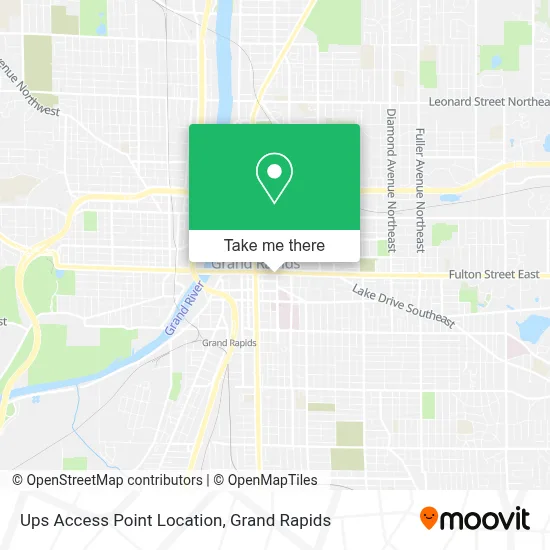
See Ups Access Point Location, Grand Rapids, on the map
Public Transit to Ups Access Point Location in Grand Rapids
Wondering how to get to Ups Access Point Location in Grand Rapids? Moovit helps you find the best way to get to Ups Access Point Location with step-by-step directions from the nearest public transit station.
Moovit provides free maps and live directions to help you navigate through your city. View schedules, routes, timetables, and find out how long does it take to get to Ups Access Point Location in real time.
Looking for the nearest stop or station to Ups Access Point Location? Check out this list of stops closest to your destination: Commerce/Weston (Sb); Fulton Street Station (Nb); Division/Weston (Sb); Fulton/Louis (Wb); Fountain/Lafayette (Eb); Cherry/La Grave (Eb); Grand Rapids Vernon J. Ehlers Station.
Bus: 1, 15, 2, 45, 6, 90, 51, 14.Train: PERE MARQUETTE.
Want to see if there’s another route that gets you there at an earlier time? Moovit helps you find alternative routes or times. Get directions from and directions to Ups Access Point Location easily from the Moovit App or Website.
We make riding to Ups Access Point Location easy, which is why over 1.5 million users, including users in Grand Rapids, trust Moovit as the best app for public transit. You don’t need to download an individual bus app or train app, Moovit is your all-in-one transit app that helps you find the best bus time or train time available.
For information on prices of bus, costs and ride fares to Ups Access Point Location, please check the Moovit app.
Use the app to navigate to popular places including to the airport, hospital, stadium, grocery store, mall, coffee shop, school, college, and university.
Ups Access Point Location Address: 150 Fulton St E street in Grand Rapids
- Public Museum High School,
- Grand Rapids Public Library,
- Cherry Health,
- Dégagé Ministries,
- Monroe Center Parking Ramp,
- 82 Ionia,
- Kendall College Of Art And Design,
- Mercy Health Lacks Cancer Center,
- Grand Rapids, MI,
- Douglas J. Aveda Institute,
- Residence Inn Grand Rapids Downtown,
- Cook Hall - GRCC,
- Rockford High School Baseball Field,
- Trinity Health,
- Steelcase,
- GRCC Bostwick Commons,
- Law Office Of Attorney John R. Beason and Michael Adams,
- Grand Rapids Community College,
- Asian Pacific Massage,
- Mel Trotter Park
Places Near Ups Access Point Location (Grand Rapids)
- Spectrum Health-Blodgett Hospital, East Grand Rapids,
- YMCA - David D. Hunting, Grand Rapids,
- University of Michigan Health Metro Health Hospital, Wyoming,
- Woodland Mall, Kentwood,
- Grand Rapids Community College, Grand Rapids,
- Lemmen-Holton Cancer Pavilion, Grand Rapids,
- Blodgett Hospital, East Grand Rapids,
- John Ball Zoo, Grand Rapids,
- Union High School, Grand Rapids,
- Kent County Courthouse, Grand Rapids,
- Frederik Meijer Gardens, Grand Rapids,
- Pine Rest Mental Health, Grand Rapids,
- Hudsonville,
- Helel DeVos Children's Hospital Food Court, Grand Rapids,
- Byron Center,
- Grandville, MI, Grandville,
- Metro Cascade,
- Spectrum Health Butterworth Hospital, Grand Rapids,
- Van Andel Arena, Grand Rapids,
- Butterworth Hospital Internal Radiology, Grand Rapids
How to get to popular places in Grand Rapids with public transit
Get around Grand Rapids by public transit!
Traveling around Grand Rapids has never been so easy. See step by step directions as you travel to any attraction, street or major public transit station. View bus and train schedules, arrival times, service alerts and detailed routes on a map, so you know exactly how to get to anywhere in Grand Rapids.
When traveling to any destination around Grand Rapids use Moovit's Live Directions with Get Off Notifications to know exactly where and how far to walk, how long to wait for your line, and how many stops are left. Moovit will alert you when it's time to get off — no need to constantly re-check whether yours is the next stop.
Wondering how to use public transit in Grand Rapids or how to pay for public transit in Grand Rapids? Moovit public transit app can help you navigate your way with public transit easily, and at minimum cost. It includes public transit fees, ticket prices, and costs. Looking for a map of Grand Rapids public transit lines? Moovit public transit app shows all public transit maps in Grand Rapids with all Bus and Train routes and stops on an interactive map.
Grand Rapids has 2 transit type(s), including: Bus and Train, operated by several transit agencies, including The Rapid, Amtrak and FlixBus-us