How to get to Ups Access Point Location by bus?
Click on the bus route to see step by step directions with maps, line arrival times and updated time schedules.
Bus stops near Ups Access Point Location in Overland Park
Bus lines to Ups Access Point Location in Overland Park
What are the closest stations to Ups Access Point Location?
The closest stations to Ups Access Point Location are:
- On 119th at Lowell Eastbound is 525 yards away, 7 min walk.
- 119th & Metcalf Walmart #2 is 721 yards away, 10 min walk.
Which bus line stops near Ups Access Point Location?
401 (Jccc)
What’s the nearest bus station to Ups Access Point Location in Overland Park?
The nearest bus station to Ups Access Point Location in Overland Park is On 119th at Lowell Eastbound. It’s a 7 min walk away.
What time is the first bus to Ups Access Point Location in Overland Park?
The 401 is the first bus that goes to Ups Access Point Location in Overland Park. It stops nearby at 4:58 AM.
What time is the last bus to Ups Access Point Location in Overland Park?
The 401 is the last bus that goes to Ups Access Point Location in Overland Park. It stops nearby at 10:46 PM.
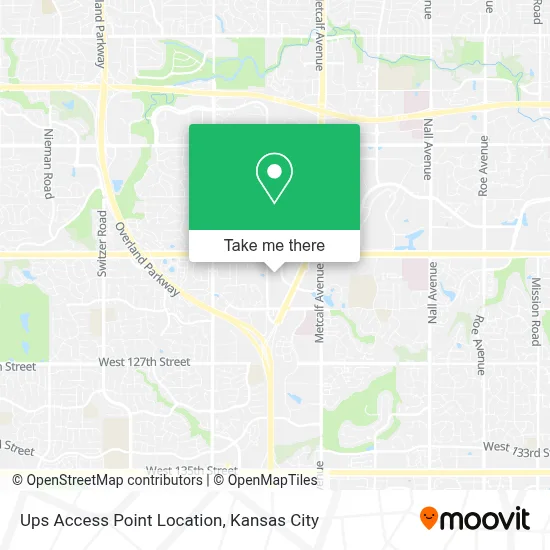
See Ups Access Point Location, Overland Park, on the map
Public Transit to Ups Access Point Location in Overland Park
Wondering how to get to Ups Access Point Location in Overland Park? Moovit helps you find the best way to get to Ups Access Point Location with step-by-step directions from the nearest public transit station.
Moovit provides free maps and live directions to help you navigate through your city. View schedules, routes, timetables, and find out how long does it take to get to Ups Access Point Location in real time.
Looking for the nearest stop or station to Ups Access Point Location? Check out this list of stops closest to your destination: On 119th at Lowell Eastbound; 119th & Metcalf Walmart #2.
Bus: 401, 404.
Want to see if there’s another route that gets you there at an earlier time? Moovit helps you find alternative routes or times. Get directions from and directions to Ups Access Point Location easily from the Moovit App or Website.
We make riding to Ups Access Point Location easy, which is why over 1.5 million users, including users in Overland Park, trust Moovit as the best app for public transit. You don’t need to download an individual bus app or train app, Moovit is your all-in-one transit app that helps you find the best bus time or train time available.
For information on prices of bus, costs and ride fares to Ups Access Point Location, please check the Moovit app.
Use the app to navigate to popular places including to the airport, hospital, stadium, grocery store, mall, coffee shop, school, college, and university.
Ups Access Point Location Address: 12140 Blue Valley Pkwy street in Overland Park
- Total Wine Spirits Beer & More,
- Solera Salon,
- Skin Lab,
- Someplace Nice,
- Catered Beauty (Dream Beauty Company),
- Rajadhani,
- Blush Fitness,
- Overland Park Ballroom and Social Club,
- Appliance Repair Overland Park,
- Dane Kaplan - Outshine Home Loans,
- Taylor Payton Investigations,
- Bright Side Plumbing,
- Salon Mia,
- Haircuts for Men,
- Hiroko - A Modern Salon by Karen Tabuchi,
- Lean Kitchen,
- Lean Kitchen Kansas City,
- PXG Kansas City,
- BMO Bank of Montreal,
- Salon Anonia
Places Near Ups Access Point Location (Overland Park)
- Grandview, MO, Grandview,
- Liberty, MO, Liberty,
- Kauffman Stadium,
- Kansas City Zoo,
- Stans Glory Hole,
- T-Mobile Center,
- Walmart Supercenter,
- Worlds of Fun,
- GEHA Field at Arrowhead Stadium,
- Country Club Plaza,
- Ku Medical Center, Kansas City,
- Arrowhead Stadium,
- St. Luke's Hospital - Medical Plaza I,
- Harrah's Casino, North Kansas City,
- Amazon Fulfilment Center-MKC6, Kansas City,
- Truman Medical Center,
- The Glory Hole,
- Legends Outlets Kansas City, Kansas City,
- Kansas City International Airport (MCI) (Kansas City International Airport),
- Walmart, Kansas City
How to get to popular places in Kansas City with public transit
Get around Overland Park by public transit!
Traveling around Overland Park has never been so easy. See step by step directions as you travel to any attraction, street or major public transit station. View bus and train schedules, arrival times, service alerts and detailed routes on a map, so you know exactly how to get to anywhere in Overland Park.
When traveling to any destination around Overland Park use Moovit's Live Directions with Get Off Notifications to know exactly where and how far to walk, how long to wait for your line, and how many stops are left. Moovit will alert you when it's time to get off — no need to constantly re-check whether yours is the next stop.
Wondering how to use public transit in Overland Park or how to pay for public transit in Overland Park? Moovit public transit app can help you navigate your way with public transit easily, and at minimum cost. It includes public transit fees, ticket prices, and costs. Looking for a map of Overland Park public transit lines? Moovit public transit app shows all public transit maps in Overland Park with all Bus, Train and Light Rail routes and stops on an interactive map.
Kansas City has 3 transit type(s), including: Bus, Train and Light Rail, operated by several transit agencies, including Kansas City Area Transportation Authority, Lawrence Transit, Topeka Metro, RideKC Johnson County, Amtrak, Greyhound-us and FlixBus-us