Directions to Ups Access Point Location (Kansas City) with public transportation
The following transit lines have routes that pass near Ups Access Point Location
 Bus: 101.
How to get to Ups Access Point Location by bus?
Click on the bus route to see step by step directions with maps, line arrival times and updated time schedules.
From Puma, Kansas City
18 minFrom Tornado Bus Company, kansas City, Kansas City
41 minFrom Corazon Saludable, Kansas City
46 minFrom The Food Pantry at St. Paul's Episcopal Church, Kansas City
38 minFrom Cortadito, Kansas City
41 minFrom bp, Kansas City
52 minFrom Park & Recreation Department, Kansas City
25 minFrom Law Office of David A Reed, Kansas City
28 min
Bus stop near Ups Access Point Location in Kansas City
- On State Ave at 82nd Eb, 2 min walk,VIEW
Bus lines to Ups Access Point Location in Kansas City
- 101, 101-State Ave / To Village West,VIEW
What are the closest stations to Ups Access Point Location?
The closest stations to Ups Access Point Location are:
- On State Ave at 82nd Eb is 157 yards away, 2 min walk.
Which bus line stops near Ups Access Point Location?
101 (101-State Ave / To East Village)
What’s the nearest bus station to Ups Access Point Location in Kansas City?
The nearest bus station to Ups Access Point Location in Kansas City is On State Ave at 82nd Eb. It’s a 2 min walk away.
What time is the first bus to Ups Access Point Location in Kansas City?
The 101 is the first bus that goes to Ups Access Point Location in Kansas City. It stops nearby at 5:55 AM.
What time is the last bus to Ups Access Point Location in Kansas City?
The 101 is the last bus that goes to Ups Access Point Location in Kansas City. It stops nearby at 11:06 PM.
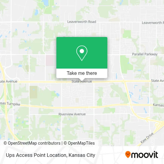
See Ups Access Point Location, Kansas City, on the map
Public Transit to Ups Access Point Location in Kansas City
Wondering how to get to Ups Access Point Location in Kansas City? Moovit helps you find the best way to get to Ups Access Point Location with step-by-step directions from the nearest public transit station.
Moovit provides free maps and live directions to help you navigate through your city. View schedules, routes, timetables, and find out how long does it take to get to Ups Access Point Location in real time.
Looking for the nearest stop or station to Ups Access Point Location? Check out this list of stops closest to your destination: On State Ave at 82nd Eb.
Bus: 101.
Want to see if there’s another route that gets you there at an earlier time? Moovit helps you find alternative routes or times. Get directions from and directions to Ups Access Point Location easily from the Moovit App or Website.
We make riding to Ups Access Point Location easy, which is why over 1.5 million users, including users in Kansas City, trust Moovit as the best app for public transit. You don’t need to download an individual bus app or train app, Moovit is your all-in-one transit app that helps you find the best bus time or train time available.
For information on prices of bus, costs and ride fares to Ups Access Point Location, please check the Moovit app.
Use the app to navigate to popular places including to the airport, hospital, stadium, grocery store, mall, coffee shop, school, college, and university.
Ups Access Point Location Address: 8101 State Ave street in Kansas City
- Wyandotte,
- Bp,
- Quick Shop,
- Nolan Local Locksmith (The Locksmith Company),
- Car Lockout Service,
- QUALITY INN,
- Store Here Self Storage,
- Kansas City Kansas Community College (KCKCC),
- KCKCC Jewell Building,
- Rest Area,
- The Brust Group Blog,
- KCKCC Community Nature Trail,
- KCKCC Baseball Field,
- 20 S 76th St,
- Stony Point South Elementary School,
- Stony Point, Kansas,
- ChargePoint,
- Stony Point Christian Chuch,
- Stony Point Cemetery,
- Capitol Federal Savings Bank
Places Near Ups Access Point Location (Kansas City)
- Liberty, MO, Liberty,
- Ku Medical Center, Kansas City,
- Amazon Fulfilment Center-MKC6, Kansas City,
- Worlds of Fun,
- Walmart, Kansas City,
- Arrowhead Stadium,
- Grandview, MO, Grandview,
- Kansas City International Airport (MCI) (Kansas City International Airport),
- The Glory Hole,
- St. Luke's Hospital - Medical Plaza I,
- Kauffman Stadium,
- Legends Outlets Kansas City, Kansas City,
- Country Club Plaza,
- Truman Medical Center,
- T-Mobile Center,
- Harrah's Casino, North Kansas City,
- Kansas City Zoo,
- Stans Glory Hole,
- GEHA Field at Arrowhead Stadium,
- Walmart Supercenter
How to get to popular places in Kansas City with public transit
Get around Kansas City by public transit!
Traveling around Kansas City has never been so easy. See step by step directions as you travel to any attraction, street or major public transit station. View bus and train schedules, arrival times, service alerts and detailed routes on a map, so you know exactly how to get to anywhere in Kansas City.
When traveling to any destination around Kansas City use Moovit's Live Directions with Get Off Notifications to know exactly where and how far to walk, how long to wait for your line, and how many stops are left. Moovit will alert you when it's time to get off — no need to constantly re-check whether yours is the next stop.
Wondering how to use public transit in Kansas City or how to pay for public transit in Kansas City? Moovit public transit app can help you navigate your way with public transit easily, and at minimum cost. It includes public transit fees, ticket prices, and costs. Looking for a map of Kansas City public transit lines? Moovit public transit app shows all public transit maps in Kansas City with all Bus, Train and Light Rail routes and stops on an interactive map.
Kansas City has 3 transit type(s), including: Bus, Train and Light Rail, operated by several transit agencies, including Kansas City Area Transportation Authority, Lawrence Transit, Topeka Metro, RideKC Johnson County, Amtrak, Greyhound-us and FlixBus-us