Train station near Ups Access Point Location in Lee'S Summit
- Lee's Summit Amtrak, 34 min walk,VIEW
- Grace United Methodist Church,
- All State Insurance - Agent: Jeffrey Silver,
- Simpson Dental Trendz,
- Lee's Summit North High School,
- Lee's Summit North Field House,
- Lee's Summit, MO,
- Ucm-summit Center,
- John Knox Village,
- Summer Time Massage,
- E State Route 350,
- Raytown South Middle School,
- Ruskin High School,
- City of Kcmo,
- Raytown, MO,
- Cooley-Marcom-Harvey Funeral Care,
- bannister rd and blue ridge,
- 5430 Woodson Rd,
- Salvation Army,
- E 87th St / Blue Ridge Blvd,
- Blue Ridge Plaza
Places Near Ups Access Point Location (Lee'S Summit)
- Harrah's Casino, North Kansas City,
- Kansas City International Airport (MCI) (Kansas City International Airport),
- Country Club Plaza,
- The Glory Hole,
- T-Mobile Center,
- St. Luke's Hospital - Medical Plaza I,
- Stans Glory Hole,
- Legends Outlets Kansas City, Kansas City,
- Truman Medical Center,
- Kansas City Zoo,
- Grandview, MO, Grandview,
- Arrowhead Stadium,
- Ku Medical Center, Kansas City,
- Amazon Fulfilment Center-MKC6, Kansas City,
- Kauffman Stadium,
- GEHA Field at Arrowhead Stadium,
- Walmart Supercenter,
- Worlds of Fun,
- Liberty, MO, Liberty,
- Walmart, Kansas City
How to get to popular places in Kansas City with public transit
What are the closest stations to Ups Access Point Location?
The closest stations to Ups Access Point Location are:
- Lee's Summit Amtrak is 2913 yards away, 34 min walk.
What time is the first train to Ups Access Point Location in Lee'S Summit?
The LINCOLN SERVICE MISSOURI RIVER RUNNER is the first train that goes to Ups Access Point Location in Lee'S Summit. It stops nearby at 9:16 AM.
What time is the last train to Ups Access Point Location in Lee'S Summit?
The LINCOLN SERVICE MISSOURI RIVER RUNNER is the last train that goes to Ups Access Point Location in Lee'S Summit. It stops nearby at 7:55 PM.
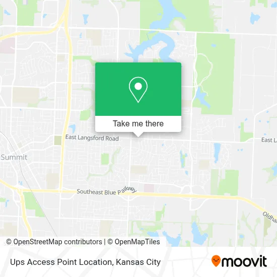
See Ups Access Point Location, Lee'S Summit, on the map
Public Transit to Ups Access Point Location in Lee'S Summit
Wondering how to get to Ups Access Point Location in Lee'S Summit? Moovit helps you find the best way to get to Ups Access Point Location with step-by-step directions from the nearest public transit station.
Moovit provides free maps and live directions to help you navigate through your city. View schedules, routes, timetables, and find out how long does it take to get to Ups Access Point Location in real time.
Looking for the nearest stop or station to Ups Access Point Location? Check out this list of stops closest to your destination: Lee's Summit Amtrak.
Want to see if there’s another route that gets you there at an earlier time? Moovit helps you find alternative routes or times. Get directions from and directions to Ups Access Point Location easily from the Moovit App or Website.
We make riding to Ups Access Point Location easy, which is why over 1.5 million users, including users in Lee'S Summit, trust Moovit as the best app for public transit. You don’t need to download an individual bus app or train app, Moovit is your all-in-one transit app that helps you find the best bus time or train time available.
Use the app to navigate to popular places including to the airport, hospital, stadium, grocery store, mall, coffee shop, school, college, and university.
Ups Access Point Location Address: 1900 E Langsford Rd street in Lee'S Summit
Get around Lee'S Summit by public transit!
Traveling around Lee'S Summit has never been so easy. See step by step directions as you travel to any attraction, street or major public transit station. View bus and train schedules, arrival times, service alerts and detailed routes on a map, so you know exactly how to get to anywhere in Lee'S Summit.
When traveling to any destination around Lee'S Summit use Moovit's Live Directions with Get Off Notifications to know exactly where and how far to walk, how long to wait for your line, and how many stops are left. Moovit will alert you when it's time to get off — no need to constantly re-check whether yours is the next stop.
Wondering how to use public transit in Lee'S Summit or how to pay for public transit in Lee'S Summit? Moovit public transit app can help you navigate your way with public transit easily, and at minimum cost. It includes public transit fees, ticket prices, and costs. Looking for a map of Lee'S Summit public transit lines? Moovit public transit app shows all public transit maps in Lee'S Summit with all Bus, Train and Light Rail routes and stops on an interactive map.
Kansas City has 3 transit type(s), including: Bus, Train and Light Rail, operated by several transit agencies, including Kansas City Area Transportation Authority, Lawrence Transit, Topeka Metro, RideKC Johnson County, Amtrak, Greyhound-us and FlixBus-us