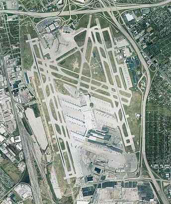
See Ups Worldport, Jefferson, on the map
Directions to Ups Worldport (Jefferson) with public transportation
The following transit lines have routes that pass near Ups Worldport
 Bus:
Bus:
How to get to Ups Worldport by bus?
Click on the bus route to see step by step directions with maps, line arrival times and updated time schedules.
Bus stations near Ups Worldport in Jefferson
- Grade @ Ashbottom,25 min walk,
Bus lines to Ups Worldport in Jefferson
- 28,Fern Valley - Ups,
- 93,Downtown Via Ul,
- 99,Ups West Louisville,
What are the closest stations to Ups Worldport?
The closest stations to Ups Worldport are:
- Grade @ Ashbottom is 2087 yards away, 25 min walk.
Which bus line stops near Ups Worldport?
18
See Ups Worldport, Jefferson, on the map
Public Transit to Ups Worldport in Jefferson
Wondering how to get to Ups Worldport in Jefferson, United States? Moovit helps you find the best way to get to Ups Worldport with step-by-step directions from the nearest public transit station.
Moovit provides free maps and live directions to help you navigate through your city. View schedules, routes, timetables, and find out how long does it take to get to Ups Worldport in real time.
Looking for the nearest stop or station to Ups Worldport? Check out this list of stops closest to your destination: Grade @ Ashbottom.
Bus:
Want to see if there’s another route that gets you there at an earlier time? Moovit helps you find alternative routes or times. Get directions from and directions to Ups Worldport easily from the Moovit App or Website.
We make riding to Ups Worldport easy, which is why over 1.5 million users, including users in Jefferson, trust Moovit as the best app for public transit. You don’t need to download an individual bus app or train app, Moovit is your all-in-one transit app that helps you find the best bus time or train time available.
For information on prices of bus, costs and ride fares to Ups Worldport, please check the Moovit app.
Use the app to navigate to popular places including to the airport, hospital, stadium, grocery store, mall, coffee shop, school, college, and university.
Location: Jefferson, Louisville
Attractions near Ups Worldport
Global Credit Union,Operations Support Group Office,UPS Worldport Air Hub,UPS Worldport North Core,UPS Worldport Wing B,UPS Wing E Lockers,Wing C Posit 4,SDF,KSDF,wing E posi 6 deskill,UPS Shuttle,UPS Wing A,wing E motor pool,UPS Wing C Dock 6 SDF-EWR,Work - UPS Worldport,Louisville International Airport,UPS Worldport,UPS Wing E Posi 2 Setup,UPS ASC,Worldport Freight FacilityHow to get to popular attractions in Jefferson with public transit
Theatair-X, Clark,UPS Guard Shack, Jefferson,Jerry E. Abramson Terminal Building, Jefferson,Louisville International Airport (SDF), Jefferson,JEC Building, 200 W. Broadway, Louisville, Ky 40202, Jefferson,Louisville Slugger Museum, Louisville,Norton Healthcare - Brownsboro - OBC / NBH, Jefferson,Kentucky Driving School, Jefferson,ridgewood apartments, Jefferson,Preston Hwy & Fern Valley Road, Jefferson,Frankfort Avenue Louisville Ky, Jefferson,Walmart Saint Matthews Neighborhood Market, Jefferson,Hikes Lane, Jefferson,Branham Tabernacle, Clark,Bloom Elem, Jefferson,Weight Watchers, Louisville,Michael Bowman for Kentucky State Treasurer, Jefferson,Beth Minton Od, Jefferson,City of St Matthews, Jefferson,Preston Hwy Louisville Ky, JeffersonGet around Jefferson by public transit!
Traveling around Jefferson has never been so easy. See step by step directions as you travel to any attraction, street or major public transit station. View bus and train schedules, arrival times, service alerts and detailed routes on a map, so you know exactly how to get to anywhere in Jefferson.
When traveling to any destination around Jefferson use Moovit's Live Directions with Get Off Notifications to know exactly where and how far to walk, how long to wait for your line, and how many stops are left. Moovit will alert you when it's time to get off — no need to constantly re-check whether yours is the next stop.
Wondering how to use public transit in Jefferson or how to pay for public transit in Jefferson? Moovit public transit app can help you navigate your way with public transit easily, and at minimum cost. It includes public transit fees, ticket prices, and costs. Looking for a map of Jefferson public transit lines? Moovit public transit app shows all public transit maps in Jefferson with all bus routes and stops on an interactive map.
Jefferson has 1 transit type(s), including: bus, operated by several transit agencies, including Transit Authority of River City, Greyhound-us and FlixBus-us