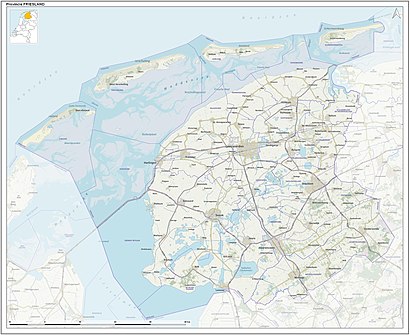
See Ureterp, Opsterland, on the map
Directions to Ureterp (Opsterland) with public transportation
The following transit lines have routes that pass near Ureterp
 Bus:
Bus:
How to get to Ureterp by bus?
Click on the bus route to see step by step directions with maps, line arrival times and updated time schedules.
Bus stations near Ureterp in Opsterland
- Ureterp Skoalleane,2 min walk,
Bus lines to Ureterp in Opsterland
- 14,Leeuwarden,
- 84,Drachten,
- 584,Drachten,
What are the closest stations to Ureterp?
The closest stations to Ureterp are:
- Ureterp Skoalleane is 104 meters away, 2 min walk.
Which bus line stops near Ureterp?
189
What’s the nearest bus stop to Ureterp in Opsterland?
The nearest bus stop to Ureterp in Opsterland is Ureterp Skoalleane. It’s a 2 min walk away.
See Ureterp, Opsterland, on the map
Public Transit to Ureterp in Opsterland
Wondering how to get to Ureterp in Opsterland, Netherlands? Moovit helps you find the best way to get to Ureterp with step-by-step directions from the nearest public transit station.
Moovit provides free maps and live directions to help you navigate through your city. View schedules, routes, timetables, and find out how long does it take to get to Ureterp in real time.
Looking for the nearest stop or station to Ureterp? Check out this list of stops closest to your destination: Ureterp Skoalleane.
Bus:
Want to see if there’s another route that gets you there at an earlier time? Moovit helps you find alternative routes or times. Get directions from and directions to Ureterp easily from the Moovit App or Website.
We make riding to Ureterp easy, which is why over 1.5 million users, including users in Opsterland, trust Moovit as the best app for public transit. You don’t need to download an individual bus app or train app, Moovit is your all-in-one transit app that helps you find the best bus time or train time available.
For information on prices of bus, costs and ride fares to Ureterp, please check the Moovit app.
Use the app to navigate to popular places including to the airport, hospital, stadium, grocery store, mall, coffee shop, school, college, and university.
Ureterp Address: Weibuorren street in Opsterland
Attractions near Ureterp
Financiele Adviseurs Noord Nederland,Primera Ureterp,Miedema Horeca,Nicole's Keuken,Cafeteria Peti,Come Back,Captain Hooks,Rabobank,De Steeg,J.O. Varwijk,Varwijk, J,Herenkapsalon Lammert,Van Smeden,Ikewei 9,Postkantoren,Coop Schaap,S F Sietzema,Siezema Wooninrichting,Smeden, Elektrospeciaalzaak Van,VariantHow to get to popular attractions in Opsterland with public transit
Euromast, Rotterdam,Winkelcentrum In de Bogaard, Rijswijk,NHL Hogeschool, Leeuwarden,Technische Universiteit Eindhoven (TU / e), Eindhoven,Busstation Hoofdstation, Groningen,Tilburg University, Tilburg,IKEA, Breda,Droomvlucht, Loon Op Zand,Ministerie van Buitenlandse Zaken, 'S-Gravenhage,Diergaarde Blijdorp, Rotterdam,Station Delft Zuid, Delft,Station Heerlen, Heerlen,Bierfabriek, Amsterdam,Busstation Arnhem, Arnhem,IKEA, Amersfoort,IKEA, Groningen,IKEA, Heerlen,Station Veenendaal-De Klomp, Ede,Venlo, Venlo,Saxion Hogeschool (Ko Wierenga), EnschedeGet around Opsterland by public transit!
Traveling around Opsterland has never been so easy. See step by step directions as you travel to any attraction, street or major public transit station. View bus and train schedules, arrival times, service alerts and detailed routes on a map, so you know exactly how to get to anywhere in Opsterland.
When traveling to any destination around Opsterland use Moovit's Live Directions with Get Off Notifications to know exactly where and how far to walk, how long to wait for your line, and how many stops are left. Moovit will alert you when it's time to get off — no need to constantly re-check whether yours is the next stop.
Wondering how to use public transit in Opsterland or how to pay for public transit in Opsterland? Moovit public transit app can help you navigate your way with public transit easily, and at minimum cost. It includes public transit fees, ticket prices, and costs. Looking for a map of Opsterland public transit lines? Moovit public transit app shows all public transit maps in Opsterland with all bus routes and stops on an interactive map.
Opsterland has 1 transit type(s), including: bus, operated by several transit agencies, including NS, NS International, GVB, GVB, GVB, GVB, U-OV, U-OV, Overal, HTM, R-net, RET, RET, De Lijn and Connexxion