Directions to Uttam Nagar (West) with public transportation
The following transit lines have routes that pass near Uttam Nagar
How to get to Uttam Nagar by bus?
Click on the bus route to see step by step directions with maps, line arrival times and updated time schedules.
How to get to Uttam Nagar by metro?
Click on the metro route to see step by step directions with maps, line arrival times and updated time schedules.
Bus stations near Uttam Nagar in West
- Om Vihar, 8 min walk,
Bus lines to Uttam Nagar in West
- NCR, Gubhana Majiri Village ⬌ Tilak Nagar,
- DW-3, Dwarka Sector 16C / G.G.S.I.P.University ⬌ Rohini Sector 16,
- 809, Neelwal Village ⬌ Tilak Nagar,
- 817N, Najafgarh (T) ⬌ Kashmere Gate I.S.B.T (T),
- 818, Jhatikara Village ⬌ Tilak Nagar,
- 821, Jaffarpur Kalan ⬌ Tilak Nagar,
- 825, Tilak Nagar ⬌ Jharoda Kalan Border (Satyam Puram),
- 825A, Tilak Nagar ⬌ Jharoda Nala Crossing (Geetanjali Enclave),
- 826, Tilak Nagar ⬌ Chaudhary Braham Prakash Ayurvedic Hospital Khera Dabar,
- 827, Tilak Nagar ⬌ Daurala Border,
- 829, Tilak Nagar ⬌ Shikarpur Village,
- 835, Tilak Nagar ⬌ Dhansa Border (T),
- 845, Tilak Nagar ⬌ Daulatpur Village,
- 848, Tilak Nagar ⬌ Bakkargarh Border,
- 873, Tilak Nagar ⬌ Tajpur Khurd Village,
- 876, Dichau Kalan Village ⬌ Tilak Nagar,
- 887, Ghumanhera Village ⬌ Tilak Nagar,
What are the closest stations to Uttam Nagar?
The closest stations to Uttam Nagar are:
- Om Vihar is 591 meters away, 8 min walk.
Which bus lines stop near Uttam Nagar?
These bus lines stop near Uttam Nagar: 817, 845.
Which metro line stops near Uttam Nagar?
3
What’s the nearest bus stop to Uttam Nagar in West?
The nearest bus stop to Uttam Nagar in West is Om Vihar. It’s a 8 min walk away.
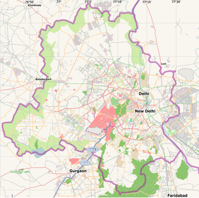
See Uttam Nagar, West, on the map
Public Transit to Uttam Nagar in West
Wondering how to get to Uttam Nagar in West, India? Moovit helps you find the best way to get to Uttam Nagar with step-by-step directions from the nearest public transit station.
Moovit provides free maps and live directions to help you navigate through your city. View schedules, routes, timetables, and find out how long does it take to get to Uttam Nagar in real time.
Looking for the nearest stop or station to Uttam Nagar? Check out this list of stops closest to your destination: Om Vihar.
Bus: 817, 845, NCR, DW-3, 809, 817N, 818.Metro: 3.
Want to see if there’s another route that gets you there at an earlier time? Moovit helps you find alternative routes or times. Get directions from and directions to Uttam Nagar easily from the Moovit App or Website.
We make riding to Uttam Nagar easy, which is why over 1.5 million users, including users in West, trust Moovit as the best app for public transit. You don’t need to download an individual bus app or train app, Moovit is your all-in-one transit app that helps you find the best bus time or train time available.
For information on prices of bus and metro, costs and ride fares to Uttam Nagar, please check the Moovit app.
Use the app to navigate to popular places including to the airport, hospital, stadium, grocery store, mall, coffee shop, school, college, and university.
Uttam Nagar Address: Delhi street in West
Attractions near Uttam Nagar
Khushi Ram Park,Ta Block,Hot and Spice,Adarsh Model School,Om Vihar,Om Vihar Extn,Param Puri,D.K Chinese Food,Block U No-6 Gali,The Salon,Ta Block,T Block,U Block,Delhi Metro Pillar No-701,Bhajan Associates & Builders,G-Grand Banquet,Sai Baba Mandir,Jain Colony I,Gulabi Bagh,Jain ParkHow to get to popular attractions in West with public transit
dwarka sector 7, Delhi,Jhandewalan Devi Mandir, Delhi,M2k Rohini, Delhi,Wazirabad Village, Delhi,Noida Sector 63, Dadri,Palm Green Hotel and Resorts, Delhi,Pitampura, Delhi,Daryaganj, Delhi,Vasundhara Enclave, Delhi,Babu Banarsi das Institute of Enginering, Delhi,Sarai Kale Khan, Delhi,G.B Pant Hospital, Delhi,Usp Monastery Market, Delhi,एलआरएस टीबी हॉस्पिटल महरौली (LRS TB Hospital Mehrauli), Delhi,Maitreyi College, Delhi,Shri Khatu Shyam Mandir, Delhi,Shri Khatu Shyam Baba Mandir, Khatu Dham, Sikar, Rajasthan, Delhi,National Science Museum (National Science Centre), Delhi,Alipur, Delhi - 110036, Delhi,Humayun's Tomb, DelhiGet around New Delhi by public transit!
Traveling around New Delhi has never been so easy. See step by step directions as you travel to any attraction, street or major public transit station. View bus and train schedules, arrival times, service alerts and detailed routes on a map, so you know exactly how to get to anywhere in New Delhi.
When traveling to any destination around New Delhi use Moovit's Live Directions with Get Off Notifications to know exactly where and how far to walk, how long to wait for your line, and how many stops are left. Moovit will alert you when it's time to get off — no need to constantly re-check whether yours is the next stop.
Wondering how to use public transit in New Delhi or how to pay for public transit in New Delhi? Moovit public transit app can help you navigate your way with public transit easily, and at minimum cost. It includes public transit fees, ticket prices, and costs. Looking for a map of New Delhi public transit lines? Moovit public transit app shows all public transit maps in New Delhi with all Bus, Train and Metro routes and stops on an interactive map.
New Delhi has 3 transit type(s), including: Bus, Train and Metro, operated by several transit agencies, including Delhi Metro Rail Corporation (DMRC), Delhi Metro Rail Corporation, Noida Metro Rail corporation, Delhi Transport Corporation (DTC), DMRC Feeder AC E-Buses, DTC AC Services, DTC Express Buses, DTC Night Bus, Delhi Integrated Multi-Modal Transit System Ltd., DIMTS (Delhi Integrated Multi-Modal Transit System Ltd.), AC bus lines, Airport AC bus lines, GMCBL (Gurugram Metropolitan City Bus Limited), Northern Railways, DTC Electric AC Buses