VCC-Clark Station station - Sunday schedule
| Line | Direction | Time |
|---|---|---|
| MILLENNIUM LINE | Lafarge Lake-Douglas | 7:30 AM |
| MILLENNIUM LINE | To VCC-Clark | 7:32 AM |
| MILLENNIUM LINE | Lafarge Lake-Douglas | 7:36 AM |
| MILLENNIUM LINE | To VCC-Clark | 7:40 AM |
| MILLENNIUM LINE | Lafarge Lake-Douglas | 7:44 AM |
| MILLENNIUM LINE | To VCC-Clark | 7:48 AM |
| MILLENNIUM LINE | Lafarge Lake-Douglas | 7:52 AM |
| MILLENNIUM LINE | To VCC-Clark | 7:56 AM |
| MILLENNIUM LINE | Lafarge Lake-Douglas | 8:00 AM |
| MILLENNIUM LINE | To VCC-Clark | 8:04 AM |
| MILLENNIUM LINE | Lafarge Lake-Douglas | 8:08 AM |
| MILLENNIUM LINE | To VCC-Clark | 8:12 AM |
| MILLENNIUM LINE | Lafarge Lake-Douglas | 8:16 AM |
| MILLENNIUM LINE | To VCC-Clark | 8:20 AM |
| MILLENNIUM LINE | Lafarge Lake-Douglas | 8:24 AM |
| MILLENNIUM LINE | To VCC-Clark | 8:28 AM |
| MILLENNIUM LINE | Lafarge Lake-Douglas | 8:32 AM |
| MILLENNIUM LINE | To VCC-Clark | 8:36 AM |
| MILLENNIUM LINE | Lafarge Lake-Douglas | 8:40 AM |
| MILLENNIUM LINE | To VCC-Clark | 8:44 AM |
| MILLENNIUM LINE | Lafarge Lake-Douglas | 8:48 AM |
| MILLENNIUM LINE | To VCC-Clark | 8:52 AM |
| MILLENNIUM LINE | Lafarge Lake-Douglas | 8:56 AM |
| MILLENNIUM LINE | To VCC-Clark | 9:00 AM |
| MILLENNIUM LINE | Lafarge Lake-Douglas | 9:05 AM |
See VCC-Clark Station, Vancouver, on the map
Directions to VCC-Clark Station (Vancouver) with public transportation
The following transit lines have routes that pass near VCC-Clark Station
 Bus:
Bus: - Train:
- SkyTrain:
- Ferry:
How to get to VCC-Clark Station by bus?
Click on the bus route to see step by step directions with maps, line arrival times and updated time schedules.
How to get to VCC-Clark Station by SkyTrain?
Click on the SkyTrain route to see step by step directions with maps, line arrival times and updated time schedules.
Bus stations near VCC-Clark Station in Vancouver
- VCC-Clark Station @ Bay 1,1 min walk,
- Southbound Clark Dr @ E 6th Ave,3 min walk,
- Westbound E Broadway @ Clark Dr,6 min walk,
Ferry stations near VCC-Clark Station in Vancouver
- Olympic Village,25 min walk,
- The Village,34 min walk,
Skytrain stations near VCC-Clark Station in Vancouver
- Commercial-Broadway Station,33 min walk,
Train stations near VCC-Clark Station in Vancouver
- Vancouver,47 min walk,
Bus lines to VCC-Clark Station in Vancouver
- 84,VCC-Clark Station,
- 22,Knight via Industrial,
- 9,Boundary/Commercial-Broadway/Granville/Alma/UBC,
- 99,Commercial-Broadway/UBC (B-Line),
- N9,Downtown/Lougheed Station/Coquitlam Central Station,
What are the closest stations to VCC-Clark Station?
The closest stations to VCC-Clark Station are:
- VCC-Clark Station @ Bay 1 is 22 meters away, 1 min walk.
- Southbound Clark Dr @ E 6th Ave is 220 meters away, 3 min walk.
- Westbound E Broadway @ Clark Dr is 421 meters away, 6 min walk.
- Olympic Village is 1898 meters away, 25 min walk.
- Commercial-Broadway Station is 2536 meters away, 33 min walk.
- The Village is 2565 meters away, 34 min walk.
- Vancouver is 3654 meters away, 47 min walk.
Which bus lines stop near VCC-Clark Station?
These bus lines stop near VCC-Clark Station: 22, 84.
Which SkyTrain line stops near VCC-Clark Station?
MILLENNIUM LINE
What’s the nearest bus stop to VCC-Clark Station in Vancouver?
The nearest bus stop to VCC-Clark Station in Vancouver is VCC-Clark Station @ Bay 1. It’s a 1 min walk away.
What’s the nearest ferry station to VCC-Clark Station in Vancouver?
The nearest ferry station to VCC-Clark Station in Vancouver is Olympic Village. It’s a 25 min walk away.
What time is the first SkyTrain to VCC-Clark Station in Vancouver?
The EXPO LINE is the first SkyTrain that goes to VCC-Clark Station in Vancouver. It stops nearby at 5:30 AM.
What time is the last SkyTrain to VCC-Clark Station in Vancouver?
The MILLENNIUM LINE is the last SkyTrain that goes to VCC-Clark Station in Vancouver. It stops nearby at 1:35 AM.
What time is the first train to VCC-Clark Station in Vancouver?
The AMTRAK CASCADES is the first train that goes to VCC-Clark Station in Vancouver. It stops nearby at 7:15 AM.
What time is the last train to VCC-Clark Station in Vancouver?
The AMTRAK CASCADES is the last train that goes to VCC-Clark Station in Vancouver. It stops nearby at 10:00 PM.
What time is the first bus to VCC-Clark Station in Vancouver?
The N9 is the first bus that goes to VCC-Clark Station in Vancouver. It stops nearby at 3:00 AM.
What time is the last bus to VCC-Clark Station in Vancouver?
The 99 is the last bus that goes to VCC-Clark Station in Vancouver. It stops nearby at 3:17 AM.
What time is the first ferry to VCC-Clark Station in Vancouver?
The AQUABUS is the first ferry that goes to VCC-Clark Station in Vancouver. It stops nearby at 7:07 AM.
What time is the last ferry to VCC-Clark Station in Vancouver?
The AQUABUS is the last ferry that goes to VCC-Clark Station in Vancouver. It stops nearby at 10:07 PM.
How much is the bus fare to VCC-Clark Station?
The bus fare to VCC-Clark Station costs about $2.60.
How much is the ferry fare to VCC-Clark Station?
The ferry fare to VCC-Clark Station costs about $2.60.
See VCC-Clark Station, Vancouver, on the map
Public transit to VCC-Clark Station station in Vancouver
Looking for directions to VCC-Clark Station in Vancouver, Canada?
Download the Moovit App to find the current schedule and step-by-step directions for Bus, SkyTrain or Ferry routes that pass through VCC-Clark Station.
Looking for the nearest stops closest to VCC-Clark Station ? Check out this list of closest stops to your destination: VCC-Clark Station @ Bay 1; Southbound Clark Dr @ E 6th Ave; Westbound E Broadway @ Clark Dr; Olympic Village; Commercial-Broadway Station; The Village; Vancouver.
Bus:Train:SkyTrain:Ferry:
We make riding on public transit to VCC-Clark Station easy, which is why over 1.5 million users, including users in Vancouver trust Moovit as the best app for public transit.
Use the app to navigate to popular places including to the airport, hospital, stadium, grocery store, mall, coffee shop, school, college, and university.
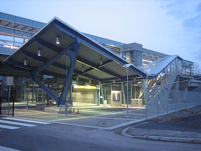
The station has the following entrances: Keith Dr
The first line to this station is MILLENNIUM LINE, at 7:30 AM, and the last line is MILLENNIUM LINE at 12:34 AM.
2102 Keith Drive, Vancouver, BC, Canada
This station serves TransLink’s lines
Popular routes from VCC-Clark Station, Vancouver
Bus stops near VCC-Clark Station
VCC-Clark Station @ Bay 1,Southbound Clark Dr @ E 6th Ave,Westbound E Broadway @ Clark DrSkytrain station near VCC-Clark Station
Commercial-Broadway StationTrain station near VCC-Clark Station
VancouverPopular public transit stations in Vancouver
Southbound 160 St @ 96 Ave,Shawnigan Lk. Rd & Cameron-Taggart,Northbound Rupert St @ E 22 Ave,Burrard Station @ Bay 7,Westbound 72 Ave @ 200 St,Southbound Mundy St @ Dawes Hill Rd,Northbound Duthie Ave @ Union St,Douglas at Kings,Northbound Scott Rd @ Old Yale Rd,Westbound E King Edward Ave @ Kingsway,Northbound Ingleton Ave @ Sunset St,Westbound Brunette Ave @ Lougheed Hwy,Village Green Mall,Westbound E 41 Ave @ Knight St,Southbound Willingdon Ave @ Burke St,Douglas at Cloverdale,Southbound Denman St @ Barclay St,Southbound Cambie St @ W 41 Ave,29th Avenue Station,Westbound W Pender St @ Seymour StGet around Vancouver by public transit!
Traveling around Vancouver has never been so easy. See step by step directions as you travel to any attraction, street or major public transit station. View bus and train schedules, arrival times, service alerts and detailed routes on a map, so you know exactly how to get to anywhere in Vancouver.
When traveling to any destination around Vancouver use Moovit's Live Directions with Get Off Notifications to know exactly where and how far to walk, how long to wait for your line, and how many stops are left. Moovit will alert you when it's time to get off — no need to constantly re-check whether yours is the next stop.
Wondering how to use public transit in Vancouver or how to pay for public transit in Vancouver? Moovit public transit app can help you navigate your way with public transit easily, and at minimum cost. It includes public transit fees, ticket prices, and costs. Looking for a map of Vancouver public transit lines? Moovit public transit app shows all public transit maps in Vancouver with all bus, SkyTrain or ferry routes and stops on an interactive map.
Vancouver has 3 transit type(s), including: bus, SkyTrain or ferry, operated by several transit agencies, including TransLink, TransLink, TransLink, TransLink, False Creek Ferries, BC Ferries, Aquabus, BC Transit - Central Fraser Valley Transit System, BCTransit, BC Transit - Comox Valley Transit System, BC Transit - Aggasiz-Harrison and Hope Transit System, BC Transit - Chilliwack Transit System, BC Transit - Squamish, BC Transit - Whistler Transit System and BC Transit - Cowichan Valley Regional Transit System