Directions to Vahto with public transportation
The following transit lines have routes that pass near Vahto
How to get to Vahto by bus?
Click on the bus route to see step by step directions with maps, line arrival times and updated time schedules.
Bus stations near Vahto
- Kolhintie, 1 min walk,
- Laukolan Koulu, 5 min walk,
Bus lines to Vahto
- 302, Kauppatori-Rusko-Vahto,
- 303, Kauppatori-Rusko-Vahto,
- V1, Järvijoki-Lavamäki-Laukolan koulu,
- V2, Soisalontie-Leinainen-Laukolan koulu,
- V3, Laukolan Koulu,
- V4, Hiidenvainion Koulu (Pohj.),
What are the closest stations to Vahto?
The closest stations to Vahto are:
- Kolhintie is 38 meters away, 1 min walk.
- Laukolan Koulu is 305 meters away, 5 min walk.
Which bus lines stop near Vahto?
These bus lines stop near Vahto: 302, 303.
What’s the nearest bus stop to Vahto?
The nearest bus stop to Vahto is Kolhintie. It’s a 1 min walk away.
What time is the first bus to Vahto?
The 303 is the first bus that goes to Vahto. It stops nearby at 10:43 AM.
What time is the last bus to Vahto?
The 303 is the last bus that goes to Vahto. It stops nearby at 5:03 PM.
See Vahto on the map
Public Transportation to Vahto
Wondering how to get to Vahto, Finland? Moovit helps you find the best way to get to Vahto with step-by-step directions from the nearest public transit station.
Moovit provides free maps and live directions to help you navigate through your city. View schedules, routes, timetables, and find out how long does it take to get to Vahto in real time.
Looking for the nearest stop or station to Vahto? Check out this list of stops closest to your destination: Kolhintie; Laukolan Koulu.
Bus: 302, 303, V1, V2, V3, V4.
Want to see if there’s another route that gets you there at an earlier time? Moovit helps you find alternative routes or times. Get directions from and directions to Vahto easily from the Moovit App or Website.
We make riding to Vahto easy, which is why over 1.5 million users, including users in Vahto, trust Moovit as the best app for public transit. You don’t need to download an individual bus app or train app, Moovit is your all-in-one transit app that helps you find the best bus time or train time available.
For information on prices of bus, costs and ride fares to Vahto, please check the Moovit app.
Use the app to navigate to popular places including to the airport, hospital, stadium, grocery store, mall, coffee shop, school, college, and university.
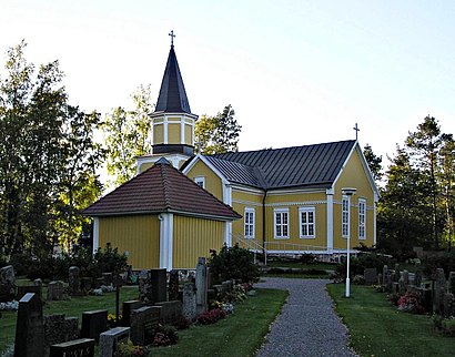
Location: Vahto, Turku
Attractions near Vahto
Vahdon Hyvinvointikeskus,Laukolan koulun kuntosali💪🏼,Transport Juha Järvinen Ky,Kaffel,Susannette Tmi,vahdon jokitupa- palvelukeskus,Nappa Risto Tauno Olavi,Vahdon ampumarata,Kankaanpää,Kautranta,Virven Talli,Talli,Paattisten Puhdin Maja,Nuohooja Mauri Hirvonen,Varjotalli,Paattinen,Gemini Cakes: Kreivilän Koulun Leipomo,Turun Pintatekniikka,Purpurikuja 8,Reipas-Matkat OyHow to get to popular attractions in Vahto with public transit
As Oy Patterinhaka, Turku,Gyltö,Jokkari, Turku,Nuvole Jäätelökioski, Naantali,Eltsun kanala🐥, Parainen,Bar Kristal, Turku,Korppoon Keskusta - Korpo Centrum, Korppoo,Ruona, Naantali,Kupittaan Rautatieasema, Turku,Kristoffer Sali, Naantali,Luolavuoren vanha kaatopaikka, Turku,jopon luokka ilpo on homo, Raisio,K-Market Kanslerintie, Turku,Luolavuoren pururata, Turku,Via Dolorosa, Turku,R-kioski Linja-autoasema, Salo,Bussipysäkki 335, Turku,Bar Poiju, Turku,empo, Kaarina,Pikavuoro Turku-Helsinki, SaloGet around Turku by public transit!
Traveling around Turku has never been so easy. See step by step directions as you travel to any attraction, street or major public transit station. View bus and train schedules, arrival times, service alerts and detailed routes on a map, so you know exactly how to get to anywhere in Turku.
When traveling to any destination around Turku use Moovit's Live Directions with Get Off Notifications to know exactly where and how far to walk, how long to wait for your line, and how many stops are left. Moovit will alert you when it's time to get off — no need to constantly re-check whether yours is the next stop.
Wondering how to use public transit in Turku or how to pay for public transit in Turku? Moovit public transit app can help you navigate your way with public transit easily, and at minimum cost. It includes public transit fees, ticket prices, and costs. Looking for a map of Turku public transit lines? Moovit public transit app shows all public transit maps in Turku with all Bus, Ferry and Funicular routes and stops on an interactive map.
Turku has 3 transit type(s), including: Bus, Ferry and Funicular, operated by several transit agencies, including FÖLI Turun seudun joukkoliikenne, LS-Liikennelinjat Oy, FÖLI Turun seudun joukkoliikenne/V-S ELY-keskus, J. Vainion Liikenne Oy, Turun kaupunki, FinFerries, V-S ELY-keskus, palveluntuottaja FinFerries, Salon Paikku, Tilausliikenne Raasepori Oy, L-S Liikennelinjat Oy / TLO Oy, RIndellbus